
Bwca ep 57 - Magnetic LAKE
AUGUST 2024
Route: Gunflint Lake. Magnetic Lake, Pine River, Little Rock Falls & Clove Lake.
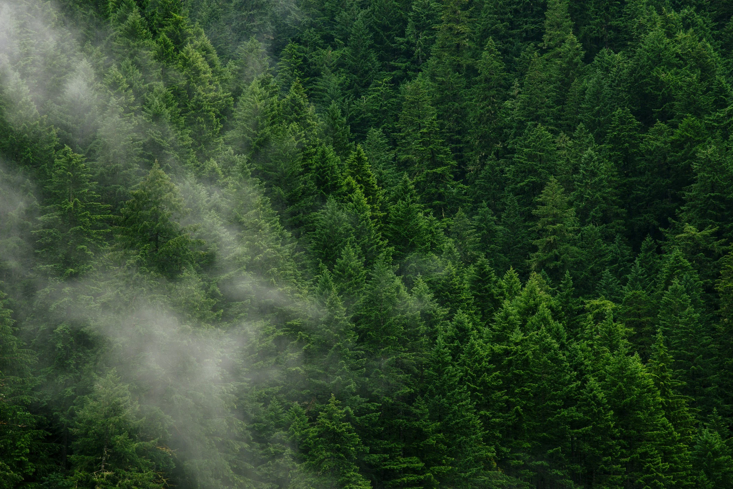
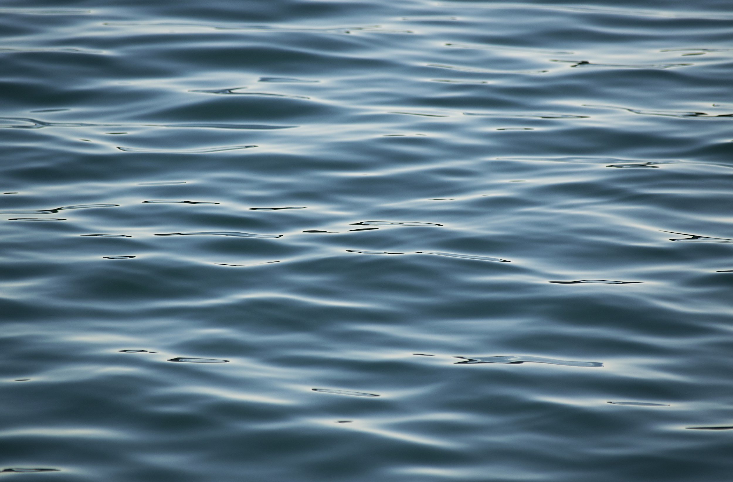
Conditions: Calm summer conditions along the U.S./Canada border made for an easy and quiet paddle into Magnetic Lake. Light winds and stable weather carried through most of the journey, with the Pine River system flowing gently between lakes. Travel was smooth overall, with peaceful waters and long stretches of solitude defining much of the route.
Purpose of Journey: This overnight solo trip into Magnetic Lake (Entry Point #57) was part of a broader effort to document remote borderland routes within the Boundary Waters Canoe Area Wilderness. After taking time earlier in the season to upgrade essential filming and travel equipment, this journey marked a return to the field—resuming a summer of exploration and visual storytelling across the BWCA.
Field Notes: Paddling through Magnetic Lake and into the winding channels of the Pine River system offered a quiet reentry into wilderness travel. The borderland terrain held a deep stillness—broken only by the sound of current moving through narrows and the occasional movement of wind across open water.
After a steady day of travel, I found a small and secluded place to make camp for the night. With no one else nearby, the evening settled into that familiar northern silence—water moving slowly past the shoreline, trees shifting in low wind, and the subtle rhythm of the forest after dark.
Flowing along what is now the international border, the Pine and Granite River system was historically part of a fluid travel landscape used by the Anishinaabe long before political lines divided these waters. The east-to-west movement of the connected lakes and falls offered natural passage between watersheds, with portage routes forming around rapids and waterfalls that could not be paddled. These same corridors supported seasonal movement for trade, fishing, and gathering—reminding modern travelers that what feels remote today was once part of an active and well-known network of Indigenous travel through the northern forest.

Bwca ep 23 - mudro LAKE
july 2024
Route: Mudro Lake, Sandpit Lake & Tin Can Mike Lake.
Conditions: Travel began under relatively stable summer conditions, with manageable winds and favorable paddling across the interior lakes leading north from Mudro. Portages along this route were moderately challenging, with rocky footing and elevation changes typical of the terrain between Mudro and the larger Basswood watershed. On the second day of travel, conditions shifted rapidly as a severe and sustained downpour moved into the area—bringing intense rainfall that significantly reduced visibility, saturated portage trails, and made continued travel both difficult and unsafe.
Purpose of Journey: This trip was undertaken with the goal of reaching Basswood Lake to view the historic pictographs located along its northern shoreline. Traveling as a team, we aimed to document the route and experience one of the Boundary Waters’ most culturally significant sites—where ancient markings remain visible on the exposed cliff faces above the waterline..
Field Notes: Paddling north from Mudro offered the familiar rhythm of lake-to-lake travel, broken up by rugged portages threading through dense forest and glacial rock. The route toward Basswood Lake carried a steady sense of anticipation, with the intention of reaching the pictographs that have drawn travelers to this area for generations.
By the morning of the second day, however, conditions changed dramatically. A powerful downpour moved in with little warning—bringing heavy rain that quickly overwhelmed the trail systems and open water alike. What would normally be manageable travel in wet conditions became unsafe, as visibility dropped and footing along portages turned slick with runoff. Despite the goal of continuing on toward Basswood, the decision was made to turn back and begin the return journey home.
The pictographs of Basswood Lake are widely believed to have been created by the ancestors of the Anishinaabe, marking places of spiritual or cultural significance along important travel routes. These ochre images—often depicting animals, canoes, or human forms—were traditionally applied to rock faces using natural pigments mixed with binders such as fish oil. Positioned along major waterways like Basswood, they served as visual expressions of story, guidance, or presence, reminding modern travelers that these routes once carried generations of Indigenous people who moved across the lakes with purpose long before recreational travel brought others to these waters.

Bwca ep 43 - BOWER TROUT LAKE
july 2024
Route: Bower Trout Lake, Marshall Lake, South Brule River, Dugout Lake, Skidway Lake, Swan Lake, Vernon Lake & Brule Lake.
Conditions: Overcast skies settled in for most of the journey, creating soft light across the lakes and forested shoreline throughout the route. Light winds made for manageable paddling conditions as we moved through the smaller interior lakes connected to the Brule watershed. Despite the cloud cover, travel remained steady and comfortable—offering ideal conditions for making our way toward the larger open water of Brule Lake.
Purpose of Journey: This trip was undertaken with my good friend Maggie, traveling from the Bower Trout entry point (EP 43) with the intention of reaching Brule Lake via the interior lake system. The goal was to spend time exploring this quieter approach into one of the Boundary Waters’ more expansive lakes—documenting the route while enjoying the slower pace of travel through smaller, forest-bound waters.
Field Notes: Launching from Bower Trout, we made our way through a chain of serene lakes connected by short portages that gradually opened toward the Brule Lake watershed. The overcast conditions gave the forest a muted tone—softening the horizon and settling the landscape into a quiet, almost suspended stillness as we traveled. Wildlife moved subtly along the shoreline, and the dense surrounding forest carried that familiar hush that comes with cloud-covered skies.
As the route progressed westward, the scale of the terrain began to shift—hinting at the broader expanse of Brule beyond the tree line. Even under gray skies, this entry offers a rewarding approach into the lake, trading the exposure of direct access for a more gradual transition through the surrounding wilderness.
This region lies within traditional Anishinaabe homeland, where interconnected lakes like those along the Bower Trout route would have served as seasonal travel corridors between inland hunting grounds and the larger watersheds to the south. These smaller lakes and portage paths formed dependable routes for movement by canoe, following natural breaks in terrain and water levels. Today’s travel through these same passages echoes a much older pattern of movement across the northern forest—where lakes like Brule were not destinations, but part of a lived landscape shaped by generations of Indigenous presence.

Bwca ep 61 - daniels LAKE
june 2024
Route: West Bearskin Lake, Daniels Lake, Rove Lake, Watap Lake, Mountain Lake & Clearwater Lake..
Conditions: Unseasonably pleasant weather settled in for this early June trip, bringing calm winds and stable skies along the border route. Mild daytime temperatures and cool nights created ideal travel conditions for paddling and portaging through the interconnected lakes leading toward Mountain Lake. Visibility remained clear throughout most of the journey—providing expansive views across open water and exposed rock formations along the international boundary.
Purpose of Journey: This solo journey from Daniels Lake (EP 61) followed the historic border route toward Mountain Lake, with the intention of documenting travel through Watap Lake and completing the well-known “Long Portage” along the Border Route Trail. The goal was to reach Mountain Lake Camp for an overnight stay—traveling through one of the most visually striking stretches of the Boundary Waters along the U.S./Canada border.
Field Notes: Departing from Daniels Lake, the route quickly narrowed into the winding chain of border lakes that lead toward Watap. Early season travel made for comfortable paddling, with still waters reflecting the steep rock faces and rising ridgelines that define this part of the wilderness. Watap Lake, in particular, offered dramatic views—its cliff-lined shoreline standing in contrast to the surrounding forest as the route bent westward along the boundary.
From there, I began the descent along the infamous Long Portage, following a stretch of trail that connects these remote waters to Mountain Lake. This segment—running alongside portions of the Border Route Trail—served as a reminder of the terrain that has shaped travel here for generations. By evening, I reached Mountain Lake Camp and settled in for the night. Under the cool quiet of a June sky, the northern lights made a brief appearance—dancing above the waterline before fading back into darkness as I slipped into the hammock for sleep.
This section of the border lakes lies within traditional Anishinaabe travel territory, where waterways like Watap and Mountain once formed part of seasonal canoe routes linking inland hunting grounds with the larger trade networks surrounding Gichi-Gami (Lake Superior). Prominent landmarks such as the cliffs of Watap would have served as natural navigational points for travelers moving between watersheds. Even today, the Long Portage reflects the same terrain breaks that Indigenous travelers would have followed—carrying canoe and goods across the ridgelines along routes known through generations of movement by water and memory.

Bwca ep 45 - Morgan LAKE
MAY 2024
Route: Morgan Lake, Carl Lake, Lax Lake, Jake Lake, Vista Lake, Horseshoe Lake, Caribou Lake, Lizz Lake & Poplar Lake.
Conditions: Travel on May 31 through June 1 brought mostly overcast skies across the Morgan to Caribou route, with occasional breaks in the cloud cover late in the evening. Daytime temperatures remained cool but comfortable for late spring travel, with calm to light winds making for manageable paddling across the smaller interior lakes. Overnight conditions dipped into the lower range typical for early June in the Boundary Waters, with still air settling in after sunset..
Purpose of Journey: This solo trip marked my first Boundary Waters journey of 2024, launching from Morgan Lake (EP 45) with the goal of reaching Caribou Lake for an overnight stay. The route offered a quiet return to wilderness travel after the winter season—documenting the subtle transition into spring across the interior lake system.
Field Notes: Departing from Morgan Lake, the route carried me through a series of smaller connected lakes and short portages leading toward Caribou. Under consistently overcast skies, the landscape felt subdued—soft light settling across the shoreline as the forest moved quietly into early season growth. Evidence of wolves became increasingly noticeable along the portage trails and muddy shoreline edges—tracks pressed into the earth and signs of recent movement through the area.
Minnesota is home to one of the largest remaining gray wolf populations in the lower forty-eight states, with an estimated 2,700–3,000 individuals primarily occupying the northern forested regions of the state. Travel through this part of the Boundary Waters serves as a reminder that these lakes remain part of an active wilderness—shared with wildlife that continues to move through these corridors much as they always have.
By evening, I reached Caribou Lake and made camp beneath a cloud-covered sky. As darkness settled in, the moon broke through briefly—casting a pale glow across the waterline before disappearing again behind the lingering cloud cover.
The lakes along this route lie within traditional Anishinaabe homeland, where waterways such as Morgan and Caribou once formed part of seasonal travel routes between inland hunting territories and larger gathering areas nearer to Gichi-Gami (Lake Superior). Smaller interior lakes like these would have provided dependable fishing sites and temporary camps during travel by canoe, with portage paths following natural breaks in terrain known through generations of lived experience on the land.

Bwca ep 62 - CLEARWATER LAKE
SEPTEMBER 2023
Route: Clearwater Lake, West Pike Lake, Pine Lake, Little Caribou Lake & Caribou Lake.
Conditions: Partly cloudy fall conditions, Wind: Light easterly wind aiding return travel. Precipitation: None encountered. Travel Notes: Ideal shoulder-season camping conditions throughout
Purpose of Journey: After securing a canceled late-season Clearwater EP 64 permit, this trip provided an opportunity to take advantage of early fall solitude in one of the most scenic travel corridors in the eastern Boundary Waters. The route offered a mix of protected interior lakes and open border water, allowing time for travel, observation, and night photography in peak seasonal conditions.
With stable weather and quiet campsites, the intent was to move deliberately through a familiar yet consistently rewarding section of the BWCAW—taking time to document changing seasonal light and sky conditions as autumn began to settle across the high ridgelines and shoreline forests.
Field Notes: Night one was spent on the island campsite on West Pike Lake, while night two was spent on Pine Lake at the campsite adjacent to the portage connecting back toward West Pike. Pine provided a clear enough window in the partly cloudy sky to attempt overnight timelapses of the stars. While no visible auroral activity was noted at the time, processing the footage after returning home revealed that the northern lights had in fact made a brief appearance—visible in the final clip of the trip’s recorded sequence.
Clearwater Lake, one of the most heavily traveled and recognizable entry points in this part of the Boundary Waters, also serves as my home water along the Gunflint Trail. Traveling out from a lake that I both live and work on creates a different relationship with the surrounding route system—particularly along the border lakes between West Pike and Pine. This stretch remains one of the most topographically distinct areas in the BWCAW, with elevated ridgelines, long sightlines across the international boundary, and a chain of scenic lakes that make it a consistent favorite for both travel and documentation.
These lakes lie within the traditional homeland of the Anishinaabe, whose travel routes historically followed these interconnected waterways long before their designation as recreational corridors. The elevated terrain and border lakes in this region formed part of seasonal movement patterns between inland hunting territories and larger trade networks. Today, while the lakes serve as designated wilderness travel routes, their deeper significance as shared ancestral pathways remains embedded in the landscape.

Bwca ep 80 - LARCH CREEK/GRANITE RIVER
AUGUST 2023
Route: Larch Creek, Larch Lake, Clove Lake, Granite River, Gneiss Lake, Devils Elbow, Maraboeuf Lake, Saganaga Falls & Saganaga Lake
Conditions: Weather: Mild late-summer temperatures with light southwest winds. Water Levels: Moderately high throughout marshland tributaries. Wildlife Activity: Significant beaver presence noted at entry point.
Entry via the Larch Creek access point began with nearly a mile of narrow swamp-grass corridor—requiring lift-overs across eight active beaver dams in the opening stretch. This lesser-used entry, often no more than six feet wide, reflects the ongoing hydrological impact of beaver activity throughout the Superior National Forest. Beyond the wetlands, the route opens into young forest regenerating from previous fire activity, allowing for scenic travel along the international boundary toward Saganaga Lake and Sag Falls.
Purpose of Journey: This late-summer traverse had been on my list for some time—shared this time with Nate and Jeremy, two younger paddlers whose contrasting personalities brought a balance of navigation and morale to the day’s travel. While the physical objective was efficiency (covering 21 miles in a single day), the deeper intention was exposure: introducing developing wilderness travelers to the emotional and ecological complexity of the Boundary Waters in a way that fosters long-term appreciation.
Despite their differences, both came away with the same quiet realization—that these borderlands are something worth respecting, learning from, and ultimately protecting. Positive early experiences in wilderness spaces like the BWCAW often serve as a catalyst for lifelong stewardship. Trips like this are not just routes on a map—they are introductions to responsibility, patience, and place-based connection.
Field Notes: Travel progressed NW along the international boundary—formally established by the 1842 Webster–Ashburton Treaty and still actively regulated today. As of August 2023, remote entry into Canada from the BWCAW required participation in the Remote Area Border Crossing (RABC) permit system administered by the Canada Border Services Agency. A staffed customs check-in station remains located on an island in central Saganaga Lake for certain waterborne crossings. Unauthorized landing north of the demarcation line—even inadvertently—constitutes a legal violation under Canadian federal law.
Sag Falls provided a welcome breakfast and lunch stop—along with a dense population of freshwater leeches (Hirudinea) observed in the shallow rock pools near the cascade. Their presence is consistent with warm, oxygenated summer waters and indicates strong macroinvertebrate diversity within the falls’ microhabitats.
Saganaga Falls itself marks a transitional hydrological feature between upstream Saganaga and downstream systems—once serving as a known landmark for voyageurs and Ojibwe trade routes navigating these shared waters. Today, it remains a point of convergence: of water, of nations, and of generations encountering the wilderness for the first time.
These border waters lie within the traditional homeland of the Anishinaabe, who traveled freely across what is now an international boundary for generations prior to treaty delineation. Routes along these interconnected inland lakes—including the waters surrounding present-day Saganaga—formed long-standing trade and kinship networks between communities throughout the region. While modern borders impose jurisdictional limits, the cultural geography of these lakes remains rooted in an older understanding of land as shared, seasonal, and relational.

270 OVERLOOK - BRT / SHT
JULY 2023
superior National Forest
Route: Arrowhead Trail, Jackson Lake Rd, BRT / SHT Spur Trail.
Conditions: Remote ridgeline travel along a spur trail near the Border Route Trail & Superior Hiking Trail leading to an exposed overlook above the Pigeon River valley. Elevated terrain with exposed rock and intermittent forest cover opened into sweeping views across both U.S. and Canadian wilderness.
Purpose of Journey: The goal of this hike was to reach what is arguably one of the most expansive and least-known viewpoints in northeastern Minnesota. Located near the junction of the Superior Hiking Trail and the eastern terminus of the Border Route Trail, 270 Overlook provides a panoramic view across the Pigeon River valley and surrounding Boundary Waters and Quetico wilderness.
From this exposed ridgeline, a full 270-degree view opens across the valley as the Pigeon River winds eastward toward Lake Superior—forming the natural boundary between Minnesota and Ontario. The overlook sits above chains of glacial lakes and Canadian Shield ridges—terrain historically traveled by voyageurs along what was once known as the inland “Voyageur Highway.”
Field Notes: Accessed via the northernmost section of the Superior Hiking Trail, the spur leading to 270 Overlook ends at a rocky summit offering sweeping views into Canada and west toward the interior lakes near South Fowl. From the overlook, distant cliffs rise across the horizon as cloud systems roll inland—casting shifting shadows across the forest canopy below. The Pigeon River can be seen winding through the valley in the distance, tracing the modern international boundary.
Despite marking the endpoint of a 300-mile trail system, it’s surprising how relatively unknown this overlook remains outside of long-distance hikers and those familiar with the eastern reaches of the Boundary Waters. There’s a quiet tension in standing here—caught between wanting to preserve the solitude that defines places like this, and wanting to share such a rare and expansive view with others who may come to appreciate it in the same way. It stands as one of the most uninterrupted panoramic vistas in Minnesota’s Northwoods—revealing the scale and solitude of the surrounding boreal wilderness from a single exposed ridge.
This overlook sits within the traditional homeland of the Anishinaabe, whose seasonal travel routes once followed these ridgelines and river valleys long before the establishment of recreational trail systems or international boundaries. The Pigeon River itself served as both a travel corridor and cultural landmark within broader inland networks connecting Lake Superior to interior hunting territories and trade routes across what is now northern Minnesota and Ontario.
BWCA EP 60 - DUNCAN LAKE
JUNE 2023
Route: West Bearskin Lake → Duncan Lake (EP 60) Single-portage solo overnight trip with one night spent on Duncan Lake
Conditions: Weather: Partly cloudy with stable summer conditions Precipitation: None encountered Travel Notes: Calm water and relaxed travel via an approximately 75–80 rod portage from West Bearskin Lake
Purpose of Journey: This solo overnight provided an opportunity to slow travel through one of the more accessible yet visually distinct lakes in the eastern Boundary Waters. With only a single moderate portage required for entry, Duncan Lake offers an ideal route for low-impact overnight trips that allow more time for observation rather than distance-based travel.
The goal of the trip was to remain largely stationary—using the campsite as a base for documenting passing weather systems during the day and conducting overnight sky timelapse photography under early summer conditions.
Field Notes: Though often used as a travel corridor toward Rose Falls and the Stairway Portage, this trip remained centered at camp, where passing cloud formations throughout the day provided dynamic lighting conditions ideal for time lapse photography. After sunset, clearing skies revealed the summer Milky Way, followed by an exceptionally clear moonrise over the lake—bringing together a rare convergence of atmospheric and astronomical conditions.
Duncan Lake feeds northward into Rose Lake via Rose Falls—an approximate 30-foot cascade that marks a significant elevation drop between the two lakes. Located along the portage route between Duncan and Rose is the well-known “Stairway Portage,” historically consisting of wooden steps used to navigate the steep terrain between the lakes. As of July 2022, the long-standing wooden staircases were replaced with hand-set native stone steps installed entirely by hand—marking one of the first permanent structural upgrades to the route in nearly a century. Your June 2023 travel season would have been among the first to make use of this updated stonework.
Despite its ease of access and popularity as a day-trip destination due to proximity to Rose Falls and connecting hiking trails such as the Border Route Trail and Caribou Rock Trail, Duncan still offers quiet overnight opportunities—particularly outside of peak July and August traffic.
Indigenous Context:
Duncan Lake lies within the traditional homeland of the Anishinaabe, whose seasonal travel routes historically followed these interconnected inland waterways. Flowing northward through Rose Lake and eventually into the Pigeon River system, these lakes formed part of a broader network linking interior hunting grounds with Lake Superior and beyond—long before their designation as recreational travel corridors within the modern Boundary Waters Canoe Area Wilderness.

WATAP CLIFFS / BORDER ROUTE TRAIL
JUNE 2023
Route: Clearwater Lake Access trail (campsite 1) to the Border Route Trail → Watap Cliffs Overlook Solo day hike via the Border Route Trail ridgeline above Watap Lake
Conditions: Weather: Ideal late-season hiking conditions. Sky: Rolling cumulus cloud cover throughout the day Precipitation: None encountered. Travel Notes: Clear trail conditions with exposed ridge travel
Purpose of Journey: This solo hike was undertaken to revisit what remains—without question—my favorite overlook within the Boundary Waters Canoe Area Wilderness. Located along the Border Route Trail, the Watap Cliffs provide an elevated vantage point rarely experienced by those traveling the region by canoe alone.
With stable weather and shifting cloud formations throughout the day, the goal of the trip was simply to spend time in a place that consistently offers something new with every visit—regardless of season or conditions.
Field Notes: The Watap Cliffs rise above Watap Lake along a section of the Border Route Trail that follows the international boundary between Minnesota and Ontario. This 65-mile wilderness trail runs through the Superior National Forest along ridgelines formed from ancient Canadian Shield bedrock—offering sweeping overlooks of the Boundary Waters and Quetico Provincial Park that are otherwise inaccessible from lake level. 
The surrounding terrain is part of the Rove Formation—a band of Precambrian sedimentary rock that extends along the U.S.–Canada border and is responsible for the region’s distinctive east–west oriented ridges and steep cliff faces overlooking lakes such as Rose, Duncan, Pine, and Watap. 
From the overlook itself, rolling cloud systems moved across the interior lake country below—casting drifting shadows across the forest canopy and revealing how dramatically this landscape changes moment to moment. Despite being home to one of the most expansive viewpoints in the BWCAW—often cited among the best overlooks along the Border Route Trail—Watap Cliffs remain relatively unknown compared to more accessible destinations in the region. 
Every visit offers a different experience depending on light, cloud movement, or season—making it a place that rewards return travel in a way few others do within the Boundary Waters.
Indigenous Context:
These ridgelines and border lakes lie within the traditional homeland of the Anishinaabe, whose travel routes historically followed these same east–west valleys formed by the underlying bedrock structure. Long before the establishment of recreational trail systems or international boundaries, these elevated corridors provided seasonal travel routes connecting inland lake systems to the Pigeon River watershed and Lake Superior beyond.
BWCA EP 41 - BRULE LAKE
JULY 2023
Route: Brule Lake, North Bay, Lily Lake, Mulligan Lake, Grassy Lake, Wanihigan Lake, Cliff Lake, North Cone Lake, Middle Cone Lake, South Cone Lake, Cone Bay, Return to Brule Lake. 2-night loop with first night in North Bay and second night on an island campsite on Brule Lake
Conditions: Weather: Initial storm systems with intermittent sun breaks; clearing to blue skies toward trip’s end. Wind: Moderate to strong winds on Brule Lake Precipitation: Storm activity present in surrounding systems, though minimal rainfall encountered during travel.
Purpose of Journey: This trip was shared with my friend Nate—one of my favorite paddle partners for his enthusiasm and willingness to lean into changing conditions rather than avoid them. Originally, we nearly canceled the trip due to a forecast that suggested persistent storms and rain across the region.
Instead, those same weather systems created some of the most visually compelling paddling conditions of the season. As we pushed into North Bay on our first evening, storm clouds moved across the horizon while low-angle sunlight broke through—casting shifting reflections across wind-driven waves in a way that made the entire lake feel alive.
Field Notes: Night one was spent in North Bay just off Brule Lake after an initial crossing from the entry point. The following morning, we completed a loop through the interior lakes north of Brule—passing through Lily, Mulligan, Grassy, Wanihigan, Cliff, and the Cone Lake chain—before returning to Brule for our final night on an island campsite.
Wind exposure on Brule can be significant due to the lake’s size and orientation, and our final evening was spent with steady wave action pushing against the shoreline. The isolation of the island campsite offered welcome shelter and a sense of solitude despite Brule’s reputation as a more frequently traveled lake due to its accessibility and numerous campsites.
Brule Lake itself occupies a basin shaped in part by glacial scouring during the last Ice Age, leaving behind a broad, relatively shallow lakebed broken by low ridgelines of exposed bedrock and moraine deposits. These rounded, “muffin top” formations—visible along the shoreline and across interior islands—reflect a slightly different geological character than the steeper ridge systems found along the eastern border lakes nearer Clearwater and Pine.
Despite occasional higher traffic levels, Brule’s expansive surface area allows for quiet travel—particularly outside of peak holiday periods. Its open water and varied shoreline make it one of the most visually distinct lakes in this section of the Boundary Waters, and one of the reasons I ultimately chose to purchase property nearby.
Indigenous Context:
Brule Lake lies within the traditional homeland of the Anishinaabe, whose seasonal travel routes historically followed these interconnected lake systems long before their modern designation as wilderness recreation corridors. The broader Brule watershed connects to interior travel routes extending toward both the Temperance River system and Lake Superior basin—forming part of a longstanding network of inland movement and resource gathering

HIDDEN FALLS - TEMPERANCE RIVER
JUNE 2023
Route: Backroad access near Temperance River State Park → Superior Hiking Trail along Temperance River Gorge → Hidden Falls Day hike within the Temperance River canyon system
Conditions: Weather: Partly cloudy with shifting spring cloud systems. Water Levels: Elevated seasonal runoff. Travel Notes: Fast-moving water and slick terrain along canyon walls.
Purpose of Journey: This trip was undertaken to document one of the lesser-known waterfalls along the Temperance River—commonly referred to as “Hidden Falls.” Located just inland from Lake Superior near Grand Marais, the falls sit within a deep river gorge accessed by sections of the Superior Hiking Trail and nearby backroad entry points. Spring runoff provided ideal flow conditions for both filming and aerial documentation of the canyon system and
Field Notes: The Temperance River has carved a series of deep and narrow gorges through nearly 1.1-billion-year-old basalt bedrock along Minnesota’s North Shore—creating the dramatic canyon system that gives rise to Hidden Falls and several unnamed cascades along the river’s course. 
During this attempt to film the falls and surrounding rapids, a drone strike with a cedar limb while flying close to the water resulted in a full loss into the river below—effectively ending the flight for good. In a sense, it took two drones to make this film. Still, the conditions inside the canyon made the effort worthwhile.
The Superior Hiking Trail follows portions of the Temperance River through this steep gorge, where spring runoff transforms the normally quiet river into a fast-moving system of chutes, cascades, and plunge pools. The surrounding canyon is densely populated with mature cedar and boreal forest species—creating a sheltered and remarkably peaceful microclimate despite the force of the water moving below.
While Hidden Falls is not as widely visited as the more accessible Lower Cascades nearer Highway 61, the Temperance River itself has cut out multiple waterfalls and narrow chasms along its inland stretch—many of which remain largely unseen from the main park trail system.
The Temperance River valley lies within the traditional homeland of the Anishinaabe, whose seasonal travel routes once followed these inland waterways as they moved between Lake Superior and interior hunting territories. The river’s gorge—formed long before modern trail systems—would have served as both a landmark and a natural corridor within broader regional travel networks.

eagle mountain
AUGUST - OCTOBER 2022
SUPERIOR NATIONAL FOREST
Route: Accessed via the Eagle Mountain Trailhead off the Gunflint Trail (County Road 12), located approximately 18 miles northwest of Grand Marais. The route follows the designated Eagle Mountain Hiking Trail through mixed boreal forest, gradually ascending toward Whale Lake near the midpoint of the hike.
From Whale Lake, the trail continues upward along increasingly exposed bedrock and root-laced terrain toward the summit ridge. The final ascent includes the steepest elevation gain of the journey before reaching the summit marker located slightly within the treeline beyond the primary overlook.Total route distance: approximately 7 miles round trip.
Conditions: This journey to Eagle Mountain took place across two separate hikes during late summer and again in the early fall of 2022. Both ascents followed the Eagle Mountain Trail within the Boundary Waters Canoe Area Wilderness of Superior National Forest. Weather conditions during the late summer hike were warm and stable, with full foliage and dense understory present along the trail corridor.
Upon returning in the fall, the forest had begun its seasonal transition. Cooler temperatures prevailed, and early leaf-fall had opened up portions of the trail that were previously enclosed by green canopy. Light wind moved across the ridgelines, and visibility through the forest was notably increased compared to the earlier ascent.
The Eagle Mountain Trail extends approximately 3.5 miles from trailhead to summit, resulting in a roughly 7-mile round trip hike with an elevation gain of approximately 550–650 feet. The trail is characterized by rocky footing, exposed roots, bog crossings with plank walkways, and a sustained climb during the final mile toward the summit ridge.
Purpose of Journey: This trip was undertaken to document one of the lesser-known waterfalls along the Temperance River—commonly referred to as “Hidden Falls.” Located just inland from Lake Superior near Grand Marais, the falls sit within a deep river gorge accessed by sections of the Superior Hiking Trail and nearby backroad entry points. Spring runoff provided ideal flow conditions for both filming and aerial documentation of the canyon system and
Field Notes: The Temperance River has carved a series of deep and narrow gorges through nearly 1.1-billion-year-old basalt bedrock along Minnesota’s North Shore—creating the dramatic canyon system that gives rise to Hidden Falls and several unnamed cascades along the river’s course. 
During this attempt to film the falls and surrounding rapids, a drone strike with a cedar limb while flying close to the water resulted in a full loss into the river below—effectively ending the flight for good. In a sense, it took two drones to make this film. Still, the conditions inside the canyon made the effort worthwhile.
The Superior Hiking Trail follows portions of the Temperance River through this steep gorge, where spring runoff transforms the normally quiet river into a fast-moving system of chutes, cascades, and plunge pools. The surrounding canyon is densely populated with mature cedar and boreal forest species—creating a sheltered and remarkably peaceful microclimate despite the force of the water moving below.
While Hidden Falls is not as widely visited as the more accessible Lower Cascades nearer Highway 61, the Temperance River itself has cut out multiple waterfalls and narrow chasms along its inland stretch—many of which remain largely unseen from the main park trail system.
The Temperance River valley lies within the traditional homeland of the Anishinaabe, whose seasonal travel routes once followed these inland waterways as they moved between Lake Superior and interior hunting territories. The river’s gorge—formed long before modern trail systems—would have served as both a landmark and a natural corridor within broader regional travel networks.
bwca ep 50 - cross RIVER - mora lake
september 2022
Route: The Cross River, Ham Lake, Cross Bay Lake, Snipe Lake, Hubbub Lake, Howl Lake/Swamp, Tuscarora Lake, Owl Lake, Crooked Lake, Tarry Lake, Mora Lake & Time Lake.
Conditions: Weather: This was a two-night, three-day paddle through the Boundary Waters Canoe Area Wilderness in early October of 2022. Seasonal conditions were cool but manageable, with daytime temperatures hovering in the low to mid-40s°F and nighttime lows dropping toward freezing. Skies remained predominantly clear throughout the journey, with occasional intermittent cloud cover drifting through during daylight hours.
During midday travel on the second day, we encountered a localized and intense hailstorm that lasted only a few minutes across roughly a quarter-mile stretch of lake and forest. The accumulation was significant enough to coat the shoreline in white, giving the impression of fresh snowfall despite no measurable snow having fallen anywhere in the region at that point in the season. As abruptly as it began, the phenomenon ended—conditions returned to normal immediately upon paddling out of the impacted area.
Purpose of Journey: The purpose of this journey was to travel deep into the Cross Bay and Tuscarora region in search of late-season solitude and to document the autumn transition of the Boundary Waters landscape under increasingly cold conditions. With leaf-fall underway and the first hints of winter approaching, the intent was to experience and capture the tonal quiet that settles across the lakes in early October, culminating in a documented moonrise over Mora Lake beneath clear northern skies.
Field Notes: Travel began at Cross Bay Entry Point 50, moving through a chain of interior lakes including Ham, Cross Bay, Snipe, Hubbub, Howl, Tuscarora, Owl, Crooked, and Tarry before reaching Mora Lake. Portages were damp with fallen leaves and late-season debris, and the surrounding forest had taken on the muted browns and greys of early dormancy.
On one of the portages, my travel partner Dan was able to harvest a ruffed grouse, which later provided a welcomed and much-needed warm meal in the cooling autumn air.
Near a portage off Tuscarora Lake, we came across the scattered skeletal remains of a moose along the rocky shoreline—bones bleached white from long exposure. Some lay half-submerged beneath the waterline, while others rested among the shoreline stones. The skull had clearly already been scavenged, though the remaining bones suggested the animal had come to rest there some time ago.
Later in the journey, Dan guided us toward a small and largely inaccessible body of water near Mora known as Time Lake. Access required navigating a narrow creek bed with no established portage trail. The approach was slow and deliberate, pushing and lifting the canoe through shallow water and submerged rock until we reached the lake basin.
Along the shoreline stood a split rock formation forming a shallow cave or recess in the cliff face. Local accounts had suggested the possible presence of pictographs in this area, though none were located during our search. Still, the remoteness of the place—untouched by established trail—invited speculation about those who may have once sheltered or paused there long before our arrival.
The journey concluded beneath a strikingly clear night sky, where a full moon rose over Mora Lake without obstruction—casting silver light across still water and silhouetted shoreline.
The Mora Lake region lies within the ancestral homeland of the Anishinaabe people, whose presence across these interconnected waterways extends back generations. Remote features such as cliff recesses and shoreline caves have long served as places of pause, shelter, or spiritual reflection along traditional travel routes. While no pictographs were observed during this journey, the oral histories and enduring cultural memory tied to these landscapes suggest that such locations may once have held ceremonial or navigational significance. Even in their silence, these hidden spaces remain part of a much older relationship between people and place—one that continues to shape the meaning of travel through this wilderness today.

bwca ep 52 - BRANT lake - PICTOGRAPHS
september 2022
Route: Round Lake, West Round Lake, Edith Lake, Brant Lake, Gotter Lake, Flying Lake, Green Lake, Bat Lake, Gillis Lake, French Lake, Powell Lake, West Fern Lake, Virgin Lake, Little Sag Lake, Elton Lake, Makwa Lake, Panhandle Lake, Pan Lake, Anit Lake, Kivaniva Lake, Kawishewe River, River Lake & Fishdance Lake.
Conditions: This journey took place over the course of three days, covering approximately 62 miles round trip through the central Boundary Waters Canoe Area Wilderness. Travel conditions throughout the majority of the trip were heavily overcast, with persistent cloud cover muting both light and color across the interconnected chain of interior lakes.
Despite the distance covered each day, winds remained manageable and water conditions were generally calm. The subdued light created an almost suspended atmosphere across the landscape, as though the forest and water existed beneath a low ceiling of cloud.
As we approached the pictograph site along the rock face of Fishdance Lake near the end of the journey, the cloud cover abruptly parted and direct sunlight illuminated the cliffside. The timing of the break in the overcast sky—occurring precisely upon arrival at the site—produced a striking visual contrast against the otherwise dim conditions experienced throughout the trip.
Purpose of Journey: The purpose of this journey was to travel deep into the Boundary Waters in search of the ancient pictograph site located along the northern shoreline of Fishdance Lake. These red ochre paintings—applied directly to exposed cliff faces—are believed to date back several hundred years and are commonly associated with spiritual or ceremonial significance among Indigenous peoples of the region.
In addition to documenting the site itself, the journey offered an opportunity to experience the transition from overcast stillness to direct illumination at the moment of arrival—highlighting the visual and atmospheric impact of natural light on these historic markings.
Field Notes: This trip was completed alongside my travel partner Dan, with daily travel distances averaging roughly 20 miles. The route passed through numerous small interior lakes connected by short portages, offering a sense of steady forward movement across an otherwise quiet and enclosed wilderness landscape.
Upon arrival at Fishdance Lake, the pictographs became visible along a vertical granite cliff rising directly from the waterline. The figures—rendered in iron-rich red ochre—depict stylized human forms, animals, and symbolic markings believed to represent spiritual or narrative elements tied to traditional lifeways.
As we drifted closer by canoe, the previously overcast sky broke unexpectedly, casting direct sunlight across the cliff face and bringing the ochre markings into sharp contrast against the surrounding stone. The sudden illumination created a momentary sense of clarity within an otherwise muted journey, emphasizing both the fragility and endurance of these historic images.
Visitors to pictograph sites within the BWCAW are asked to observe from the water and avoid physical contact with the rock face, as even minor disturbance can accelerate the fading of these culturally significant markings.
The pictographs at Fishdance Lake are attributed to the Anishinaabe people, who have inhabited and traveled through this region for generations. Created using natural pigments such as red ochre mixed with organic binders, these images were often placed along prominent travel routes or spiritually significant locations near water.
Interpretations of the figures vary, though many are thought to represent clan symbols, spiritual beings, or important events connected to subsistence and seasonal movement across the landscape. Their placement along sheer rock faces rising directly from the lake suggests both intentional visibility to passing travelers and a connection between water, stone, and story.
Today, these markings remain as one of the few physical links between present-day wilderness travelers and the long-standing cultural traditions of those who navigated these waterways centuries before established portages and maps.

mountain lake overlook
june 2022 - TORNADO DAMAGE SURVEY
boundary waters canoe area
Route: Clearwater Lake, Mountain Lake Portage, West on Border Route Trail.
Conditions: Sky Conditions: Deep blue skies with vertically developed summer cloud formations This journey followed the established portage from Clearwater Lake toward Mountain Lake, connecting with the westward stretch of the Border Route Trail leading toward the Mountain Lake Overlook. Trail conditions were seasonally dry, though portions of the boardwalk system through lowland sections remained damp beneath shaded canopy. Visibility across the Clearwater basin remained excellent, with ideal atmospheric conditions for landscape documentation.
This outing occurred approximately eight months after the October 2021 tornadic event that impacted the Clearwater Lake region. That storm system, initially believed by regional authorities to have been the result of a downburst or microburst wind event, was later confirmed through damage-path survey to have been produced by a tornado — one of the rare late-season tornadic occurrences documented within the Superior National Forest. The storm left behind a narrow but highly concentrated corridor of snapped and uprooted spruce, pine, and birch along portions of the Clearwater shoreline and adjacent uplands.
Purpose of Journey: The primary purpose of this journey was post-disturbance documentation. Following the confirmed tornadic activity that occurred in late Fall of 2021, this return trip into the Clearwater–Mountain Lake corridor was undertaken to assess and visually document the ecological impact several months after the event. By midsummer of 2022, initial signs of structural forest damage had begun transitioning into early-stage recovery — blowdowns settling into understory gaps, light reaching previously shaded forest floor, and scattered regrowth beginning beneath the broken canopy.
A secondary objective was to capture interpretive landscape imagery from the Mountain Lake Overlook, including the boardwalk segments and elevated ridgeline views accessible from this portion of the Border Route Trail. The overlook offers one of the most expansive inland vistas along the eastern Gunflint corridor — revealing the long glacial trough of Mountain Lake extending toward the international boundary.
JUNE 2022
OCTOBER 2021
Field Notes: Travel began by water across Clearwater — a lake you know better than most — before landing at the portage leading toward Mountain Lake. The forest here still carried visible memory of the storm. Pockets of standing timber gave way suddenly to open scars where trunks had been twisted or snapped mid-growth, laid down in directional patterns that spoke clearly of rotation rather than simple straight-line wind.
But what this second journey revealed — and what this video captures — was not just the damage, but the quiet labor that followed.
Moving west along the Border Route Trail, it became immediately clear how much work had gone into reopening this corridor. In the months since the tornado carved its narrow path along Clearwater’s uplands, members of the Border Route Trail Association had returned to these ridgelines and lowlands to clear what they could — not with chainsaws or machinery, but entirely by hand. The Boundary Waters does not permit motorized equipment. Everything you see here — every log bucked, every passage reopened, every section of boardwalk accessible once again — was cut with crosscut saws. Two-person blades, drawn back and forth through downed pine and spruce, hour after hour.
There is something deeply humbling in that.
A modern trail system maintained with tools older than the storm itself.
Boardwalk segments wound through saturated lowlands before climbing toward exposed ridgeline — the same high ground voyageurs and Anishinaabe travelers once used as natural passage between watersheds. Above it all, July clouds rose in towering white formations against an impossible blue. The kind of sky that feels almost theatrical — too beautiful for what lay broken below.
At the overlook, Mountain Lake stretched outward in silence. From this vantage point, the disturbance below was difficult to detect. The forest canopy, though wounded in places, still held its shape across the greater landscape.
Storm paths become future clearings.

high cliffs - gunflint lake
july 2022
superior national forest / border route trail
Conditions: Trail access to the Gunflint Lake High Cliffs was made via the Border Route Trail (BRT) — a 65-mile wilderness footpath running parallel to the international boundary through the Boundary Waters Canoe Area Wilderness and Superior National Forest. Two primary access points to this overlook exist:
• Via the trail system behind Gunflint Lodge
• From the public landing near Lone (Lonely) Lake, connecting to the BRT spur leading toward the cliffs
The hike to the Gunflint High Cliffs from the Loon Lake Landing access point is approximately 0.8 miles out-and-back, gaining rapid elevation to exposed bedrock overlooking the Gunflint basin. 
Moisture-laden air rising from the lake basin produced localized updraft cloud movement along the ridgeline — resulting in swirling mist conditions across the overlook and adjacent forest canopy.
Purpose of Journey: The intent of this outing was landscape documentation under dynamic weather conditions — specifically the interaction between low cloud systems and the elevated granite ridgelines overlooking Gunflint Lake.
Mist events of this type create short-lived atmospheric inversions within the Superior National Forest, allowing cloud cover to settle into upland terrain before lifting again with thermal movement from the lake surface. This journey sought to visually interpret the Superior basin during one of these transitional weather patterns — when visibility shifts minute-to-minute and the forest alternates between concealment and revelation.
Additionally, this location represents a recurring site of interest for future seasonal documentation — particularly during autumn inversion events and winter hoarfrost conditions.
Field Notes: The trail rose quickly from the landing — lifting out of the quiet shoreline into wet timber where the sound of rainfall softened everything into a kind of hush.
Mist clung low to the basin that day. Not drifting across the land so much as gathering — pooling in the valleys between ridges before lifting again in slow, invisible currents. As elevation increased along the Border Route Trail, the forest began to disappear in pieces. First the lower understory. Then the mid-canopy. Until finally the entire lake seemed to exhale upward — sending breath after breath of cloud against the granite face below the overlook.
By the time the cliffs were reached, the Superior National Forest had begun to move.
Cloud banks pushed upslope from Gunflint Lake in long, unraveling sheets — curling through jack pine and black spruce before breaking apart against exposed bedrock. At times the opposite shoreline vanished entirely. At others it returned in fragments — an island here, a ridge there — suspended briefly before dissolving again into grey.
It is one thing to look out across the wilderness.
It is another to watch it assemble and disappear in real time.
This place — accessed quietly from behind the Lodge or from the Lone Lake landing — feels less like a destination than a threshold. One that waits for weather. One that asks you to return.
Gunflint Lake lies within the ancestral homeland of the Anishinaabe people, whose travel routes followed these interconnected watersheds for generations. Elevated cliff systems such as these would have offered vantage points for observing incoming weather, tracking game movement, and orienting between lake systems during seasonal travel. In many oral traditions, mist and low cloud were understood not simply as weather but as transitional states — moments when the land shifts between visibility and spirit — revealing that the wilderness is not always meant to be fully seen at once.

bwca ep 58 - south lake
july 2022
boundary waters canoe area
Conditions: Mid-July offered near-perfect travel conditions across this chain of lakes along the international border. Clear blue skies stretched across the Superior National Forest with only a light summer breeze moving through the spruce and jack pine. Daytime temperatures hovered comfortably in the mid-70s, allowing for easy paddling and portaging without the oppressive heat often associated with peak summer travel. Water levels across the route—from South through Rat, Rose, and Duncan Lakes—were seasonally stable, making for straightforward navigation across both paddle stretches and portage landings.
Even in the height of summer, the deeper border lakes such as Rose remained cool and clear beneath the cliffs of the Border Route escarpment, offering excellent visibility below the surface and calm reflections throughout the morning hours.
Purpose of Journey: This overnight journey into the Boundary Waters Canoe Area Wilderness through Entry Point #58 was undertaken alongside two fellow Clearwater Historic Lodge staff members as both a recreational outing and a field familiarization trip along one of the Gunflint Trail’s most scenic lake chains. Traveling through Topper, South, Rat, Rose, Duncan, and ultimately West Bearskin Lakes, the goal was to experience firsthand the interconnected travel corridor that parallels the international border—an area rich with both geological significance and wilderness travel history.
As guides and outfitters working along the Gunflint Trail, maintaining an intimate familiarity with these travel routes allows us to better interpret and recommend journeys for guests looking to explore the quieter, cliff-lined waters of Rose Lake and the historic portages that once connected voyageurs across this northern landscape.
Field Notes: The paddle north from South Lake into Rat carries you quickly into a different world. The lakes narrow, the forest thickens, and by the time Rose opens beneath the towering cliffs along the Border Route Trail, it feels less like a recreational corridor and more like a passage carved into the edge of something ancient. These cliffs—remnants of billion-year-old volcanic activity tied to the Midcontinent Rift—rise sharply from the waterline and catch the light differently throughout the day, shifting from soft greys to deep ochre as the sun moves west.
To exit Rose toward Duncan Lake, we encountered one of the more physically demanding features on this route—the Stairway Portage. Rising steeply from the edge of Rose Lake, this historic carry earns its name honestly. Over the past few years, trail crews—working entirely by hand in accordance with BWCAW motor restrictions—have rebuilt sections of the ascent using locally sourced stone, carefully setting each step to stabilize erosion-prone sections of the slope. What once was a root-tangled climb has become a rugged but enduring stone stairway that helps protect the surrounding hillside from further wear.
Even so, with a loaded canoe overhead or pack on your back, the climb is no small task. It marked the final major obstacle on our route before reaching Duncan and continuing west toward West Bearskin—one last reminder that even on a bluebird July day, travel in this wilderness still demands effort and intention.
For generations, the Anishinaabe moved seasonally across these waters—fishing, harvesting manoomin in nearby lowland lakes, and using these same portage trails as connective threads between communities. To paddle this chain now under a clear July sky is to follow, however briefly, a path that has existed far longer than recreation alone—one shaped by sustenance, trade, and relationship with the land.

bridal veil falls - Border Route Trail
june 2022
superior national forest / bwca
Conditions: Mid-June along the Gunflint Trail often brings a kind of quiet saturation to the forest — that early summer stretch where spring runoff still lingers in the creeks and lowlands. On this particular day, a steady overcast settled over the ridge above Gunflint Lake with intermittent drizzle drifting through the canopy.
The trail from the Crab Lake Spur toward the Border Route was heavily soaked from recent rainfall. Standing water collected in depressions, and sections of the footpath remained thick with mud and runoff. Even in early summer conditions, this stretch of trail moves through low boreal terrain where wet vegetation crowds in tight — soaking boots and pant legs from both rain above and foliage below.
Spring flow conditions made Bridal Veil Falls particularly active, with increased runoff feeding the narrow chute of water that drops over a sheer rock face along the Gunflint Lake ridge.  
Purpose of Journey: To document one of the lesser-known waterfalls along the international ridgeline of the Boundary Waters Canoe Area Wilderness — accessed by foot from the Crab Lake Spur Trail to the Border Route Trail above Gunflint Lake.
This approximately 7-mile round-trip hike begins near Loon Lake Road and follows the shoreline of Crab Lake before joining the Border Route Trail high above Gunflint Lake. From this junction, a short spur trail leads toward the rapids and eventual drop that form Bridal Veil Falls. 
On this trip, I was joined by two coworkers from Clearwater Historic Lodge — setting out under gray skies to experience the seasonal flow of one of the trail’s more hidden interior features. 
Field Notes: Bridal Veil Falls lies just north of the Gunflint Lake ridge, tucked along a spur off the Border Route Trail — a 65-mile wilderness footpath that traces the international boundary through some of the most rugged topography in northeastern Minnesota. 
The trail itself ascends gradually from Crab Lake before climbing onto an exposed ridgeline that offers intermittent views north across Gunflint Lake into Ontario. Much of this section was reshaped by the Ham Lake Fire of 2007, leaving behind open regeneration zones where smaller growth and elevation combine to provide consistent views along the lake’s northern shoreline. 
The falls can be easy to miss — often marked only by a small wooden bridge crossing the moving water upstream of the drop. From there, a steep descent through rock and root systems leads down to where the water narrows into a ten-foot-wide chute before spilling over the cliff face in a seasonal cascade. 
Though accessible by boat from Gunflint Lake, approaching the falls by foot from the southern ridge allows for a layered view of the terrain — moving from interior forest to exposed rock, and finally to the sound of falling water hidden beneath the canopy.
Long before the Border Route Trail connected these ridges by footpath, waterways like Gunflint, Loon, and Crab formed part of a seasonal travel network used by Anishinaabe communities moving between inland hunting territories and the Lake Superior watershed.
Spring runoff — now admired for feeding falls like Bridal Veil — would once have signaled shifting travel conditions, open routes, and renewed passage between lakes. These moving waters were not destinations, but indicators — markers of timing in a landscape where safe travel depended on understanding when the land itself began to move again.

BWCA EP 44 - RAM LAKE
MAY 2022
superior national forest / bwca
Route: Ram Lake, Kroft Lake, Rum Lake, Little Trout Lake, Misquah Lake, Vista Lake, Caribou Lake, Lizz Lake to Poplar Lake.
Conditions:May in the Boundary Waters marks the transition between thaw and travel — when ice-out has passed but the water still holds the memory of winter. Average daytime highs in the BWCA during May typically reach into the low 60s°F, with nighttime lows still dipping near 40°F. Rainfall begins to increase heading toward June, the wettest month of the year in northeastern Minnesota. 
On this particular day in May of 2022, skies were clear and the lake surface reflected the deep early-season clarity often seen before full algal bloom begins. The waters of Ram Lake carried a striking emerald tone — a combination of spring runoff, low sediment disturbance, and cold-water clarity that is common shortly after ice-out in shield lakes throughout the Superior National Forest.
Purpose of Journey: To complete a single-day interior paddle through one of the more rugged entry points along the Gunflint Trail corridor — documenting early-season conditions in the Misquah Hills region during the opening weeks of the paddling season.
This trip began at Entry Point 44 — Ram Lake, completing an out-and-back paddle over the course of approximately seven hours without overnight camping. The objective was to observe early spring water clarity, lake conditions, and terrain accessibility following seasonal thaw. 
Field Notes: Entry Point 44 provides access to Ram Lake via a 90-rod portage from the parking area — beginning with a gradual uphill climb before descending sharply down a rough rock staircase to the shoreline below. 
Ram Lake sits within the heart of the Misquah Hills, the highest elevation region in Minnesota, where portages between nearby lakes such as Kroft, Rum, and Little Trout involve significant elevation change and rocky terrain. 
The lake itself is designated as a trout lake — containing naturally reproducing lake trout in addition to stocked rainbow trout populations, a relatively uncommon combination in BWCA fisheries management. 
In early May conditions, insect activity remained minimal and shoreline vegetation had yet to fully leaf out — leaving exposed ridgelines and reflective water surfaces uninterrupted by summer growth.
The sensation of approaching summer was unmistakable — that brief window where the forest has awakened but not yet filled in
The elevated lake chains of the Misquah Hills form part of an ancient watershed divide — where short portages often connect drainage basins flowing in entirely different directions across the Superior Upland.
For generations, Anishinaabe travelers would have read these elevation shifts not as obstacles, but as navigational thresholds — markers indicating movement between seasonal hunting grounds and interior lake systems.
In spring, when ice release opened the high lakes first, routes through these upland waters once again became passable — just as they do now.

BWCA EP 77 - SOUTH HEGMAN LAKE
MARCH 2022 - PICTOGRAPHS
superior national forest / bwca
Conditions: March of 2022 brought an early hint of spring to the Boundary Waters — with warming daytime temperatures and extended sunlight beginning to soften the surface of interior lakes across northeastern Minnesota.
On this particular day, skies were clear with strong sun and deep blue overhead. Shorelines had begun to show signs of seasonal melt, but lake ice remained stable enough to allow safe travel by foot across South Hegman Lake, with a short portage into North Hegman Lake — where the pictographs are located.
Late-season snowpack remained in shaded forest sections, though exposed granite faces along the narrows were already beginning to shed ice — revealing the ochre figures against the cliffside.summer sun filtering through the canopy along Pine Lake and the river corridor leading inland toward the falls.
Purpose of Journey: To document one of the most well-preserved and frequently visited pictograph sites within the Boundary Waters Canoe Area Wilderness during late-winter access conditions.
Entry was made via South Hegman Lake Entry Point 77, traveling north across the frozen surface before completing the short portage into North Hegman Lake, where the pictographs appear along a granite cliff face overlooking a narrow section of shoreline.
The objective was to document the site under clear March conditions as seasonal thaw began transitioning the wilderness toward spring. 
Field Notes:The Hegman Lake Pictographs are believed to have been created by Ojibwe artists approximately 500 to 1,000 years ago, using red ochre pigment derived from iron hematite and bound with organic materials such as fish oils or animal fat.
Located on North Hegman Lake, the pictographs appear along a sheer rock wall just above the waterline — positioned intentionally for visibility to those traveling by canoe through the narrow lake corridor below.
Among the most recognizable figures are:
• A large bull moose
• Canoes with paddlers
• A human-like figure with outstretched arms
• A cross or star-like symbol above
• Additional quadrupeds and abstract markings
While the exact meaning of these images remains uncertain, many interpretations suggest that the central anthropomorphic figure may represent a spiritual entity tied to seasonal cycles — possibly reflecting Ojibwe winter constellation systems used for navigation and ceremonial timing during hunting months.
Some researchers believe the panel may even reflect celestial alignments visible during winter skies — functioning not simply as artwork, but as a cosmological or seasonal record embedded within the landscape itself.
Standing before the site in March — as winter begins to loosen its hold — reinforces this connection between sky, season, and survival. These were not decorations, but records: markers of knowledge placed directly onto the land.
Indigenous occupation of the Hegman Lake region extends back thousands of years, with the Ojibwe later establishing seasonal travel routes through these interior lake systems as part of their broader homeland across what is now the Superior National Forest.
Pictograph sites such as this are often associated with vision quests or ceremonial encounters — moments of spiritual experience recorded in pigment and placed in visually significant locations along travel corridors.
In winter, when lakes freeze and forest routes reopen by foot, access to these sites becomes possible once again — much as it would have been for those who first came here seeking guidance written not in words, but in stone..
BWCA EP 62 - WINTER CAMP/ CARIBOU LAKE
FEBUARY 2022
BOUNDARY WATERS CANOE AREA
Conditions: Mid-winter conditions in February across the Boundary Waters typically bring daytime highs in the teens to mid-20s°F, with overnight temperatures often dropping well below zero — particularly across interior lake basins shielded from wind by dense boreal forest.
On this trip, overcast skies dominated both days on Clearwater and Caribou Lake, holding daytime temperatures in the low-to-mid 20s°F. Lake ice remained solid across Clearwater, allowing for sled travel by snowshoe directly across the lake before descending the portage trail into Caribou Lake.
Snowpack along the portage was firm but uneven in sections of conifer cover — typical of mid-season trail compression where wind-sheltered areas accumulate deeper drifts.
Purpose of Journey: To establish a two-night winter basecamp on Caribou Lake via Entry Point 62 using traditional sled travel and hot-tent shelter — documenting cold-season travel conditions between Clearwater and Caribou Lake during late winter.
Access was made by crossing Clearwater Lake on snowshoes while pulling sleds before descending the portage into Caribou Lake and securing the first available campsite for a two-night stay under overcast winter conditions. 
Field Notes: Clearwater Lake lies within the eastern Gunflint corridor and sits within a glacially carved basin bordered by steep ridgelines formed during the last glaciation of the Superior Upland approximately 10,000–12,000 years ago.
Caribou Lake, connected by a well-traveled 210-rod portage from Clearwater, is known for its populations of:
• Walleye
• Northern Pike
• Smallmouth Bass
• Lake Trout in nearby connected watersheds
The Clearwater–Caribou chain forms part of a broader interior travel route linking the eastern BWCA lake systems along the international border.
Winter travel across these frozen corridors was historically essential — allowing access to interior traplines and seasonal hunting territories when canoe routes were inaccessible.
On this trip, shelter was established using a hot tent with a wood-burning stove — a traditional winter camping system increasingly used in modern BWCA winter expeditions. Heated canvas shelters allow interior drying of gear and improved thermal regulation, particularly during multi-day stays where condensation and moisture buildup can present significant cold-weather hazards.
Proper stove ventilation and stable fuel sourcing remain critical safety considerations when establishing heated shelters in sub-freezing environments.
Lakes such as Clearwater and Caribou once served as winter travel corridors for Anishinaabe communities navigating between inland hunting grounds and seasonal gathering areas.
When frozen, these lakes provided direct passage across terrain otherwise restricted by forest density and elevation — opening routes used for trapping, trade, and subsistence travel.
Even today, winter crossings follow many of the same lines first traveled generations ago — drawn not by trails, but by ice..

Rose falls / Rose Lake overlook
August 2021
boundary waters canoe area
Conditions: August in the Boundary Waters can be a gamble — either dry heat and still air, or passing cloud systems that break up the light just enough to make the land feel alive. On this day, scattered clouds moved slowly across the sky, leaving wide openings for deep blue and late-summer sun to spill across the lakes and ridgelines.
Despite the time of year, Rose Falls was still flowing strong, cascading through the rock cut between Duncan Lake and Rose Lake along what is known as the Stairway Portage — a well-used portage made famous for its long wooden staircases that descend toward the border lake below. 
Water levels were healthy for late summer, and the surrounding forest — white pine, cedar, and boreal understory — still held the dense green of midseason growth. 
Purpose of Journey: To document one of the most iconic interior destinations along the international border route of the Boundary Waters — where moving water, exposed cliffs, and ancient geology meet in a rare convergence of access and remoteness.
This journey followed a classic interior canoe route beginning from Hungary Jack Road access via West Bearskin Lake, paddling through Duncan Lake before reaching Rose Lake. From the Stairway Portage, access to both Rose Falls and the Rose Lake Overlook along the Border Route Trail allowed for an exploration of this landscape from both water and elevation — capturing not only the falls themselves but the dramatic ridgelines formed by the Rove Formation that rise nearly 300 feet above the lake’s surface. 
Field Notes: Rose Lake sits directly along the international boundary between Minnesota and Ontario — a 1,300+ acre border lake carved into long east-west ridges of ancient Animikie slate and diabase that now define the cliff systems seen from above. 
After navigating from West Bearskin through Duncan Lake, the trail from the Stairway Portage connects directly to the Border Route Trail, a 65-mile volunteer-built wilderness footpath that traces the edge of the U.S.–Canada border through some of the most rugged topography in the BWCA. 
From this junction, the Rose Lake Overlook rises sharply above the southern ridge — offering exposed rock platforms with uninterrupted views across the lake toward Canada. These cliffs, sometimes referred to as the Rose Cliffs, are one of the few elevated vantage points in the dense boreal canopy where the terrain drops away dramatically enough to reveal the true scale of the border lakes below. 
Standing above Rose after approaching it by paddle feels like stepping briefly outside the forest’s grip — the same lake that hides itself from within suddenly laid open in slate, light, and wind.
Long before the Border Route Trail was carved into these ridges by volunteers in the 1970s, this chain of lakes formed part of an ancient travel corridor used by Anishinaabe voyageurs and earlier Indigenous travelers moving between the inland waters and Lake Superior. The natural stair-stepping terrain between Duncan and Rose — now formalized as the Stairway Portage — mirrors the same elevation breaks that once guided seasonal movement, trade routes, and canoe passage across what is now the international border.
Even today, the falls continue to flow along pathways first followed by water — and then by those who learned to follow it.

Johnson Falls - Pine Lake
august 2021
superior national forest / bwca
Conditions: August of 2021 fell within a major statewide drought event across Minnesota, as persistent moisture deficits and above-normal summer temperatures led to reduced streamflow across much of the state — including northeastern Minnesota and the Superior National Forest. 
Climate data from the Minnesota State Climatology Office shows that the drought intensified through the summer months, with August remaining generally warm and precipitation levels across northeastern Minnesota falling below seasonal norms in many areas. 
Despite these reduced hydrologic conditions, Johnson Falls was still flowing steadily — though likely at a diminished late-season rate compared to peak spring runoff. The exposed bedrock and narrower chute structure of the Johnson Falls drainage often allows it to maintain visible flow later into dry seasons when broader wetlands and surface streams have already receded.
Skies on this particular day were clear with late-summer sun filtering through the canopy along Pine Lake and the river corridor leading inland toward the falls.
Purpose of Journey: To document one of the most accessible interior waterfalls within the Boundary Waters Canoe Area Wilderness — located along the drainage between Pine Lake and the higher interior ridge systems of the Border Route corridor.
This route followed a classic eastern Gunflint paddle sequence beginning from Clearwater Lake through Caribou Lake, Little Caribou Lake, and into Pine Lake before continuing by foot approximately half a mile upstream along the rocky riverbed to reach Johnson Falls.
The objective was to capture both tiers of the falls during late-season flow conditions — a time when reduced water volume reveals the underlying geology of the cascade. 
Field Notes: Johnson Falls consists of two separate drop systems located along the same drainage channel — with the lower falls appearing first upon approach from the Pine Lake access trail.
Many visitors stop here, assuming they’ve reached the full extent of the site.
However, the upper falls lie further upstream, accessible by briefly backtracking along the trail before continuing inland along the main footpath. This second cascade drops through a narrower rock corridor and often presents a more vertically defined chute — particularly scenic when viewed under lower summer flow.
The drainage feeding Johnson Falls flows southward toward Pine Lake — itself part of the larger international watershed that ultimately drains north toward the Rainy River basin along the U.S.–Canada border.
In dry-season years like 2021, reduced runoff can expose portions of the riverbed leading to the falls, allowing access by walking sections of exposed rock and shallow channel.
Pine Lake lies along a historic east-west travel corridor used for generations by Anishinaabe travelers moving between inland lake systems and the greater border watershed.
Small interior falls such as Johnson would not have served as destinations in themselves — but rather as markers along seasonal canoe routes, signaling elevation change, safe portage access, or narrowing terrain between lake basins.
Today, the same drainage still moves quietly toward Pine — following paths first read not as scenery, but as instruction.

TORNADO - CLEARWATER LAKE
October 2021
BOUNDARY WATERS CANOE AREA / SUPERIIOR NATIONAL FOREST
(NWS-confirmed tornado in the Superior National Forest / Gunflint Trail region)
Conditions: On the evening of October 10, 2021, a powerful storm system moved across northeastern Minnesota, bringing intense lightning, heavy rainfall, hail, and strong convective wind gusts to the Gunflint Trail corridor and surrounding Superior National Forest.
According to the National Weather Service in Duluth, a brief but impactful EF-0 tornado touched down in a remote portion of the Boundary Waters Canoe Area Wilderness near Clearwater Lake. The tornado carved a narrow but concentrated path of damage through mature boreal forest, snapping and uprooting hundreds of trees along a northeast trajectory consistent with tornadic rotation rather than straight-line wind or microburst activity.
The damage path extended across wilderness terrain between Clearwater Lake and Mountain Lake, impacting sections of the Border Route Trail and surrounding backcountry areas. Initial reports suggested a possible microburst due to the localized nature of the damage. However, following an aerial damage survey conducted by the U.S. Forest Service in coordination with the National Weather Service, the event was officially classified as a tornado based on observed tree-fall patterns and convergent wind signatures typical of tornadic circulation.
Purpose of Journey: Three days after the storm system passed through the area, I made a routine trip down toward Clearwater Lake to inspect shoreline conditions before seasonal boat removal. With no indication of large-scale disturbance visible from the lodge or surrounding access points, the intent was simply to assess windfall or storm debris along commonly traveled routes prior to winter.
What began as a routine end-of-season check quickly shifted into an informal field survey after encountering extensive and unusual blowdown along the trail system—damage severe enough to fully obscure sections of the established route and render passage difficult or impossible in places.
Field Notes:The VIDEO accompanying this log documents my initial discovery of the damage path on October 18, 2021 — three days after the storm event.
Large swaths of mature spruce and pine had been snapped or uprooted in a tight, directional pattern inconsistent with the broader wind events typical of fall storms along the Gunflint Trail. Entire sections of trail were buried beneath crisscrossed trunks and suspended root systems, with tree fall appearing to converge inward along a defined corridor.
After reporting these findings to the U.S. Forest Service, the event was initially believed to be the result of a localized microburst. However, a subsequent aerial reconnaissance survey revealed rotational damage patterns — including opposing fall directions and convergent lay — ultimately leading to official classification of the event as an EF-0 tornado by the National Weather Service.
At the time of reporting, this discovery represented the first known documentation of the tornado’s impact within this section of the BWCAW.
Long before the Border Route Trail crossed these ridgelines, the lakes and uplands surrounding Clearwater formed part of the seasonal travel and trade networks of the Anishinaabe people. Sudden forest disturbance — whether from fire or storm — was not seen solely as destruction, but as renewal. Blowdown created openings for berry growth, moose browse, and early successional plant life that would sustain both wildlife and human movement through the forest.
Even today, events like the Clearwater tornado quietly reshape the living memory of the land — altering trails, shifting habitat, and reminding us that wilderness is not static, but always in motion beneath wind, water, and time.

BWCA EP 82 - CARIBOU ROCK TRAIL
SEPTEMBER 2021
BOUNDARY WATERS CANOE AREA / SUPERIIOR NATIONAL FOREST
Entered via Caribou Rock Trailhead (EP 82) off Hungry Jack Road.
Hiked northbound along the Caribou Rock Trail past:
• West Bearskin Lake Overlook (~0.75 mi)
• Moss Lake Overlook (~1.5–2 mi)
• Duncan Lake ridgeline views
• Stairway Portage / Rose Falls junction
Continued to intersection with the Border Route Trail, using the spur connection near Rose Lake before returning via the same route.
The Caribou Rock Trail serves as a primary access spur to the 65-mile Border Route Trail, which follows the international border between Minnesota and Ontario through some of the most rugged terrain in the Boundary Waters Canoe Area Wilderness.
Conditions: Early autumn conditions typical of the Gunflint uplands.
• Overcast skies during the early portion of the hike
• Cool late-September air with minimal wind
• Ground cover still largely green — pre-peak fall color
• Cloud cover gradually broke by mid-afternoon
• Blue skies and direct sun illuminating ridge-top overlooks toward the end of the hike
The clearing conditions created stark lighting across Moss Lake and West Bearskin, offering high-contrast visibility into valleys normally muted under canopy.
Purpose of Journey: To travel the historic Caribou Rock spur trail from its BWCA entry to its intersection with the Border Route Trail, documenting terrain, ridge-line overlooks, and lake-basin views during the transitional period between late summer and fall.
This section of trail is often cited as one of the most rugged mile-for-mile hiking routes in the BWCA, climbing repeatedly from lowland bog and creek crossings up to exposed ridges overlooking Moss Lake, Duncan Lake, and West Bearskin Lake. 
With peak foliage still days away, the goal was to capture the quiet threshold between seasons — before the boreal forest shifts into its autumn burn.
Field Notes: The Caribou Rock Trail wastes no time gaining elevation. Within the first three-quarters of a mile, the forest thins and the ground begins to fall away beneath you — revealing the long blue reach of West Bearskin Lake through a clearing in the spruce.
Another mile in, Moss Lake appears from above — held in a bowl of ridges carved by retreating glacial ice. From this vantage, it becomes clear why this trail was routed along the heights. The terrain here moves in waves — ridge to valley, bluff to creek — forcing you to climb with your hands as often as your feet in places. 
Late in the day, the ceiling lifted.
Cloud gave way to fractured blue — sunlight pushing through the jack pine canopy and igniting the water below in brief flashes of silver. The overlooks that had felt enclosed all morning opened outward toward Canada, toward the Voyageur highway of lakes that once carried trade routes and birchbark hulls.
By the time the trail met the Border Route — itself first laid out by volunteers in the early 1970s along the international divide — the forest had shifted tone completely. What began as shadowed and subdued ended in light.
Long before it was formalized into hiking trail or entry point, this corridor formed part of a vast travel network used by the Anishinaabe and earlier Indigenous peoples moving between inland hunting grounds and the border lakes. The high ridgelines above Moss and Bearskin would have provided strategic vantage across water routes that now mirror the historic canoe highway linking Lake Superior to the interior. These overlooks are not only scenic—they are ancient ways of seeing.