
Bwca ep 62 - CLEARWATER LAKE
SEPTEMBER 2023
Route: Clearwater Lake, West Pike Lake, Pine Lake, Little Caribou Lake & Caribou Lake.
Conditions: Partly cloudy fall conditions, Wind: Light easterly wind aiding return travel. Precipitation: None encountered. Travel Notes: Ideal shoulder-season camping conditions throughout
Purpose of Journey: After securing a canceled late-season Clearwater EP 64 permit, this trip provided an opportunity to take advantage of early fall solitude in one of the most scenic travel corridors in the eastern Boundary Waters. The route offered a mix of protected interior lakes and open border water, allowing time for travel, observation, and night photography in peak seasonal conditions.
With stable weather and quiet campsites, the intent was to move deliberately through a familiar yet consistently rewarding section of the BWCAW—taking time to document changing seasonal light and sky conditions as autumn began to settle across the high ridgelines and shoreline forests.
Field Notes: Night one was spent on the island campsite on West Pike Lake, while night two was spent on Pine Lake at the campsite adjacent to the portage connecting back toward West Pike. Pine provided a clear enough window in the partly cloudy sky to attempt overnight timelapses of the stars. While no visible auroral activity was noted at the time, processing the footage after returning home revealed that the northern lights had in fact made a brief appearance—visible in the final clip of the trip’s recorded sequence.
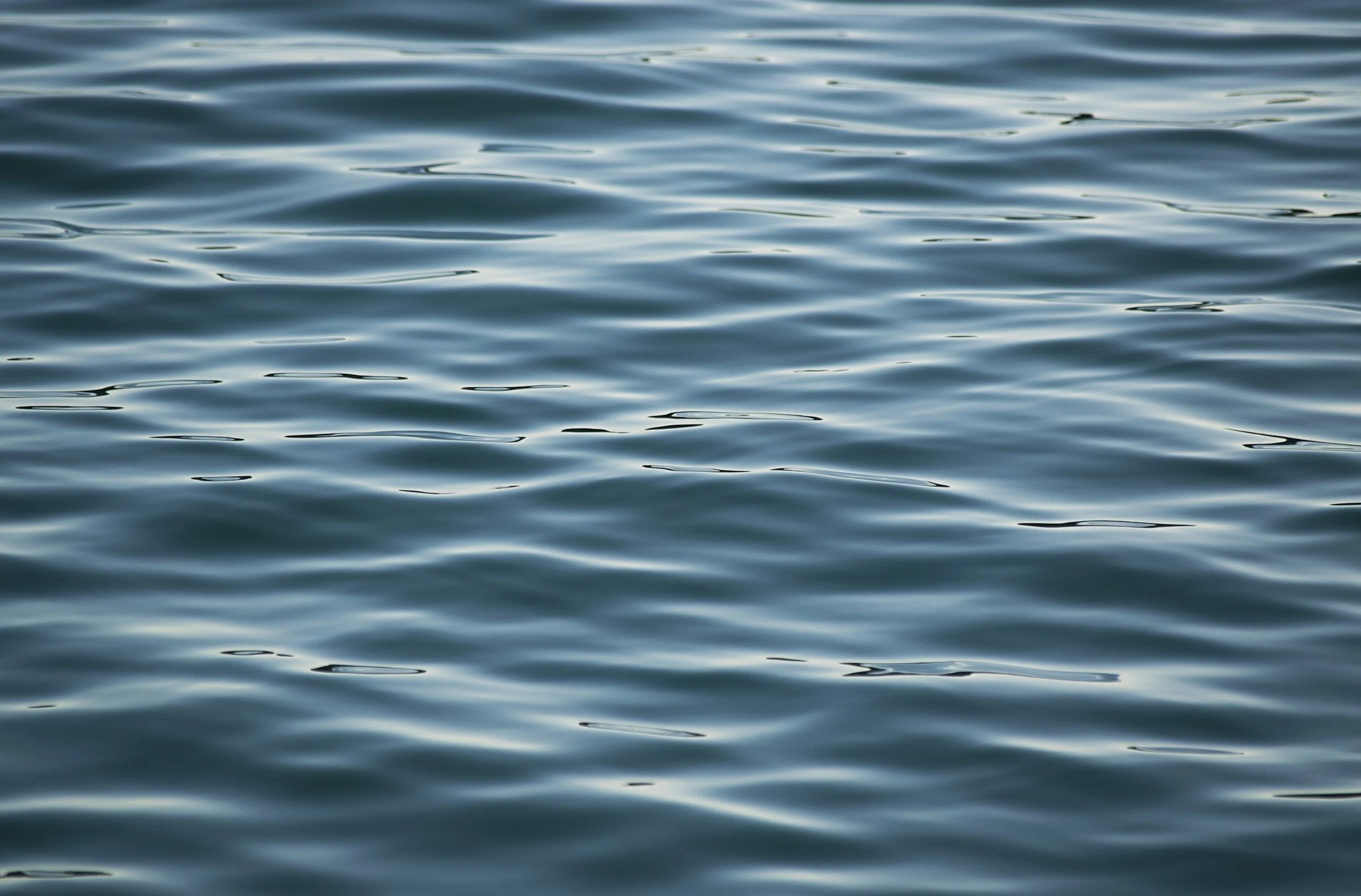
Clearwater Lake, one of the most heavily traveled and recognizable entry points in this part of the Boundary Waters, also serves as my home water along the Gunflint Trail. Traveling out from a lake that I both live and work on creates a different relationship with the surrounding route system—particularly along the border lakes between West Pike and Pine. This stretch remains one of the most topographically distinct areas in the BWCAW, with elevated ridgelines, long sightlines across the international boundary, and a chain of scenic lakes that make it a consistent favorite for both travel and documentation.
These lakes lie within the traditional homeland of the Anishinaabe, whose travel routes historically followed these interconnected waterways long before their designation as recreational corridors. The elevated terrain and border lakes in this region formed part of seasonal movement patterns between inland hunting territories and larger trade networks. Today, while the lakes serve as designated wilderness travel routes, their deeper significance as shared ancestral pathways remains embedded in the landscape.

Bwca ep 80 - LARCH CREEK/GRANITE RIVER
AUGUST 2023
Route: Larch Creek, Larch Lake, Clove Lake, Granite River, Gneiss Lake, Devils Elbow, Maraboeuf Lake, Saganaga Falls & Saganaga Lake
Conditions: Weather: Mild late-summer temperatures with light southwest winds. Water Levels: Moderately high throughout marshland tributaries. Wildlife Activity: Significant beaver presence noted at entry point.
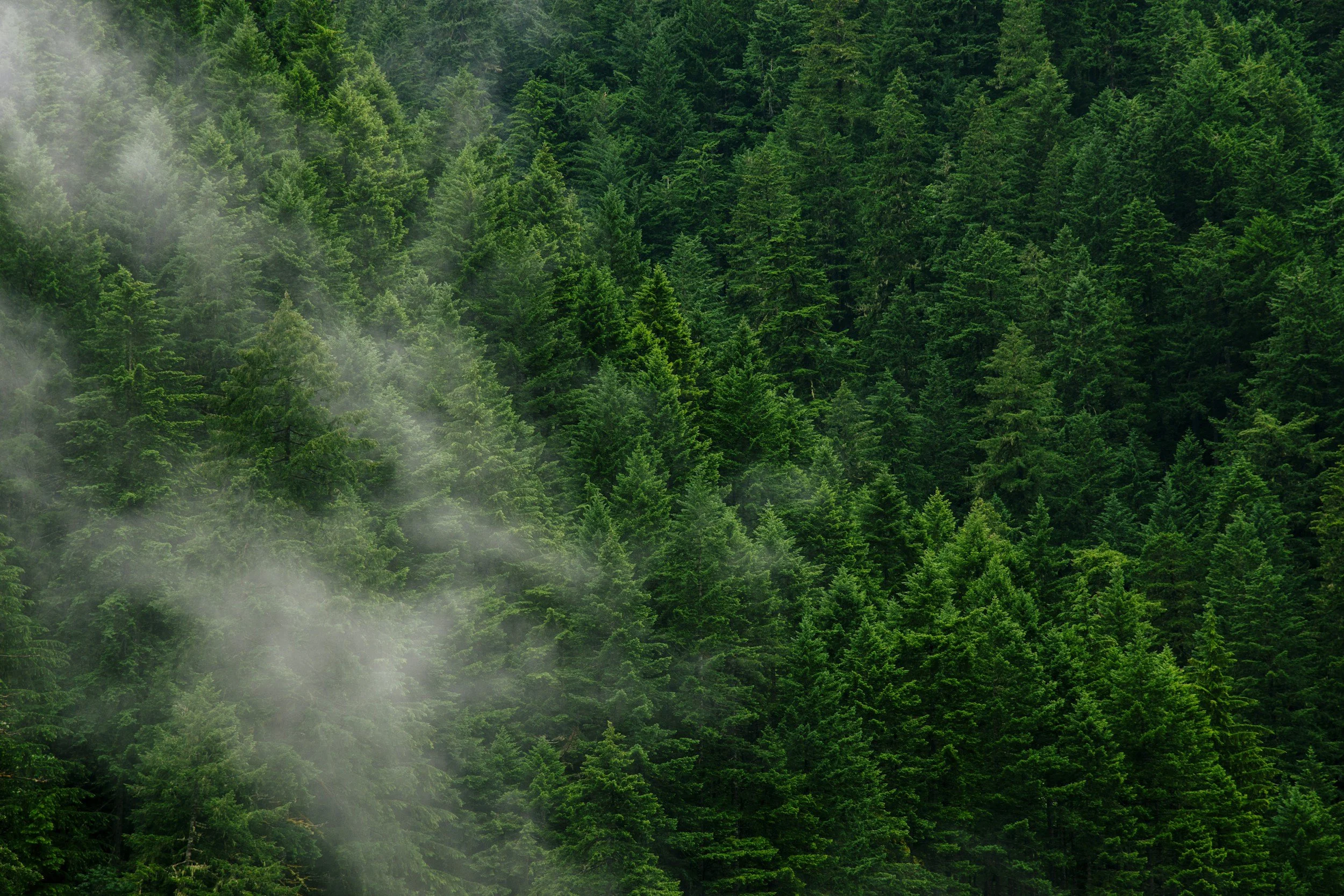
Entry via the Larch Creek access point began with nearly a mile of narrow swamp-grass corridor—requiring lift-overs across eight active beaver dams in the opening stretch. This lesser-used entry, often no more than six feet wide, reflects the ongoing hydrological impact of beaver activity throughout the Superior National Forest. Beyond the wetlands, the route opens into young forest regenerating from previous fire activity, allowing for scenic travel along the international boundary toward Saganaga Lake and Sag Falls.
Purpose of Journey: This late-summer traverse had been on my list for some time—shared this time with Nate and Jeremy, two younger paddlers whose contrasting personalities brought a balance of navigation and morale to the day’s travel. While the physical objective was efficiency (covering 21 miles in a single day), the deeper intention was exposure: introducing developing wilderness travelers to the emotional and ecological complexity of the Boundary Waters in a way that fosters long-term appreciation.
Despite their differences, both came away with the same quiet realization—that these borderlands are something worth respecting, learning from, and ultimately protecting. Positive early experiences in wilderness spaces like the BWCAW often serve as a catalyst for lifelong stewardship. Trips like this are not just routes on a map—they are introductions to responsibility, patience, and place-based connection.
Field Notes: Travel progressed NW along the international boundary—formally established by the 1842 Webster–Ashburton Treaty and still actively regulated today. As of August 2023, remote entry into Canada from the BWCAW required participation in the Remote Area Border Crossing (RABC) permit system administered by the Canada Border Services Agency. A staffed customs check-in station remains located on an island in central Saganaga Lake for certain waterborne crossings. Unauthorized landing north of the demarcation line—even inadvertently—constitutes a legal violation under Canadian federal law.
Sag Falls provided a welcome breakfast and lunch stop—along with a dense population of freshwater leeches (Hirudinea) observed in the shallow rock pools near the cascade. Their presence is consistent with warm, oxygenated summer waters and indicates strong macroinvertebrate diversity within the falls’ microhabitats.
Saganaga Falls itself marks a transitional hydrological feature between upstream Saganaga and downstream systems—once serving as a known landmark for voyageurs and Ojibwe trade routes navigating these shared waters. Today, it remains a point of convergence: of water, of nations, and of generations encountering the wilderness for the first time.
These border waters lie within the traditional homeland of the Anishinaabe, who traveled freely across what is now an international boundary for generations prior to treaty delineation. Routes along these interconnected inland lakes—including the waters surrounding present-day Saganaga—formed long-standing trade and kinship networks between communities throughout the region. While modern borders impose jurisdictional limits, the cultural geography of these lakes remains rooted in an older understanding of land as shared, seasonal, and relational.
270 OVERLOOK - BRT / SHT
JULY 2023
superior National Forest
Route: Arrowhead Trail, Jackson Lake Rd, BRT / SHT Spur Trail.
Conditions: Remote ridgeline travel along a spur trail near the Border Route Trail & Superior Hiking Trail leading to an exposed overlook above the Pigeon River valley. Elevated terrain with exposed rock and intermittent forest cover opened into sweeping views across both U.S. and Canadian wilderness.
Purpose of Journey: The goal of this hike was to reach what is arguably one of the most expansive and least-known viewpoints in northeastern Minnesota. Located near the junction of the Superior Hiking Trail and the eastern terminus of the Border Route Trail, 270 Overlook provides a panoramic view across the Pigeon River valley and surrounding Boundary Waters and Quetico wilderness.
From this exposed ridgeline, a full 270-degree view opens across the valley as the Pigeon River winds eastward toward Lake Superior—forming the natural boundary between Minnesota and Ontario. The overlook sits above chains of glacial lakes and Canadian Shield ridges—terrain historically traveled by voyageurs along what was once known as the inland “Voyageur Highway.”
Field Notes: Accessed via the northernmost section of the Superior Hiking Trail, the spur leading to 270 Overlook ends at a rocky summit offering sweeping views into Canada and west toward the interior lakes near South Fowl. From the overlook, distant cliffs rise across the horizon as cloud systems roll inland—casting shifting shadows across the forest canopy below. The Pigeon River can be seen winding through the valley in the distance, tracing the modern international boundary.
Despite marking the endpoint of a 300-mile trail system, it’s surprising how relatively unknown this overlook remains outside of long-distance hikers and those familiar with the eastern reaches of the Boundary Waters. There’s a quiet tension in standing here—caught between wanting to preserve the solitude that defines places like this, and wanting to share such a rare and expansive view with others who may come to appreciate it in the same way. It stands as one of the most uninterrupted panoramic vistas in Minnesota’s Northwoods—revealing the scale and solitude of the surrounding boreal wilderness from a single exposed ridge.
This overlook sits within the traditional homeland of the Anishinaabe, whose seasonal travel routes once followed these ridgelines and river valleys long before the establishment of recreational trail systems or international boundaries. The Pigeon River itself served as both a travel corridor and cultural landmark within broader inland networks connecting Lake Superior to interior hunting territories and trade routes across what is now northern Minnesota and Ontario.
BWCA EP 60 - DUNCAN LAKE
JUNE 2023
Route: West Bearskin Lake → Duncan Lake (EP 60) Single-portage solo overnight trip with one night spent on Duncan Lake
Conditions: Weather: Partly cloudy with stable summer conditions Precipitation: None encountered Travel Notes: Calm water and relaxed travel via an approximately 75–80 rod portage from West Bearskin Lake
Purpose of Journey: This solo overnight provided an opportunity to slow travel through one of the more accessible yet visually distinct lakes in the eastern Boundary Waters. With only a single moderate portage required for entry, Duncan Lake offers an ideal route for low-impact overnight trips that allow more time for observation rather than distance-based travel.
The goal of the trip was to remain largely stationary—using the campsite as a base for documenting passing weather systems during the day and conducting overnight sky timelapse photography under early summer conditions.
Field Notes: Though often used as a travel corridor toward Rose Falls and the Stairway Portage, this trip remained centered at camp, where passing cloud formations throughout the day provided dynamic lighting conditions ideal for time lapse photography. After sunset, clearing skies revealed the summer Milky Way, followed by an exceptionally clear moonrise over the lake—bringing together a rare convergence of atmospheric and astronomical conditions.
Duncan Lake feeds northward into Rose Lake via Rose Falls—an approximate 30-foot cascade that marks a significant elevation drop between the two lakes. Located along the portage route between Duncan and Rose is the well-known “Stairway Portage,” historically consisting of wooden steps used to navigate the steep terrain between the lakes. As of July 2022, the long-standing wooden staircases were replaced with hand-set native stone steps installed entirely by hand—marking one of the first permanent structural upgrades to the route in nearly a century. Your June 2023 travel season would have been among the first to make use of this updated stonework.
Despite its ease of access and popularity as a day-trip destination due to proximity to Rose Falls and connecting hiking trails such as the Border Route Trail and Caribou Rock Trail, Duncan still offers quiet overnight opportunities—particularly outside of peak July and August traffic.
Indigenous Context:
Duncan Lake lies within the traditional homeland of the Anishinaabe, whose seasonal travel routes historically followed these interconnected inland waterways. Flowing northward through Rose Lake and eventually into the Pigeon River system, these lakes formed part of a broader network linking interior hunting grounds with Lake Superior and beyond—long before their designation as recreational travel corridors within the modern Boundary Waters Canoe Area Wilderness.
WATAP CLIFFS / BORDER ROUTE TRAIL
JUNE 2023
Route: Clearwater Lake Access trail (campsite 1) to the Border Route Trail → Watap Cliffs Overlook Solo day hike via the Border Route Trail ridgeline above Watap Lake
Conditions: Weather: Ideal late-season hiking conditions. Sky: Rolling cumulus cloud cover throughout the day Precipitation: None encountered. Travel Notes: Clear trail conditions with exposed ridge travel
Purpose of Journey: This solo hike was undertaken to revisit what remains—without question—my favorite overlook within the Boundary Waters Canoe Area Wilderness. Located along the Border Route Trail, the Watap Cliffs provide an elevated vantage point rarely experienced by those traveling the region by canoe alone.
With stable weather and shifting cloud formations throughout the day, the goal of the trip was simply to spend time in a place that consistently offers something new with every visit—regardless of season or conditions.
Field Notes: The Watap Cliffs rise above Watap Lake along a section of the Border Route Trail that follows the international boundary between Minnesota and Ontario. This 65-mile wilderness trail runs through the Superior National Forest along ridgelines formed from ancient Canadian Shield bedrock—offering sweeping overlooks of the Boundary Waters and Quetico Provincial Park that are otherwise inaccessible from lake level. 
The surrounding terrain is part of the Rove Formation—a band of Precambrian sedimentary rock that extends along the U.S.–Canada border and is responsible for the region’s distinctive east–west oriented ridges and steep cliff faces overlooking lakes such as Rose, Duncan, Pine, and Watap. 
From the overlook itself, rolling cloud systems moved across the interior lake country below—casting drifting shadows across the forest canopy and revealing how dramatically this landscape changes moment to moment. Despite being home to one of the most expansive viewpoints in the BWCAW—often cited among the best overlooks along the Border Route Trail—Watap Cliffs remain relatively unknown compared to more accessible destinations in the region. 
Every visit offers a different experience depending on light, cloud movement, or season—making it a place that rewards return travel in a way few others do within the Boundary Waters.
Indigenous Context:
These ridgelines and border lakes lie within the traditional homeland of the Anishinaabe, whose travel routes historically followed these same east–west valleys formed by the underlying bedrock structure. Long before the establishment of recreational trail systems or international boundaries, these elevated corridors provided seasonal travel routes connecting inland lake systems to the Pigeon River watershed and Lake Superior beyond.
BWCA EP 41 - BRULE LAKE
JULY 2023
Route: Brule Lake, North Bay, Lily Lake, Mulligan Lake, Grassy Lake, Wanihigan Lake, Cliff Lake, North Cone Lake, Middle Cone Lake, South Cone Lake, Cone Bay, Return to Brule Lake. 2-night loop with first night in North Bay and second night on an island campsite on Brule Lake
Conditions: Weather: Initial storm systems with intermittent sun breaks; clearing to blue skies toward trip’s end. Wind: Moderate to strong winds on Brule Lake Precipitation: Storm activity present in surrounding systems, though minimal rainfall encountered during travel.
Purpose of Journey: This trip was shared with my friend Nate—one of my favorite paddle partners for his enthusiasm and willingness to lean into changing conditions rather than avoid them. Originally, we nearly canceled the trip due to a forecast that suggested persistent storms and rain across the region.
Instead, those same weather systems created some of the most visually compelling paddling conditions of the season. As we pushed into North Bay on our first evening, storm clouds moved across the horizon while low-angle sunlight broke through—casting shifting reflections across wind-driven waves in a way that made the entire lake feel alive.
Field Notes: Night one was spent in North Bay just off Brule Lake after an initial crossing from the entry point. The following morning, we completed a loop through the interior lakes north of Brule—passing through Lily, Mulligan, Grassy, Wanihigan, Cliff, and the Cone Lake chain—before returning to Brule for our final night on an island campsite.
Wind exposure on Brule can be significant due to the lake’s size and orientation, and our final evening was spent with steady wave action pushing against the shoreline. The isolation of the island campsite offered welcome shelter and a sense of solitude despite Brule’s reputation as a more frequently traveled lake due to its accessibility and numerous campsites.
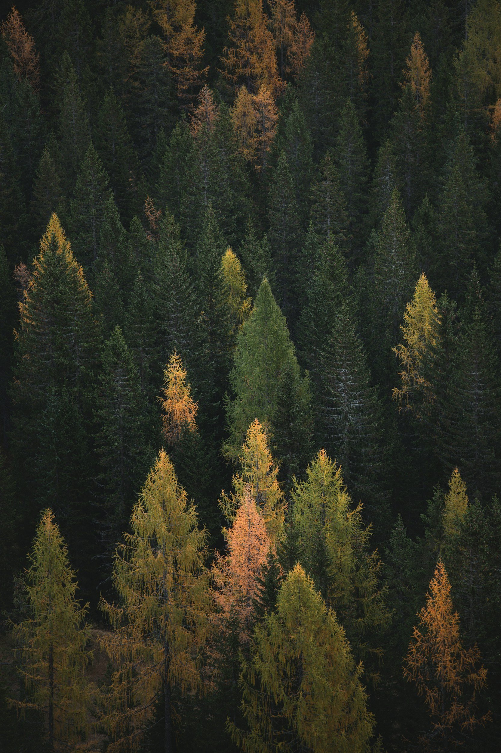
Brule Lake itself occupies a basin shaped in part by glacial scouring during the last Ice Age, leaving behind a broad, relatively shallow lakebed broken by low ridgelines of exposed bedrock and moraine deposits. These rounded, “muffin top” formations—visible along the shoreline and across interior islands—reflect a slightly different geological character than the steeper ridge systems found along the eastern border lakes nearer Clearwater and Pine.
Despite occasional higher traffic levels, Brule’s expansive surface area allows for quiet travel—particularly outside of peak holiday periods. Its open water and varied shoreline make it one of the most visually distinct lakes in this section of the Boundary Waters, and one of the reasons I ultimately chose to purchase property nearby.
Indigenous Context:
Brule Lake lies within the traditional homeland of the Anishinaabe, whose seasonal travel routes historically followed these interconnected lake systems long before their modern designation as wilderness recreation corridors. The broader Brule watershed connects to interior travel routes extending toward both the Temperance River system and Lake Superior basin—forming part of a longstanding network of inland movement and resource gathering

HIDDEN FALLS - TEMPERANCE RIVER
JUNE 2023
Route: Backroad access near Temperance River State Park → Superior Hiking Trail along Temperance River Gorge → Hidden Falls Day hike within the Temperance River canyon system
Conditions: Weather: Partly cloudy with shifting spring cloud systems. Water Levels: Elevated seasonal runoff. Travel Notes: Fast-moving water and slick terrain along canyon walls.
Purpose of Journey: This trip was undertaken to document one of the lesser-known waterfalls along the Temperance River—commonly referred to as “Hidden Falls.” Located just inland from Lake Superior near Grand Marais, the falls sit within a deep river gorge accessed by sections of the Superior Hiking Trail and nearby backroad entry points. Spring runoff provided ideal flow conditions for both filming and aerial documentation of the canyon system and
Field Notes: The Temperance River has carved a series of deep and narrow gorges through nearly 1.1-billion-year-old basalt bedrock along Minnesota’s North Shore—creating the dramatic canyon system that gives rise to Hidden Falls and several unnamed cascades along the river’s course. 
During this attempt to film the falls and surrounding rapids, a drone strike with a cedar limb while flying close to the water resulted in a full loss into the river below—effectively ending the flight for good. In a sense, it took two drones to make this film. Still, the conditions inside the canyon made the effort worthwhile.
The Superior Hiking Trail follows portions of the Temperance River through this steep gorge, where spring runoff transforms the normally quiet river into a fast-moving system of chutes, cascades, and plunge pools. The surrounding canyon is densely populated with mature cedar and boreal forest species—creating a sheltered and remarkably peaceful microclimate despite the force of the water moving below.
While Hidden Falls is not as widely visited as the more accessible Lower Cascades nearer Highway 61, the Temperance River itself has cut out multiple waterfalls and narrow chasms along its inland stretch—many of which remain largely unseen from the main park trail system.
The Temperance River valley lies within the traditional homeland of the Anishinaabe, whose seasonal travel routes once followed these inland waterways as they moved between Lake Superior and interior hunting territories. The river’s gorge—formed long before modern trail systems—would have served as both a landmark and a natural corridor within broader regional travel networks.