
Bwca ep 66 - crocodile lake
sept 2024
Route: Bean Lake, Parsnip Lake, Crocodile River, Crocodile Lake & East Bearskin Lake.
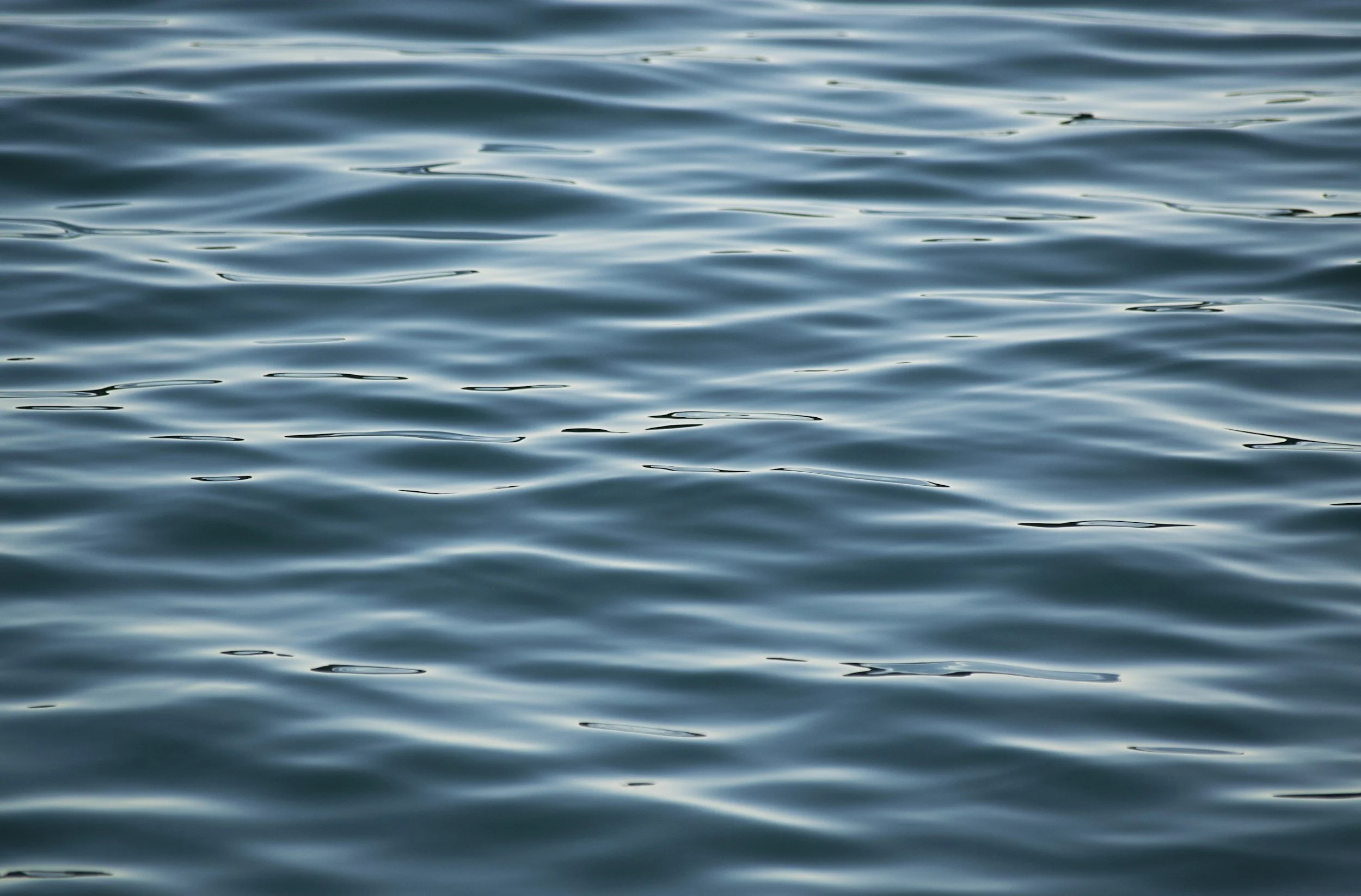
Conditions: Stable late-summer travel conditions with generally clear skies throughout the day and light wind across the Crocodile Lake basin. Evening conditions remained calm, allowing for extended nighttime visibility and favorable conditions for stargazing and moonrise observation.
Purpose of Journey: To repeat a previously completed solo route through the South Bean–Parsnip–Crocodile chain following the loss of original footage due to hard drive failure — documenting the Crocodile River corridor and overnight conditions on Crocodile Lake under comparable seasonal timing.
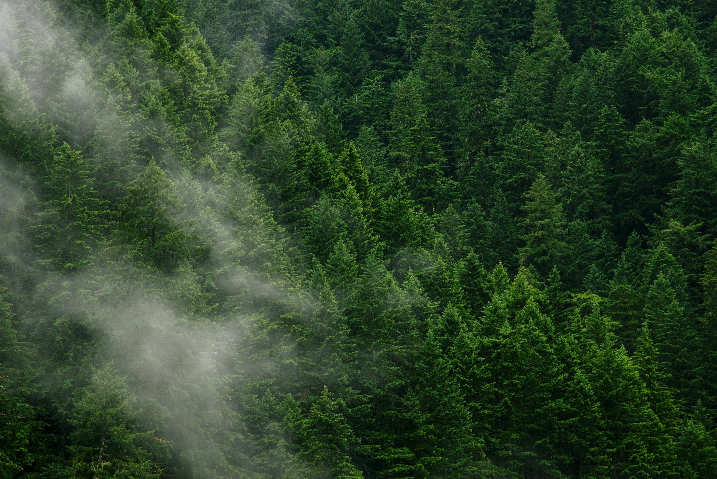
Field Notes: This solo journey began at BWCA Entry Point 66 (Crocodile Lake), launching into the lesser-traveled chain of lakes extending from South Bean through Parsnip and into the Crocodile River system. The route required multiple beaver dam crossings and slow travel through winding channels before opening into the broader basin of Crocodile Lake itself.
This trip followed an identical route completed the previous year, undertaken again after the original footage from that journey was lost to a damaged hard drive. Returning under similar seasonal conditions offered an opportunity to revisit the corridor with increased familiarity — observing subtle differences in water level, flow, and vegetation across the river system.
Evening conditions on Crocodile Lake provided a clear sky for nighttime observation. While setting up a timelapse sequence after dark, a misstep near camp resulted in boiling water being overturned — briefly disrupting the quiet of the basin and leaving a minor burn as an unintended reminder of the challenges associated with solo travel in low-light conditions.
Nightfall brought stillness across the lake as wind moved through the surrounding pines, with starlight and rising moonlight settling across the treeline.
The quiet waters of Crocodile Lake lie within a landscape that has long been part of traditional Anishinaabe travel and harvesting territory. Lakes such as these—set just beyond the larger travel corridors—were often used as seasonal fishing grounds or temporary campsites during movements between inland hunting areas and the north shore of Gichi-Gami (Lake Superior). The surrounding wetlands and sheltered shoreline would have supported plant gathering and wildlife habitat, making places like Crocodile not just destinations, but working parts of a much broader network of life lived by canoe across the northern forest.

Bwca ep 64 - EAST BEARSKIN LAKE
sept 2024
Conditions: Favorable late-season travel conditions with stable weather and light winds throughout the East Bearskin–Alder chain. Clear skies and minimal insect activity contributed to extended intervals of stillness across open water during both travel and overnight conditions on Canoe Lake..
Route: East Bearskin Lake, Alder Lake & Canoe Lake.
Purpose of Journey: TTo complete a short-duration solo overnight through the East Bearskin–Alder corridor, documenting campsite conditions and travel routes leading into Canoe Lake under calm late-season conditions.
Field Notes: This solo overnight began at BWCA Entry Point 64 (East Bearskin Lake), with travel carrying north through Alder Lake before reaching Canoe Lake — where I established camp for the night along a quiet stretch of shoreline. Conditions throughout the day remained stable, with minimal wind across the lake surfaces and long intervals of silence once clear of the landing.
Canoe Lake offered a sheltered campsite and a noticeably quieter basin for the evening, with little sign of recent travel through the area. Overnight conditions remained calm, allowing the lake to settle into stillness by nightfall.
On the return route, travel followed the northern portage from Alder Lake back into East Bearskin. While not documented on video during the trip, this section of trail was heavily overgrown — with limited visible footpath and multiple obstructed segments along the carry. Despite remaining marked on current maps, travelers moving through this corridor may encounter slower-than-expected passage due to vegetation and reduced trail maintenance along this portage.
The lakes connected by the East Bearskin entry were once part of a larger network of canoe travel routes used by the Anishinaabe to move between inland hunting territories and the north shore of Gichi-Gami (Lake Superior). Alder and Canoe Lakes would have served not only as travel corridors, but as seasonal fishing and harvesting areas—places where movement across the land was guided by familiarity rather than maps. The portages between these lakes follow the same natural breaks in terrain that Indigenous travelers would have identified generations ago, creating passageways that quietly predate modern wilderness boundaries.

BWCA EP 40 - HOMER LAKe
August 2024
Route: Homer Lake / Boundary Waters / Superior National Forest
Conditions: Mild mid-August conditions with stable daytime temperatures and generally clear skies throughout the duration of the trip. Light winds moved intermittently through the Homer Lake basin, with increasing calm toward evening as the moon rose over open water.
Purpose of Journey: To conduct a short-duration solo overnight into the Homer Lake area (BWCA Entry Point 40), documenting travel and campsite conditions within a less frequently visited entry point situated along the boundary between the Boundary Waters Canoe Area Wilderness and the surrounding Superior National Forest.
Field Notes: This solo overnight began at BWCA Entry Point 40 (Homer Lake), a quieter access point located along the southern edge of the wilderness boundary. With a single pack and hammock system, the goal was to travel light and spend a brief period observing the lake basin under stable late-summer conditions.
Homer Lake remains less frequently visited than many of the region’s more central routes, offering extended intervals of stillness once clear of the landing. Camping along the transition zone between designated wilderness and the broader Superior National Forest introduced a subtle shift in terrain and use patterns not always present deeper within the BWCA.
Evening brought clearing skies and a gradual moonrise over the waterline. As wind dropped off across the basin, the lake settled into a quiet that tends to accompany solo travel — where movement becomes minimal and observation takes precedence over distance covered.
Homer Lake rests within a network of inland waterways historically used by the Anishinaabe as part of seasonal movement between hunting territories and larger gathering areas. Lakes like Homer—connected through quiet portage trails and narrow passages—would have served as reliable fishing sites and temporary camps during travel across the forest. The same low ridges and natural clearings that guide modern portage paths today often follow terrain features first identified generations ago, forming quiet corridors of movement through a landscape once navigated entirely by paddle and memory.
Bwca ep 57 - Magnetic LAKE
AUGUST 2024
Route: Gunflint Lake. Magnetic Lake, Pine River, Little Rock Falls & Clove Lake.
Conditions: Calm summer conditions along the U.S./Canada border made for an easy and quiet paddle into Magnetic Lake. Light winds and stable weather carried through most of the journey, with the Pine River system flowing gently between lakes. Travel was smooth overall, with peaceful waters and long stretches of solitude defining much of the route.
Purpose of Journey: This overnight solo trip into Magnetic Lake (Entry Point #57) was part of a broader effort to document remote borderland routes within the Boundary Waters Canoe Area Wilderness. After taking time earlier in the season to upgrade essential filming and travel equipment, this journey marked a return to the field—resuming a summer of exploration and visual storytelling across the BWCA.
Field Notes: Paddling through Magnetic Lake and into the winding channels of the Pine River system offered a quiet reentry into wilderness travel. The borderland terrain held a deep stillness—broken only by the sound of current moving through narrows and the occasional movement of wind across open water.
After a steady day of travel, I found a small and secluded place to make camp for the night. With no one else nearby, the evening settled into that familiar northern silence—water moving slowly past the shoreline, trees shifting in low wind, and the subtle rhythm of the forest after dark.
Flowing along what is now the international border, the Pine and Granite River system was historically part of a fluid travel landscape used by the Anishinaabe long before political lines divided these waters. The east-to-west movement of the connected lakes and falls offered natural passage between watersheds, with portage routes forming around rapids and waterfalls that could not be paddled. These same corridors supported seasonal movement for trade, fishing, and gathering—reminding modern travelers that what feels remote today was once part of an active and well-known network of Indigenous travel through the northern forest.

Bwca ep 23 - mudro LAKE
july 2024
Route: Mudro Lake, Sandpit Lake & Tin Can Mike Lake.
Conditions: Travel began under relatively stable summer conditions, with manageable winds and favorable paddling across the interior lakes leading north from Mudro. Portages along this route were moderately challenging, with rocky footing and elevation changes typical of the terrain between Mudro and the larger Basswood watershed. On the second day of travel, conditions shifted rapidly as a severe and sustained downpour moved into the area—bringing intense rainfall that significantly reduced visibility, saturated portage trails, and made continued travel both difficult and unsafe.
Purpose of Journey: This trip was undertaken with the goal of reaching Basswood Lake to view the historic pictographs located along its northern shoreline. Traveling as a team, we aimed to document the route and experience one of the Boundary Waters’ most culturally significant sites—where ancient markings remain visible on the exposed cliff faces above the waterline..
Field Notes: Paddling north from Mudro offered the familiar rhythm of lake-to-lake travel, broken up by rugged portages threading through dense forest and glacial rock. The route toward Basswood Lake carried a steady sense of anticipation, with the intention of reaching the pictographs that have drawn travelers to this area for generations.
By the morning of the second day, however, conditions changed dramatically. A powerful downpour moved in with little warning—bringing heavy rain that quickly overwhelmed the trail systems and open water alike. What would normally be manageable travel in wet conditions became unsafe, as visibility dropped and footing along portages turned slick with runoff. Despite the goal of continuing on toward Basswood, the decision was made to turn back and begin the return journey home.
The pictographs of Basswood Lake are widely believed to have been created by the ancestors of the Anishinaabe, marking places of spiritual or cultural significance along important travel routes. These ochre images—often depicting animals, canoes, or human forms—were traditionally applied to rock faces using natural pigments mixed with binders such as fish oil. Positioned along major waterways like Basswood, they served as visual expressions of story, guidance, or presence, reminding modern travelers that these routes once carried generations of Indigenous people who moved across the lakes with purpose long before recreational travel brought others to these waters.

Bwca ep 43 - BOWER TROUT LAKE
july 2024
Route: Bower Trout Lake, Marshall Lake, South Brule River, Dugout Lake, Skidway Lake, Swan Lake, Vernon Lake & Brule Lake.
Conditions: Overcast skies settled in for most of the journey, creating soft light across the lakes and forested shoreline throughout the route. Light winds made for manageable paddling conditions as we moved through the smaller interior lakes connected to the Brule watershed. Despite the cloud cover, travel remained steady and comfortable—offering ideal conditions for making our way toward the larger open water of Brule Lake.
Purpose of Journey: This trip was undertaken with my good friend Maggie, traveling from the Bower Trout entry point (EP 43) with the intention of reaching Brule Lake via the interior lake system. The goal was to spend time exploring this quieter approach into one of the Boundary Waters’ more expansive lakes—documenting the route while enjoying the slower pace of travel through smaller, forest-bound waters.
Field Notes: Launching from Bower Trout, we made our way through a chain of serene lakes connected by short portages that gradually opened toward the Brule Lake watershed. The overcast conditions gave the forest a muted tone—softening the horizon and settling the landscape into a quiet, almost suspended stillness as we traveled. Wildlife moved subtly along the shoreline, and the dense surrounding forest carried that familiar hush that comes with cloud-covered skies.
As the route progressed westward, the scale of the terrain began to shift—hinting at the broader expanse of Brule beyond the tree line. Even under gray skies, this entry offers a rewarding approach into the lake, trading the exposure of direct access for a more gradual transition through the surrounding wilderness.
This region lies within traditional Anishinaabe homeland, where interconnected lakes like those along the Bower Trout route would have served as seasonal travel corridors between inland hunting grounds and the larger watersheds to the south. These smaller lakes and portage paths formed dependable routes for movement by canoe, following natural breaks in terrain and water levels. Today’s travel through these same passages echoes a much older pattern of movement across the northern forest—where lakes like Brule were not destinations, but part of a lived landscape shaped by generations of Indigenous presence.
Bwca ep 61 - daniels LAKE
june 2024
Route: West Bearskin Lake, Daniels Lake, Rove Lake, Watap Lake, Mountain Lake & Clearwater Lake..
Conditions: Unseasonably pleasant weather settled in for this early June trip, bringing calm winds and stable skies along the border route. Mild daytime temperatures and cool nights created ideal travel conditions for paddling and portaging through the interconnected lakes leading toward Mountain Lake. Visibility remained clear throughout most of the journey—providing expansive views across open water and exposed rock formations along the international boundary.
Purpose of Journey: This solo journey from Daniels Lake (EP 61) followed the historic border route toward Mountain Lake, with the intention of documenting travel through Watap Lake and completing the well-known “Long Portage” along the Border Route Trail. The goal was to reach Mountain Lake Camp for an overnight stay—traveling through one of the most visually striking stretches of the Boundary Waters along the U.S./Canada border.
Field Notes: Departing from Daniels Lake, the route quickly narrowed into the winding chain of border lakes that lead toward Watap. Early season travel made for comfortable paddling, with still waters reflecting the steep rock faces and rising ridgelines that define this part of the wilderness. Watap Lake, in particular, offered dramatic views—its cliff-lined shoreline standing in contrast to the surrounding forest as the route bent westward along the boundary.
From there, I began the descent along the infamous Long Portage, following a stretch of trail that connects these remote waters to Mountain Lake. This segment—running alongside portions of the Border Route Trail—served as a reminder of the terrain that has shaped travel here for generations. By evening, I reached Mountain Lake Camp and settled in for the night. Under the cool quiet of a June sky, the northern lights made a brief appearance—dancing above the waterline before fading back into darkness as I slipped into the hammock for sleep.
This section of the border lakes lies within traditional Anishinaabe travel territory, where waterways like Watap and Mountain once formed part of seasonal canoe routes linking inland hunting grounds with the larger trade networks surrounding Gichi-Gami (Lake Superior). Prominent landmarks such as the cliffs of Watap would have served as natural navigational points for travelers moving between watersheds. Even today, the Long Portage reflects the same terrain breaks that Indigenous travelers would have followed—carrying canoe and goods across the ridgelines along routes known through generations of movement by water and memory.
Bwca ep 45 - Morgan LAKE
MAY 2024
Route: Morgan Lake, Carl Lake, Lax Lake, Jake Lake, Vista Lake, Horseshoe Lake, Caribou Lake, Lizz Lake & Poplar Lake.
Conditions: Travel on May 31 through June 1 brought mostly overcast skies across the Morgan to Caribou route, with occasional breaks in the cloud cover late in the evening. Daytime temperatures remained cool but comfortable for late spring travel, with calm to light winds making for manageable paddling across the smaller interior lakes. Overnight conditions dipped into the lower range typical for early June in the Boundary Waters, with still air settling in after sunset..
Purpose of Journey: This solo trip marked my first Boundary Waters journey of 2024, launching from Morgan Lake (EP 45) with the goal of reaching Caribou Lake for an overnight stay. The route offered a quiet return to wilderness travel after the winter season—documenting the subtle transition into spring across the interior lake system.
Field Notes: Departing from Morgan Lake, the route carried me through a series of smaller connected lakes and short portages leading toward Caribou. Under consistently overcast skies, the landscape felt subdued—soft light settling across the shoreline as the forest moved quietly into early season growth. Evidence of wolves became increasingly noticeable along the portage trails and muddy shoreline edges—tracks pressed into the earth and signs of recent movement through the area.
Minnesota is home to one of the largest remaining gray wolf populations in the lower forty-eight states, with an estimated 2,700–3,000 individuals primarily occupying the northern forested regions of the state. Travel through this part of the Boundary Waters serves as a reminder that these lakes remain part of an active wilderness—shared with wildlife that continues to move through these corridors much as they always have.
By evening, I reached Caribou Lake and made camp beneath a cloud-covered sky. As darkness settled in, the moon broke through briefly—casting a pale glow across the waterline before disappearing again behind the lingering cloud cover.
The lakes along this route lie within traditional Anishinaabe homeland, where waterways such as Morgan and Caribou once formed part of seasonal travel routes between inland hunting territories and larger gathering areas nearer to Gichi-Gami (Lake Superior). Smaller interior lakes like these would have provided dependable fishing sites and temporary camps during travel by canoe, with portage paths following natural breaks in terrain known through generations of lived experience on the land.