
eagle mountain
AUGUST - OCTOBER 2022
SUPERIOR NATIONAL FOREST
Route: Accessed via the Eagle Mountain Trailhead off the Gunflint Trail (County Road 12), located approximately 18 miles northwest of Grand Marais. The route follows the designated Eagle Mountain Hiking Trail through mixed boreal forest, gradually ascending toward Whale Lake near the midpoint of the hike.
From Whale Lake, the trail continues upward along increasingly exposed bedrock and root-laced terrain toward the summit ridge. The final ascent includes the steepest elevation gain of the journey before reaching the summit marker located slightly within the treeline beyond the primary overlook.Total route distance: approximately 7 miles round trip.
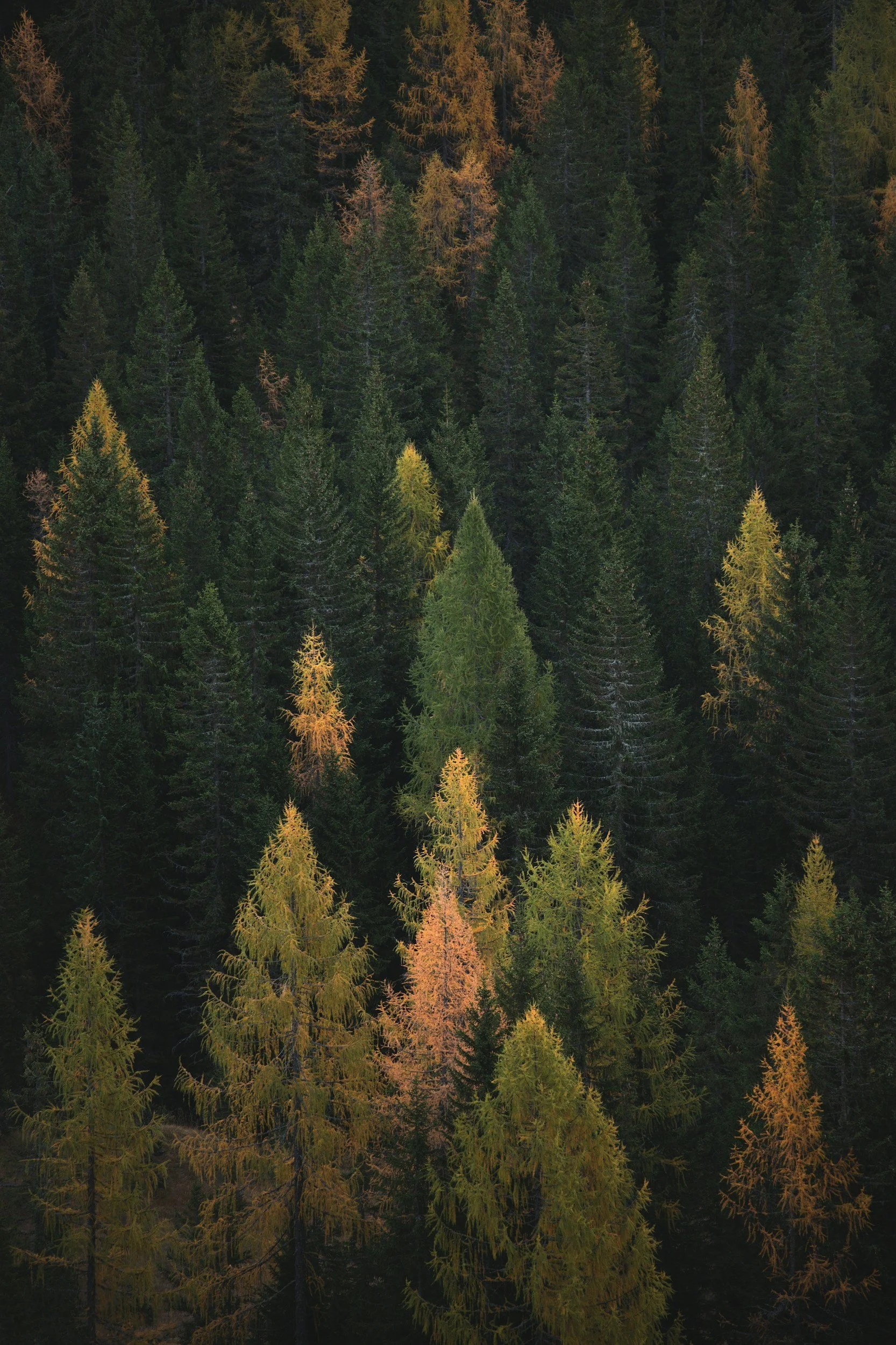
Conditions: This journey to Eagle Mountain took place across two separate hikes during late summer and again in the early fall of 2022. Both ascents followed the Eagle Mountain Trail within the Boundary Waters Canoe Area Wilderness of Superior National Forest. Weather conditions during the late summer hike were warm and stable, with full foliage and dense understory present along the trail corridor.
Upon returning in the fall, the forest had begun its seasonal transition. Cooler temperatures prevailed, and early leaf-fall had opened up portions of the trail that were previously enclosed by green canopy. Light wind moved across the ridgelines, and visibility through the forest was notably increased compared to the earlier ascent.
The Eagle Mountain Trail extends approximately 3.5 miles from trailhead to summit, resulting in a roughly 7-mile round trip hike with an elevation gain of approximately 550–650 feet. The trail is characterized by rocky footing, exposed roots, bog crossings with plank walkways, and a sustained climb during the final mile toward the summit ridge.
Purpose of Journey: This trip was undertaken to document one of the lesser-known waterfalls along the Temperance River—commonly referred to as “Hidden Falls.” Located just inland from Lake Superior near Grand Marais, the falls sit within a deep river gorge accessed by sections of the Superior Hiking Trail and nearby backroad entry points. Spring runoff provided ideal flow conditions for both filming and aerial documentation of the canyon system and
Field Notes: The Temperance River has carved a series of deep and narrow gorges through nearly 1.1-billion-year-old basalt bedrock along Minnesota’s North Shore—creating the dramatic canyon system that gives rise to Hidden Falls and several unnamed cascades along the river’s course. 
During this attempt to film the falls and surrounding rapids, a drone strike with a cedar limb while flying close to the water resulted in a full loss into the river below—effectively ending the flight for good. In a sense, it took two drones to make this film. Still, the conditions inside the canyon made the effort worthwhile.
The Superior Hiking Trail follows portions of the Temperance River through this steep gorge, where spring runoff transforms the normally quiet river into a fast-moving system of chutes, cascades, and plunge pools. The surrounding canyon is densely populated with mature cedar and boreal forest species—creating a sheltered and remarkably peaceful microclimate despite the force of the water moving below.
While Hidden Falls is not as widely visited as the more accessible Lower Cascades nearer Highway 61, the Temperance River itself has cut out multiple waterfalls and narrow chasms along its inland stretch—many of which remain largely unseen from the main park trail system.
The Temperance River valley lies within the traditional homeland of the Anishinaabe, whose seasonal travel routes once followed these inland waterways as they moved between Lake Superior and interior hunting territories. The river’s gorge—formed long before modern trail systems—would have served as both a landmark and a natural corridor within broader regional travel networks.
eagle mountain
AUGUST - OCTOBER 2022
SUPERIOR NATIONAL FOREST
Route: Accessed via the Eagle Mountain Trailhead off the Gunflint Trail (County Road 12), located approximately 18 miles northwest of Grand Marais. The route follows the designated Eagle Mountain Hiking Trail through mixed boreal forest, gradually ascending toward Whale Lake near the midpoint of the hike.
From Whale Lake, the trail continues upward along increasingly exposed bedrock and root-laced terrain toward the summit ridge. The final ascent includes the steepest elevation gain of the journey before reaching the summit marker located slightly within the treeline beyond the primary overlook.Total route distance: approximately 7 miles round trip.
Conditions: This journey to Eagle Mountain took place across two separate hikes during late summer and again in the early fall of 2022. Both ascents followed the Eagle Mountain Trail within the Boundary Waters Canoe Area Wilderness of Superior National Forest. Weather conditions during the late summer hike were warm and stable, with full foliage and dense understory present along the trail corridor.
Upon returning in the fall, the forest had begun its seasonal transition. Cooler temperatures prevailed, and early leaf-fall had opened up portions of the trail that were previously enclosed by green canopy. Light wind moved across the ridgelines, and visibility through the forest was notably increased compared to the earlier ascent.
The Eagle Mountain Trail extends approximately 3.5 miles from trailhead to summit, resulting in a roughly 7-mile round trip hike with an elevation gain of approximately 550–650 feet. The trail is characterized by rocky footing, exposed roots, bog crossings with plank walkways, and a sustained climb during the final mile toward the summit ridge.
Purpose of Journey: This trip was undertaken to document one of the lesser-known waterfalls along the Temperance River—commonly referred to as “Hidden Falls.” Located just inland from Lake Superior near Grand Marais, the falls sit within a deep river gorge accessed by sections of the Superior Hiking Trail and nearby backroad entry points. Spring runoff provided ideal flow conditions for both filming and aerial documentation of the canyon system and
Field Notes: The Temperance River has carved a series of deep and narrow gorges through nearly 1.1-billion-year-old basalt bedrock along Minnesota’s North Shore—creating the dramatic canyon system that gives rise to Hidden Falls and several unnamed cascades along the river’s course. 
During this attempt to film the falls and surrounding rapids, a drone strike with a cedar limb while flying close to the water resulted in a full loss into the river below—effectively ending the flight for good. In a sense, it took two drones to make this film. Still, the conditions inside the canyon made the effort worthwhile.
The Superior Hiking Trail follows portions of the Temperance River through this steep gorge, where spring runoff transforms the normally quiet river into a fast-moving system of chutes, cascades, and plunge pools. The surrounding canyon is densely populated with mature cedar and boreal forest species—creating a sheltered and remarkably peaceful microclimate despite the force of the water moving below.
While Hidden Falls is not as widely visited as the more accessible Lower Cascades nearer Highway 61, the Temperance River itself has cut out multiple waterfalls and narrow chasms along its inland stretch—many of which remain largely unseen from the main park trail system.
The Temperance River valley lies within the traditional homeland of the Anishinaabe, whose seasonal travel routes once followed these inland waterways as they moved between Lake Superior and interior hunting territories. The river’s gorge—formed long before modern trail systems—would have served as both a landmark and a natural corridor within broader regional travel networks.
bwca ep 50 - cross RIVER - mora lake
september 2022
Route: The Cross River, Ham Lake, Cross Bay Lake, Snipe Lake, Hubbub Lake, Howl Lake/Swamp, Tuscarora Lake, Owl Lake, Crooked Lake, Tarry Lake, Mora Lake & Time Lake.
Conditions: Weather: This was a two-night, three-day paddle through the Boundary Waters Canoe Area Wilderness in early October of 2022. Seasonal conditions were cool but manageable, with daytime temperatures hovering in the low to mid-40s°F and nighttime lows dropping toward freezing. Skies remained predominantly clear throughout the journey, with occasional intermittent cloud cover drifting through during daylight hours.
During midday travel on the second day, we encountered a localized and intense hailstorm that lasted only a few minutes across roughly a quarter-mile stretch of lake and forest. The accumulation was significant enough to coat the shoreline in white, giving the impression of fresh snowfall despite no measurable snow having fallen anywhere in the region at that point in the season. As abruptly as it began, the phenomenon ended—conditions returned to normal immediately upon paddling out of the impacted area.
Purpose of Journey: The purpose of this journey was to travel deep into the Cross Bay and Tuscarora region in search of late-season solitude and to document the autumn transition of the Boundary Waters landscape under increasingly cold conditions. With leaf-fall underway and the first hints of winter approaching, the intent was to experience and capture the tonal quiet that settles across the lakes in early October, culminating in a documented moonrise over Mora Lake beneath clear northern skies.
Field Notes: Travel began at Cross Bay Entry Point 50, moving through a chain of interior lakes including Ham, Cross Bay, Snipe, Hubbub, Howl, Tuscarora, Owl, Crooked, and Tarry before reaching Mora Lake. Portages were damp with fallen leaves and late-season debris, and the surrounding forest had taken on the muted browns and greys of early dormancy.
On one of the portages, my travel partner Dan was able to harvest a ruffed grouse, which later provided a welcomed and much-needed warm meal in the cooling autumn air.
Near a portage off Tuscarora Lake, we came across the scattered skeletal remains of a moose along the rocky shoreline—bones bleached white from long exposure. Some lay half-submerged beneath the waterline, while others rested among the shoreline stones. The skull had clearly already been scavenged, though the remaining bones suggested the animal had come to rest there some time ago.
Later in the journey, Dan guided us toward a small and largely inaccessible body of water near Mora known as Time Lake. Access required navigating a narrow creek bed with no established portage trail. The approach was slow and deliberate, pushing and lifting the canoe through shallow water and submerged rock until we reached the lake basin.
Along the shoreline stood a split rock formation forming a shallow cave or recess in the cliff face. Local accounts had suggested the possible presence of pictographs in this area, though none were located during our search. Still, the remoteness of the place—untouched by established trail—invited speculation about those who may have once sheltered or paused there long before our arrival.
The journey concluded beneath a strikingly clear night sky, where a full moon rose over Mora Lake without obstruction—casting silver light across still water and silhouetted shoreline.
The Mora Lake region lies within the ancestral homeland of the Anishinaabe people, whose presence across these interconnected waterways extends back generations. Remote features such as cliff recesses and shoreline caves have long served as places of pause, shelter, or spiritual reflection along traditional travel routes. While no pictographs were observed during this journey, the oral histories and enduring cultural memory tied to these landscapes suggest that such locations may once have held ceremonial or navigational significance. Even in their silence, these hidden spaces remain part of a much older relationship between people and place—one that continues to shape the meaning of travel through this wilderness today.

bwca ep 52 - BRANT lake - PICTOGRAPHS
september 2022
Route: Round Lake, West Round Lake, Edith Lake, Brant Lake, Gotter Lake, Flying Lake, Green Lake, Bat Lake, Gillis Lake, French Lake, Powell Lake, West Fern Lake, Virgin Lake, Little Sag Lake, Elton Lake, Makwa Lake, Panhandle Lake, Pan Lake, Anit Lake, Kivaniva Lake, Kawishewe River, River Lake & Fishdance Lake.
Conditions: This journey took place over the course of three days, covering approximately 62 miles round trip through the central Boundary Waters Canoe Area Wilderness. Travel conditions throughout the majority of the trip were heavily overcast, with persistent cloud cover muting both light and color across the interconnected chain of interior lakes.
Despite the distance covered each day, winds remained manageable and water conditions were generally calm. The subdued light created an almost suspended atmosphere across the landscape, as though the forest and water existed beneath a low ceiling of cloud.
As we approached the pictograph site along the rock face of Fishdance Lake near the end of the journey, the cloud cover abruptly parted and direct sunlight illuminated the cliffside. The timing of the break in the overcast sky—occurring precisely upon arrival at the site—produced a striking visual contrast against the otherwise dim conditions experienced throughout the trip.
Purpose of Journey: The purpose of this journey was to travel deep into the Boundary Waters in search of the ancient pictograph site located along the northern shoreline of Fishdance Lake. These red ochre paintings—applied directly to exposed cliff faces—are believed to date back several hundred years and are commonly associated with spiritual or ceremonial significance among Indigenous peoples of the region.
In addition to documenting the site itself, the journey offered an opportunity to experience the transition from overcast stillness to direct illumination at the moment of arrival—highlighting the visual and atmospheric impact of natural light on these historic markings.
Field Notes: This trip was completed alongside my travel partner Dan, with daily travel distances averaging roughly 20 miles. The route passed through numerous small interior lakes connected by short portages, offering a sense of steady forward movement across an otherwise quiet and enclosed wilderness landscape.
Upon arrival at Fishdance Lake, the pictographs became visible along a vertical granite cliff rising directly from the waterline. The figures—rendered in iron-rich red ochre—depict stylized human forms, animals, and symbolic markings believed to represent spiritual or narrative elements tied to traditional lifeways.
As we drifted closer by canoe, the previously overcast sky broke unexpectedly, casting direct sunlight across the cliff face and bringing the ochre markings into sharp contrast against the surrounding stone. The sudden illumination created a momentary sense of clarity within an otherwise muted journey, emphasizing both the fragility and endurance of these historic images.
Visitors to pictograph sites within the BWCAW are asked to observe from the water and avoid physical contact with the rock face, as even minor disturbance can accelerate the fading of these culturally significant markings.
The pictographs at Fishdance Lake are attributed to the Anishinaabe people, who have inhabited and traveled through this region for generations. Created using natural pigments such as red ochre mixed with organic binders, these images were often placed along prominent travel routes or spiritually significant locations near water.
Interpretations of the figures vary, though many are thought to represent clan symbols, spiritual beings, or important events connected to subsistence and seasonal movement across the landscape. Their placement along sheer rock faces rising directly from the lake suggests both intentional visibility to passing travelers and a connection between water, stone, and story.
Today, these markings remain as one of the few physical links between present-day wilderness travelers and the long-standing cultural traditions of those who navigated these waterways centuries before established portages and maps.

mountain lake overlook
june 2022 - TORNADO DAMAGE SURVEY
boundary waters canoe area
Route: Clearwater Lake, Mountain Lake Portage, West on Border Route Trail.
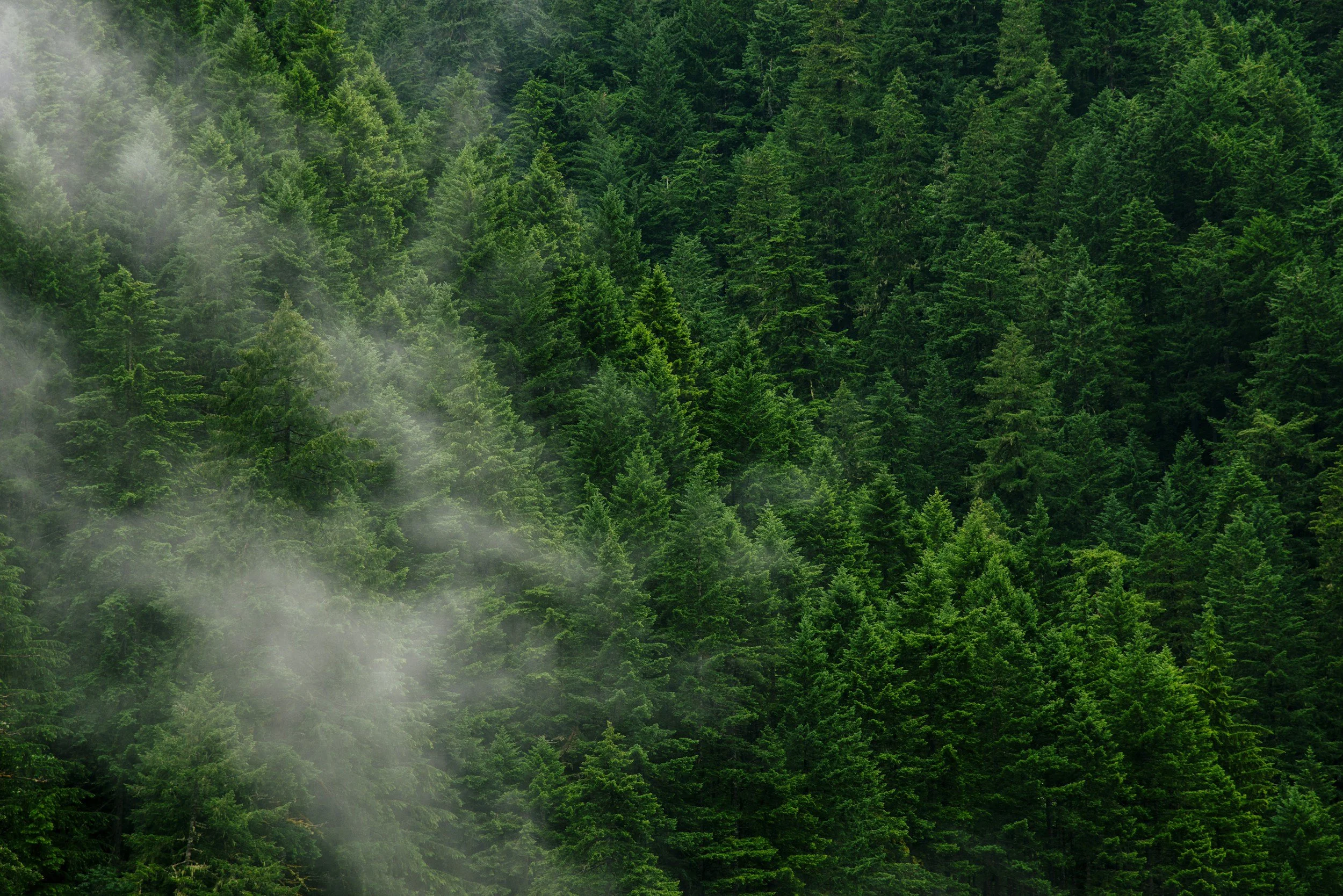
Conditions: Sky Conditions: Deep blue skies with vertically developed summer cloud formations This journey followed the established portage from Clearwater Lake toward Mountain Lake, connecting with the westward stretch of the Border Route Trail leading toward the Mountain Lake Overlook. Trail conditions were seasonally dry, though portions of the boardwalk system through lowland sections remained damp beneath shaded canopy. Visibility across the Clearwater basin remained excellent, with ideal atmospheric conditions for landscape documentation.
This outing occurred approximately eight months after the October 2021 tornadic event that impacted the Clearwater Lake region. That storm system, initially believed by regional authorities to have been the result of a downburst or microburst wind event, was later confirmed through damage-path survey to have been produced by a tornado — one of the rare late-season tornadic occurrences documented within the Superior National Forest. The storm left behind a narrow but highly concentrated corridor of snapped and uprooted spruce, pine, and birch along portions of the Clearwater shoreline and adjacent uplands.
Purpose of Journey: The primary purpose of this journey was post-disturbance documentation. Following the confirmed tornadic activity that occurred in late Fall of 2021, this return trip into the Clearwater–Mountain Lake corridor was undertaken to assess and visually document the ecological impact several months after the event. By midsummer of 2022, initial signs of structural forest damage had begun transitioning into early-stage recovery — blowdowns settling into understory gaps, light reaching previously shaded forest floor, and scattered regrowth beginning beneath the broken canopy.
A secondary objective was to capture interpretive landscape imagery from the Mountain Lake Overlook, including the boardwalk segments and elevated ridgeline views accessible from this portion of the Border Route Trail. The overlook offers one of the most expansive inland vistas along the eastern Gunflint corridor — revealing the long glacial trough of Mountain Lake extending toward the international boundary.
JUNE 2022
OCTOBER 2021
Field Notes: Travel began by water across Clearwater — a lake you know better than most — before landing at the portage leading toward Mountain Lake. The forest here still carried visible memory of the storm. Pockets of standing timber gave way suddenly to open scars where trunks had been twisted or snapped mid-growth, laid down in directional patterns that spoke clearly of rotation rather than simple straight-line wind.
But what this second journey revealed — and what this video captures — was not just the damage, but the quiet labor that followed.
Moving west along the Border Route Trail, it became immediately clear how much work had gone into reopening this corridor. In the months since the tornado carved its narrow path along Clearwater’s uplands, members of the Border Route Trail Association had returned to these ridgelines and lowlands to clear what they could — not with chainsaws or machinery, but entirely by hand. The Boundary Waters does not permit motorized equipment. Everything you see here — every log bucked, every passage reopened, every section of boardwalk accessible once again — was cut with crosscut saws. Two-person blades, drawn back and forth through downed pine and spruce, hour after hour.
There is something deeply humbling in that.
A modern trail system maintained with tools older than the storm itself.
Boardwalk segments wound through saturated lowlands before climbing toward exposed ridgeline — the same high ground voyageurs and Anishinaabe travelers once used as natural passage between watersheds. Above it all, July clouds rose in towering white formations against an impossible blue. The kind of sky that feels almost theatrical — too beautiful for what lay broken below.
At the overlook, Mountain Lake stretched outward in silence. From this vantage point, the disturbance below was difficult to detect. The forest canopy, though wounded in places, still held its shape across the greater landscape.
Storm paths become future clearings.

high cliffs - gunflint lake
july 2022
superior national forest / border route trail
Conditions: Trail access to the Gunflint Lake High Cliffs was made via the Border Route Trail (BRT) — a 65-mile wilderness footpath running parallel to the international boundary through the Boundary Waters Canoe Area Wilderness and Superior National Forest. Two primary access points to this overlook exist:
• Via the trail system behind Gunflint Lodge
• From the public landing near Lone (Lonely) Lake, connecting to the BRT spur leading toward the cliffs
The hike to the Gunflint High Cliffs from the Loon Lake Landing access point is approximately 0.8 miles out-and-back, gaining rapid elevation to exposed bedrock overlooking the Gunflint basin. 
Moisture-laden air rising from the lake basin produced localized updraft cloud movement along the ridgeline — resulting in swirling mist conditions across the overlook and adjacent forest canopy.
Purpose of Journey: The intent of this outing was landscape documentation under dynamic weather conditions — specifically the interaction between low cloud systems and the elevated granite ridgelines overlooking Gunflint Lake.
Mist events of this type create short-lived atmospheric inversions within the Superior National Forest, allowing cloud cover to settle into upland terrain before lifting again with thermal movement from the lake surface. This journey sought to visually interpret the Superior basin during one of these transitional weather patterns — when visibility shifts minute-to-minute and the forest alternates between concealment and revelation.
Additionally, this location represents a recurring site of interest for future seasonal documentation — particularly during autumn inversion events and winter hoarfrost conditions.
Field Notes: The trail rose quickly from the landing — lifting out of the quiet shoreline into wet timber where the sound of rainfall softened everything into a kind of hush.
Mist clung low to the basin that day. Not drifting across the land so much as gathering — pooling in the valleys between ridges before lifting again in slow, invisible currents. As elevation increased along the Border Route Trail, the forest began to disappear in pieces. First the lower understory. Then the mid-canopy. Until finally the entire lake seemed to exhale upward — sending breath after breath of cloud against the granite face below the overlook.
By the time the cliffs were reached, the Superior National Forest had begun to move.
Cloud banks pushed upslope from Gunflint Lake in long, unraveling sheets — curling through jack pine and black spruce before breaking apart against exposed bedrock. At times the opposite shoreline vanished entirely. At others it returned in fragments — an island here, a ridge there — suspended briefly before dissolving again into grey.
It is one thing to look out across the wilderness.
It is another to watch it assemble and disappear in real time.
This place — accessed quietly from behind the Lodge or from the Lone Lake landing — feels less like a destination than a threshold. One that waits for weather. One that asks you to return.
Gunflint Lake lies within the ancestral homeland of the Anishinaabe people, whose travel routes followed these interconnected watersheds for generations. Elevated cliff systems such as these would have offered vantage points for observing incoming weather, tracking game movement, and orienting between lake systems during seasonal travel. In many oral traditions, mist and low cloud were understood not simply as weather but as transitional states — moments when the land shifts between visibility and spirit — revealing that the wilderness is not always meant to be fully seen at once.

bwca ep 58 - south lake
july 2022
boundary waters canoe area
Conditions: Mid-July offered near-perfect travel conditions across this chain of lakes along the international border. Clear blue skies stretched across the Superior National Forest with only a light summer breeze moving through the spruce and jack pine. Daytime temperatures hovered comfortably in the mid-70s, allowing for easy paddling and portaging without the oppressive heat often associated with peak summer travel. Water levels across the route—from South through Rat, Rose, and Duncan Lakes—were seasonally stable, making for straightforward navigation across both paddle stretches and portage landings.
Even in the height of summer, the deeper border lakes such as Rose remained cool and clear beneath the cliffs of the Border Route escarpment, offering excellent visibility below the surface and calm reflections throughout the morning hours.
Purpose of Journey: This overnight journey into the Boundary Waters Canoe Area Wilderness through Entry Point #58 was undertaken alongside two fellow Clearwater Historic Lodge staff members as both a recreational outing and a field familiarization trip along one of the Gunflint Trail’s most scenic lake chains. Traveling through Topper, South, Rat, Rose, Duncan, and ultimately West Bearskin Lakes, the goal was to experience firsthand the interconnected travel corridor that parallels the international border—an area rich with both geological significance and wilderness travel history.
As guides and outfitters working along the Gunflint Trail, maintaining an intimate familiarity with these travel routes allows us to better interpret and recommend journeys for guests looking to explore the quieter, cliff-lined waters of Rose Lake and the historic portages that once connected voyageurs across this northern landscape.
Field Notes: The paddle north from South Lake into Rat carries you quickly into a different world. The lakes narrow, the forest thickens, and by the time Rose opens beneath the towering cliffs along the Border Route Trail, it feels less like a recreational corridor and more like a passage carved into the edge of something ancient. These cliffs—remnants of billion-year-old volcanic activity tied to the Midcontinent Rift—rise sharply from the waterline and catch the light differently throughout the day, shifting from soft greys to deep ochre as the sun moves west.
To exit Rose toward Duncan Lake, we encountered one of the more physically demanding features on this route—the Stairway Portage. Rising steeply from the edge of Rose Lake, this historic carry earns its name honestly. Over the past few years, trail crews—working entirely by hand in accordance with BWCAW motor restrictions—have rebuilt sections of the ascent using locally sourced stone, carefully setting each step to stabilize erosion-prone sections of the slope. What once was a root-tangled climb has become a rugged but enduring stone stairway that helps protect the surrounding hillside from further wear.
Even so, with a loaded canoe overhead or pack on your back, the climb is no small task. It marked the final major obstacle on our route before reaching Duncan and continuing west toward West Bearskin—one last reminder that even on a bluebird July day, travel in this wilderness still demands effort and intention.
For generations, the Anishinaabe moved seasonally across these waters—fishing, harvesting manoomin in nearby lowland lakes, and using these same portage trails as connective threads between communities. To paddle this chain now under a clear July sky is to follow, however briefly, a path that has existed far longer than recreation alone—one shaped by sustenance, trade, and relationship with the land.
bridal veil falls - Border Route Trail
june 2022
superior national forest / bwca
Conditions: Mid-June along the Gunflint Trail often brings a kind of quiet saturation to the forest — that early summer stretch where spring runoff still lingers in the creeks and lowlands. On this particular day, a steady overcast settled over the ridge above Gunflint Lake with intermittent drizzle drifting through the canopy.
The trail from the Crab Lake Spur toward the Border Route was heavily soaked from recent rainfall. Standing water collected in depressions, and sections of the footpath remained thick with mud and runoff. Even in early summer conditions, this stretch of trail moves through low boreal terrain where wet vegetation crowds in tight — soaking boots and pant legs from both rain above and foliage below.
Spring flow conditions made Bridal Veil Falls particularly active, with increased runoff feeding the narrow chute of water that drops over a sheer rock face along the Gunflint Lake ridge.  
Purpose of Journey: To document one of the lesser-known waterfalls along the international ridgeline of the Boundary Waters Canoe Area Wilderness — accessed by foot from the Crab Lake Spur Trail to the Border Route Trail above Gunflint Lake.
This approximately 7-mile round-trip hike begins near Loon Lake Road and follows the shoreline of Crab Lake before joining the Border Route Trail high above Gunflint Lake. From this junction, a short spur trail leads toward the rapids and eventual drop that form Bridal Veil Falls. 
On this trip, I was joined by two coworkers from Clearwater Historic Lodge — setting out under gray skies to experience the seasonal flow of one of the trail’s more hidden interior features. 
Field Notes: Bridal Veil Falls lies just north of the Gunflint Lake ridge, tucked along a spur off the Border Route Trail — a 65-mile wilderness footpath that traces the international boundary through some of the most rugged topography in northeastern Minnesota. 
The trail itself ascends gradually from Crab Lake before climbing onto an exposed ridgeline that offers intermittent views north across Gunflint Lake into Ontario. Much of this section was reshaped by the Ham Lake Fire of 2007, leaving behind open regeneration zones where smaller growth and elevation combine to provide consistent views along the lake’s northern shoreline. 
The falls can be easy to miss — often marked only by a small wooden bridge crossing the moving water upstream of the drop. From there, a steep descent through rock and root systems leads down to where the water narrows into a ten-foot-wide chute before spilling over the cliff face in a seasonal cascade. 
Though accessible by boat from Gunflint Lake, approaching the falls by foot from the southern ridge allows for a layered view of the terrain — moving from interior forest to exposed rock, and finally to the sound of falling water hidden beneath the canopy.
Long before the Border Route Trail connected these ridges by footpath, waterways like Gunflint, Loon, and Crab formed part of a seasonal travel network used by Anishinaabe communities moving between inland hunting territories and the Lake Superior watershed.
Spring runoff — now admired for feeding falls like Bridal Veil — would once have signaled shifting travel conditions, open routes, and renewed passage between lakes. These moving waters were not destinations, but indicators — markers of timing in a landscape where safe travel depended on understanding when the land itself began to move again.

BWCA EP 44 - RAM LAKE
MAY 2022
superior national forest / bwca
Route: Ram Lake, Kroft Lake, Rum Lake, Little Trout Lake, Misquah Lake, Vista Lake, Caribou Lake, Lizz Lake to Poplar Lake.
Conditions:May in the Boundary Waters marks the transition between thaw and travel — when ice-out has passed but the water still holds the memory of winter. Average daytime highs in the BWCA during May typically reach into the low 60s°F, with nighttime lows still dipping near 40°F. Rainfall begins to increase heading toward June, the wettest month of the year in northeastern Minnesota. 
On this particular day in May of 2022, skies were clear and the lake surface reflected the deep early-season clarity often seen before full algal bloom begins. The waters of Ram Lake carried a striking emerald tone — a combination of spring runoff, low sediment disturbance, and cold-water clarity that is common shortly after ice-out in shield lakes throughout the Superior National Forest.
Purpose of Journey: To complete a single-day interior paddle through one of the more rugged entry points along the Gunflint Trail corridor — documenting early-season conditions in the Misquah Hills region during the opening weeks of the paddling season.
This trip began at Entry Point 44 — Ram Lake, completing an out-and-back paddle over the course of approximately seven hours without overnight camping. The objective was to observe early spring water clarity, lake conditions, and terrain accessibility following seasonal thaw. 
Field Notes: Entry Point 44 provides access to Ram Lake via a 90-rod portage from the parking area — beginning with a gradual uphill climb before descending sharply down a rough rock staircase to the shoreline below. 
Ram Lake sits within the heart of the Misquah Hills, the highest elevation region in Minnesota, where portages between nearby lakes such as Kroft, Rum, and Little Trout involve significant elevation change and rocky terrain. 
The lake itself is designated as a trout lake — containing naturally reproducing lake trout in addition to stocked rainbow trout populations, a relatively uncommon combination in BWCA fisheries management. 
In early May conditions, insect activity remained minimal and shoreline vegetation had yet to fully leaf out — leaving exposed ridgelines and reflective water surfaces uninterrupted by summer growth.
The sensation of approaching summer was unmistakable — that brief window where the forest has awakened but not yet filled in
The elevated lake chains of the Misquah Hills form part of an ancient watershed divide — where short portages often connect drainage basins flowing in entirely different directions across the Superior Upland.
For generations, Anishinaabe travelers would have read these elevation shifts not as obstacles, but as navigational thresholds — markers indicating movement between seasonal hunting grounds and interior lake systems.
In spring, when ice release opened the high lakes first, routes through these upland waters once again became passable — just as they do now.

BWCA EP 77 - SOUTH HEGMAN LAKE
MARCH 2022 - PICTOGRAPHS
superior national forest / bwca
Conditions: March of 2022 brought an early hint of spring to the Boundary Waters — with warming daytime temperatures and extended sunlight beginning to soften the surface of interior lakes across northeastern Minnesota.
On this particular day, skies were clear with strong sun and deep blue overhead. Shorelines had begun to show signs of seasonal melt, but lake ice remained stable enough to allow safe travel by foot across South Hegman Lake, with a short portage into North Hegman Lake — where the pictographs are located.
Late-season snowpack remained in shaded forest sections, though exposed granite faces along the narrows were already beginning to shed ice — revealing the ochre figures against the cliffside.summer sun filtering through the canopy along Pine Lake and the river corridor leading inland toward the falls.
Purpose of Journey: To document one of the most well-preserved and frequently visited pictograph sites within the Boundary Waters Canoe Area Wilderness during late-winter access conditions.
Entry was made via South Hegman Lake Entry Point 77, traveling north across the frozen surface before completing the short portage into North Hegman Lake, where the pictographs appear along a granite cliff face overlooking a narrow section of shoreline.
The objective was to document the site under clear March conditions as seasonal thaw began transitioning the wilderness toward spring. 
Field Notes:The Hegman Lake Pictographs are believed to have been created by Ojibwe artists approximately 500 to 1,000 years ago, using red ochre pigment derived from iron hematite and bound with organic materials such as fish oils or animal fat.
Located on North Hegman Lake, the pictographs appear along a sheer rock wall just above the waterline — positioned intentionally for visibility to those traveling by canoe through the narrow lake corridor below.
Among the most recognizable figures are:
• A large bull moose
• Canoes with paddlers
• A human-like figure with outstretched arms
• A cross or star-like symbol above
• Additional quadrupeds and abstract markings
While the exact meaning of these images remains uncertain, many interpretations suggest that the central anthropomorphic figure may represent a spiritual entity tied to seasonal cycles — possibly reflecting Ojibwe winter constellation systems used for navigation and ceremonial timing during hunting months.
Some researchers believe the panel may even reflect celestial alignments visible during winter skies — functioning not simply as artwork, but as a cosmological or seasonal record embedded within the landscape itself.
Standing before the site in March — as winter begins to loosen its hold — reinforces this connection between sky, season, and survival. These were not decorations, but records: markers of knowledge placed directly onto the land.
Indigenous occupation of the Hegman Lake region extends back thousands of years, with the Ojibwe later establishing seasonal travel routes through these interior lake systems as part of their broader homeland across what is now the Superior National Forest.
Pictograph sites such as this are often associated with vision quests or ceremonial encounters — moments of spiritual experience recorded in pigment and placed in visually significant locations along travel corridors.
In winter, when lakes freeze and forest routes reopen by foot, access to these sites becomes possible once again — much as it would have been for those who first came here seeking guidance written not in words, but in stone..
BWCA EP 62 - WINTER CAMP/ CARIBOU LAKE
FEBUARY 2022
BOUNDARY WATERS CANOE AREA
Conditions: Mid-winter conditions in February across the Boundary Waters typically bring daytime highs in the teens to mid-20s°F, with overnight temperatures often dropping well below zero — particularly across interior lake basins shielded from wind by dense boreal forest.
On this trip, overcast skies dominated both days on Clearwater and Caribou Lake, holding daytime temperatures in the low-to-mid 20s°F. Lake ice remained solid across Clearwater, allowing for sled travel by snowshoe directly across the lake before descending the portage trail into Caribou Lake.
Snowpack along the portage was firm but uneven in sections of conifer cover — typical of mid-season trail compression where wind-sheltered areas accumulate deeper drifts.
Purpose of Journey: To establish a two-night winter basecamp on Caribou Lake via Entry Point 62 using traditional sled travel and hot-tent shelter — documenting cold-season travel conditions between Clearwater and Caribou Lake during late winter.
Access was made by crossing Clearwater Lake on snowshoes while pulling sleds before descending the portage into Caribou Lake and securing the first available campsite for a two-night stay under overcast winter conditions. 
Field Notes: Clearwater Lake lies within the eastern Gunflint corridor and sits within a glacially carved basin bordered by steep ridgelines formed during the last glaciation of the Superior Upland approximately 10,000–12,000 years ago.
Caribou Lake, connected by a well-traveled 210-rod portage from Clearwater, is known for its populations of:
• Walleye
• Northern Pike
• Smallmouth Bass
• Lake Trout in nearby connected watersheds
The Clearwater–Caribou chain forms part of a broader interior travel route linking the eastern BWCA lake systems along the international border.
Winter travel across these frozen corridors was historically essential — allowing access to interior traplines and seasonal hunting territories when canoe routes were inaccessible.
On this trip, shelter was established using a hot tent with a wood-burning stove — a traditional winter camping system increasingly used in modern BWCA winter expeditions. Heated canvas shelters allow interior drying of gear and improved thermal regulation, particularly during multi-day stays where condensation and moisture buildup can present significant cold-weather hazards.
Proper stove ventilation and stable fuel sourcing remain critical safety considerations when establishing heated shelters in sub-freezing environments.
Lakes such as Clearwater and Caribou once served as winter travel corridors for Anishinaabe communities navigating between inland hunting grounds and seasonal gathering areas.
When frozen, these lakes provided direct passage across terrain otherwise restricted by forest density and elevation — opening routes used for trapping, trade, and subsistence travel.
Even today, winter crossings follow many of the same lines first traveled generations ago — drawn not by trails, but by ice..