field journal
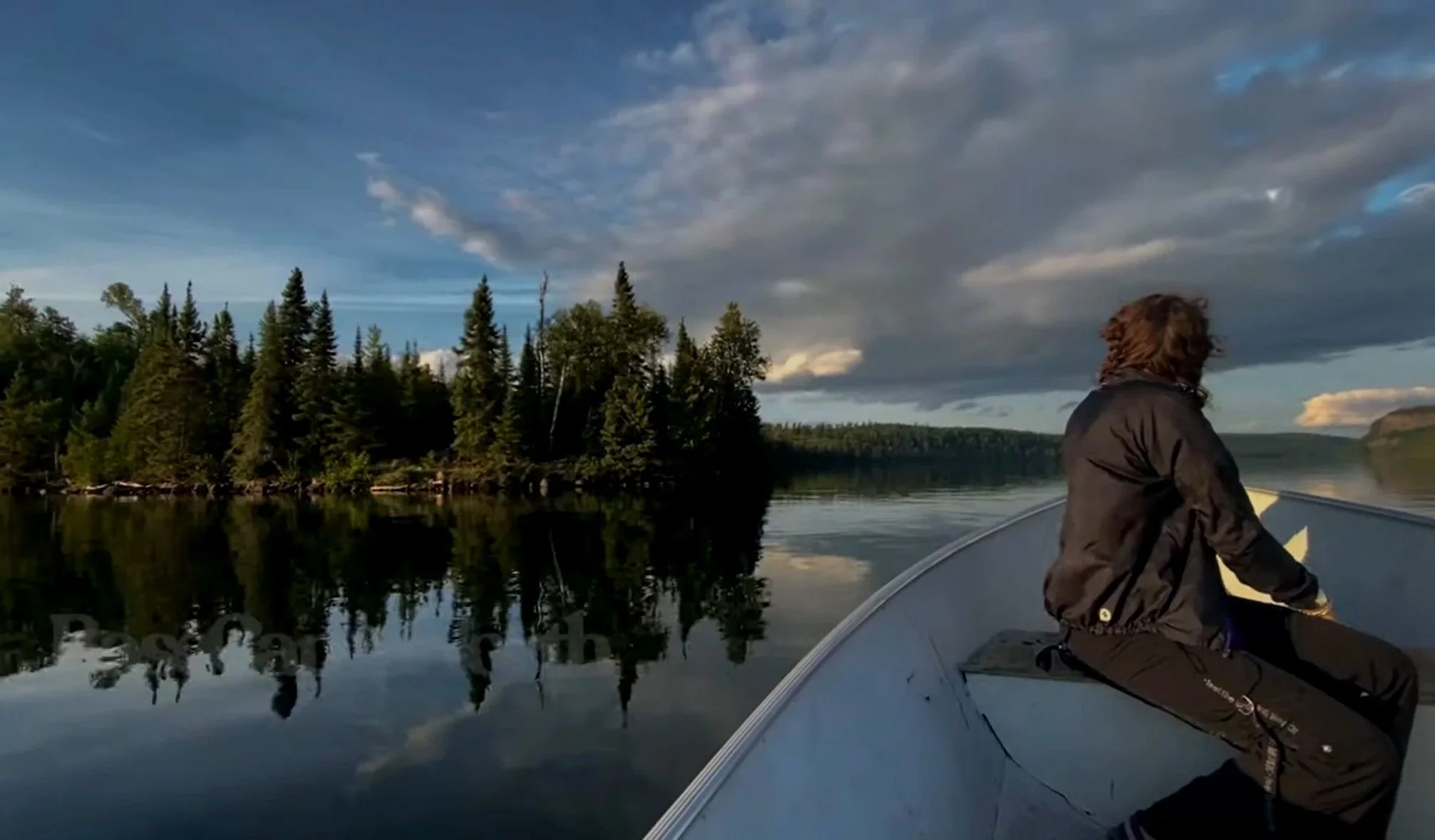
The Journey Log is a seasonal record of solo travel through the Boundary Waters Canoe Area Wilderness and along the greater North Shore—an evolving archive of routes taken, camps made, and quiet places found along the way.
Each entry documents not only the physical experience of moving through these lakes and forests, but also a deeper effort to understand the land itself—exploring the history, ecology, and Indigenous presence that has shaped these travel corridors for generations. Along these routes, I aim to learn from the landscapes I move through, including the cultural knowledge and traditions connected to the Anishinaabe who have long known these waters by paddle and memory.
BWCA EP 51 - Missing Link Lake
August 2025
Route: Round Lake, Missing Link Lake & Tuscarora Lake.
Conditions: Unseasonably warm late-August conditions with daytime temperatures reaching into the low 80s. Clear skies persisted throughout much of the trip, though regional wildfire smoke from Canadian fires created a noticeable haze across the lakes — tinting the sun a deep red along the horizon during evening travel. Overnight, conditions shifted to partly cloudy skies with improved visibility as the moon rose above the Tuscarora basin.
Purpose of Journey: To travel the Missing Link–Tuscarora route as a small group expedition, documenting late-season travel conditions along one of the more physically demanding portages in the eastern Boundary Waters while introducing a younger paddler to extended wilderness travel.
Field Notes: This journey began at BWCA Entry Point 51 (Missing Link Lake), launching into a warm stretch of late-season travel conditions that contrasted with the more typical cool transitions of August in the eastern BWCA. From the initial paddle across Missing Link, the route carried us toward the well-known portage into Tuscarora Lake — a trail with a longstanding reputation for both length and difficulty within canoe country.
Wildfire smoke drifting south from Canadian burn zones settled across the region during the day, muting distance and flattening the light across open water. By evening, the sun hung low in the haze — appearing as a dull red disk through the smoke before dropping below the tree line.
Travel was shared between three paddlers — Nate, Norah, and myself — with Norah’s running commentary and steady curiosity shaping the pace of the journey as much as terrain or weather. Movement along the Tuscarora portage was slow but consistent, marked by muddy footing and extended carry time beneath the canopy.
Nightfall brought partial clearing overhead. With the moon rising between broken cloud layers, visibility returned across the basin and the stillness of the lake settled in — briefly reframing the day’s effort against the quiet that followed.
The route through Missing Link Lake toward Tuscarora passes through terrain that has long been shaped by Indigenous travel and place-based knowledge. While the Anishinaabe traditionally inhabited and traveled this region of northern Minnesota, the name “Tuscarora” itself comes from the Tuscarora Nation of the Haudenosaunee Confederacy—reflecting a broader pattern of Indigenous place names applied across the North American landscape. In this way, modern maps carry layered histories, where local travel routes used for generations by canoe intersect with names drawn from distant Native nations, quietly embedding cultural memory into the geography of the Boundary Waters.
BWCA EP 47 - lizz & Swamp lake
July 2025
Route: Poplar Lake, Lizz Lake, Caribou Lake, Horseshoe Lake, Allen Lake, Pillsbury Lake, Henson Lake, Gaskin Lake & Jump Lake.
Conditions: Late-July travel conditions with generally clear skies overhead and moderate insect activity throughout the route. While surrounding storm systems remained active in the region — with visible rainfall and lightning observed across nearby lake basins — our travel corridor remained largely dry. Passing cloud cover and distant thunder offered intermittent views of weather systems in motion without direct precipitation along the route.
Purpose of Journey: To complete a single-day traverse through the Liz–Caribou–Vista chain alongside fellow Clearwater outfitter Colin, covering nine lakes and approximately twenty miles within a 24-hour travel window.
Field Notes: Launching from BWCA Entry Point 47 (Liz & Swamp Lakes), this route carried us through a sequence of interconnected basins including Caribou, Horseshoe, Gaskin, Allen, Jump, and Vista — with the goal of covering twenty miles of travel across nine lakes in the span of a single day.
Storm systems developed and moved around us throughout the trip, with rain shafts and lightning frequently visible in the distance. At several points, conditions suggested the likelihood of incoming weather, though shifting wind patterns ultimately allowed us to continue without encountering direct rainfall.
Over time, I’ve found that many of the trips I’ve considered postponing due to forecasted rain have become some of the most visually dynamic journeys — offering rare views of atmospheric conditions unfolding across open water. Moving through the chain under blue sky while watching storms build and dissipate beyond the treeline provided a clear reminder of how the surrounding elements often shape the experience as much as the route itself.
Travel was shared with Colin, each of us maintaining a steady pace through the portages and crossings, with long stretches of silence returning between wind gusts and the occasional roll of distant thunder.
The sheltered waters of Liz and Swamp Lakes sit within a corridor of travel historically used by the Anishinaabe to move between inland lake systems and larger watershed routes to the south. These smaller lakes and connecting wetlands would have supported fishing, trapping, and the gathering of plant materials used for food and medicine. Portage paths through this terrain often followed the driest natural ridges between marsh and forest, creating passageways shaped by generations of seasonal travel across a landscape navigated by canoe and deep familiarity with place.
BWCA EP 69 - John lake
July 2025
Route: Mcfarland Lake, Royal River, Little John Lake, John Lake, East Pike Lake, West Pike and Clearwater Lake.
Conditions: Mild summer conditions with stable weather throughout the duration of the trip. Daytime temperatures remained comfortable for travel and fishing, with light winds across the Pike chain. Clear skies during the evening hours provided intermittent aurora visibility on the first night from East Pike Lake campsite #3.
Purpose of Journey: To assess reported smallmouth bass fishing conditions on East Pike Lake through direct field experience, following repeated anecdotal accounts of strong summer populations within the Pike chain.
⚠️ Quick Note on the Mountain Lion:
There are documented but unconfirmed reports of mountain lion sightings in Cook County and the greater Superior National Forest region, occasionally investigated by the Minnesota Department of Natural Resources. Most are transient individuals passing through rather than established populations.
Field Notes: This journey began at BWCA Entry Point 69 (John Lake), launching from McFarland Lake and moving north through Little John before crossing into John Lake and continuing on to East Pike.
We established a two-night basecamp at East Pike Lake campsite #3 — a site locally associated with a past mountain lion sighting, adding a subtle layer of awareness to an otherwise calm stretch of border country travel. Classic terrain defined the route: clear water, tight portages, and long intervals of quiet broken only by wind across the surface and the echo of loons along the shoreline.
Fishing became the primary rhythm of the trip. Over two days on East Pike, smallmouth bass proved active with several larger fish brought in, while northern pike remained notably less responsive. Having heard repeated accounts of strong bass populations in this area, the goal was to confirm those reports through time spent on the water — a process that ultimately shaped the pace of the journey itself.
Travel was shared with longtime canoeing partner Nate, each of us paddling solo canoes. Moving independently but within visual range allowed for both efficient travel and extended periods of quiet observation across the lake.
On the first evening, intermittent auroral movement became visible overhead — a slow shifting presence across an otherwise still sky that briefly reoriented the scale of the landscape around us.
The return route carried us west through the Pike chain before exiting onto Clearwater Lake, ending the trip with calm water, tired shoulders, and the familiar reluctance that accompanies leaving a place only partially understood.
John Lake lies within a web of smaller interior lakes that were historically part of seasonal travel and subsistence patterns for the Anishinaabe. Lakes like these—connected through short portages and narrow channels—provided reliable fishing grounds and quiet campsites during movement between larger waterways and inland hunting areas. The routes linking John Lake to surrounding waters follow natural contours in the terrain that would have been recognized and used long before modern maps, forming part of a lived geography shaped by generations traveling these forests by canoe.
Watap Cliffs - BORDER ROUTE TRAIL
JuNE 2025
Route: Clearwater Lake / Border Route Trail
Conditions: Variable early-summer conditions with broken cloud cover and intermittent blue sky throughout the day. Distant rain showers moved across adjacent lake basins, remaining largely offshore while contributing to shifting light across the cliffs. Light regional haze from Canadian wildfire smoke was present at elevation, subtly muting contrast along the horizon while allowing for dynamic cloud movement overhead.
Purpose of Journey: To document Watap Cliffs as part of the inaugural entry in the Along the Border Route Trail series — a developing effort to revisit and record significant overlooks and ecological features along the Border Route Trail through direct seasonal observation.
Field Notes: This hike brought Katrina and I back to Watap Cliffs via boat access from Clearwater Lake, followed by the short spur trail connecting Campsite #1 to the Border Route Trail. Positioned roughly sixteen miles west of the trail’s eastern terminus, the overlook rises above the international boundary — offering extended views across Watap Lake, Mountain Lake, and into the forested interior of Ontario.
Cloud systems moved through the region throughout the day, with rain visible in the distance beyond the border lakes. A light presence of smoke from Canadian fires lingered at elevation, softening the far treeline while allowing breaks of blue sky to pass between cloud layers. The result was a shifting atmosphere across the basin — where light and shadow moved slowly over open water and exposed rock.
Having returned to this overlook multiple times across seasons, the vantage point continues to reveal subtle changes in tone and visibility — reinforcing the value of repeated visits to the same landscape under evolving environmental conditions.
The dramatic rise of the Watap Cliffs overlooks a section of the international border that has long been part of traditional Anishinaabe travel routes through the border lakes region. These elevated rock formations would have served as natural landmarks for canoe travelers moving between watersheds, helping guide seasonal travel across what is now known as the Granite River system. Prominent features like these were often embedded within oral knowledge of the land—points of reference remembered and passed down through generations navigating the interconnected lakes and portages of the northern forest.
BWCA EP 40 - HOMER LAKe
August 2024
Route: Homer Lake / Boundary Waters / Superior National Forest
Conditions: Mild mid-August conditions with stable daytime temperatures and generally clear skies throughout the duration of the trip. Light winds moved intermittently through the Homer Lake basin, with increasing calm toward evening as the moon rose over open water.
Purpose of Journey: To conduct a short-duration solo overnight into the Homer Lake area (BWCA Entry Point 40), documenting travel and campsite conditions within a less frequently visited entry point situated along the boundary between the Boundary Waters Canoe Area Wilderness and the surrounding Superior National Forest.
Field Notes: This solo overnight began at BWCA Entry Point 40 (Homer Lake), a quieter access point located along the southern edge of the wilderness boundary. With a single pack and hammock system, the goal was to travel light and spend a brief period observing the lake basin under stable late-summer conditions.
Homer Lake remains less frequently visited than many of the region’s more central routes, offering extended intervals of stillness once clear of the landing. Camping along the transition zone between designated wilderness and the broader Superior National Forest introduced a subtle shift in terrain and use patterns not always present deeper within the BWCA.
Evening brought clearing skies and a gradual moonrise over the waterline. As wind dropped off across the basin, the lake settled into a quiet that tends to accompany solo travel — where movement becomes minimal and observation takes precedence over distance covered.
Homer Lake rests within a network of inland waterways historically used by the Anishinaabe as part of seasonal movement between hunting territories and larger gathering areas. Lakes like Homer—connected through quiet portage trails and narrow passages—would have served as reliable fishing sites and temporary camps during travel across the forest. The same low ridges and natural clearings that guide modern portage paths today often follow terrain features first identified generations ago, forming quiet corridors of movement through a landscape once navigated entirely by paddle and memory.
Bwca ep 66 - crocodile lake
sept 2024
Route: Bean Lake, Parsnip Lake, Crocodile River, Crocodile Lake & East Bearskin Lake.
Conditions: Stable late-summer travel conditions with generally clear skies throughout the day and light wind across the Crocodile Lake basin. Evening conditions remained calm, allowing for extended nighttime visibility and favorable conditions for stargazing and moonrise observation.
Purpose of Journey: To repeat a previously completed solo route through the South Bean–Parsnip–Crocodile chain following the loss of original footage due to hard drive failure — documenting the Crocodile River corridor and overnight conditions on Crocodile Lake under comparable seasonal timing.
Field Notes: This solo journey began at BWCA Entry Point 66 (Crocodile Lake), launching into the lesser-traveled chain of lakes extending from South Bean through Parsnip and into the Crocodile River system. The route required multiple beaver dam crossings and slow travel through winding channels before opening into the broader basin of Crocodile Lake itself.
This trip followed an identical route completed the previous year, undertaken again after the original footage from that journey was lost to a damaged hard drive. Returning under similar seasonal conditions offered an opportunity to revisit the corridor with increased familiarity — observing subtle differences in water level, flow, and vegetation across the river system.
Evening conditions on Crocodile Lake provided a clear sky for nighttime observation. While setting up a timelapse sequence after dark, a misstep near camp resulted in boiling water being overturned — briefly disrupting the quiet of the basin and leaving a minor burn as an unintended reminder of the challenges associated with solo travel in low-light conditions.
Nightfall brought stillness across the lake as wind moved through the surrounding pines, with starlight and rising moonlight settling across the treeline.
The quiet waters of Crocodile Lake lie within a landscape that has long been part of traditional Anishinaabe travel and harvesting territory. Lakes such as these—set just beyond the larger travel corridors—were often used as seasonal fishing grounds or temporary campsites during movements between inland hunting areas and the north shore of Gichi-Gami (Lake Superior). The surrounding wetlands and sheltered shoreline would have supported plant gathering and wildlife habitat, making places like Crocodile not just destinations, but working parts of a much broader network of life lived by canoe across the northern forest.
Bwca ep 64 - EAST BEARSKIN LAKE
sept 2024
Route: East Bearskin Lake, Alder Lake & Canoe Lake.
Conditions: Favorable late-season travel conditions with stable weather and light winds throughout the East Bearskin–Alder chain. Clear skies and minimal insect activity contributed to extended intervals of stillness across open water during both travel and overnight conditions on Canoe Lake..
Purpose of Journey: TTo complete a short-duration solo overnight through the East Bearskin–Alder corridor, documenting campsite conditions and travel routes leading into Canoe Lake under calm late-season conditions.
Field Notes: This solo overnight began at BWCA Entry Point 64 (East Bearskin Lake), with travel carrying north through Alder Lake before reaching Canoe Lake — where I established camp for the night along a quiet stretch of shoreline. Conditions throughout the day remained stable, with minimal wind across the lake surfaces and long intervals of silence once clear of the landing.
Canoe Lake offered a sheltered campsite and a noticeably quieter basin for the evening, with little sign of recent travel through the area. Overnight conditions remained calm, allowing the lake to settle into stillness by nightfall.
On the return route, travel followed the northern portage from Alder Lake back into East Bearskin. While not documented on video during the trip, this section of trail was heavily overgrown — with limited visible footpath and multiple obstructed segments along the carry. Despite remaining marked on current maps, travelers moving through this corridor may encounter slower-than-expected passage due to vegetation and reduced trail maintenance along this portage.
The lakes connected by the East Bearskin entry were once part of a larger network of canoe travel routes used by the Anishinaabe to move between inland hunting territories and the north shore of Gichi-Gami (Lake Superior). Alder and Canoe Lakes would have served not only as travel corridors, but as seasonal fishing and harvesting areas—places where movement across the land was guided by familiarity rather than maps. The portages between these lakes follow the same natural breaks in terrain that Indigenous travelers would have identified generations ago, creating passageways that quietly predate modern wilderness boundaries.
Bwca ep 57 - Magnetic LAKE
AUGUST 2024
Route: Gunflint Lake. Magnetic Lake, Pine River, Little Rock Falls & Clove Lake.
Conditions: Calm summer conditions along the U.S./Canada border made for an easy and quiet paddle into Magnetic Lake. Light winds and stable weather carried through most of the journey, with the Pine River system flowing gently between lakes. Travel was smooth overall, with peaceful waters and long stretches of solitude defining much of the route.
Purpose of Journey: This overnight solo trip into Magnetic Lake (Entry Point #57) was part of a broader effort to document remote borderland routes within the Boundary Waters Canoe Area Wilderness. After taking time earlier in the season to upgrade essential filming and travel equipment, this journey marked a return to the field—resuming a summer of exploration and visual storytelling across the BWCA.
Field Notes: Paddling through Magnetic Lake and into the winding channels of the Pine River system offered a quiet reentry into wilderness travel. The borderland terrain held a deep stillness—broken only by the sound of current moving through narrows and the occasional movement of wind across open water.
After a steady day of travel, I found a small and secluded place to make camp for the night. With no one else nearby, the evening settled into that familiar northern silence—water moving slowly past the shoreline, trees shifting in low wind, and the subtle rhythm of the forest after dark.
Flowing along what is now the international border, the Pine and Granite River system was historically part of a fluid travel landscape used by the Anishinaabe long before political lines divided these waters. The east-to-west movement of the connected lakes and falls offered natural passage between watersheds, with portage routes forming around rapids and waterfalls that could not be paddled. These same corridors supported seasonal movement for trade, fishing, and gathering—reminding modern travelers that what feels remote today was once part of an active and well-known network of Indigenous travel through the northern forest.
Bwca ep 23 - mudro LAKE
july 2024
Route: Mudro Lake, Sandpit Lake & Tin Can Mike Lake.
Conditions: Travel began under relatively stable summer conditions, with manageable winds and favorable paddling across the interior lakes leading north from Mudro. Portages along this route were moderately challenging, with rocky footing and elevation changes typical of the terrain between Mudro and the larger Basswood watershed. On the second day of travel, conditions shifted rapidly as a severe and sustained downpour moved into the area—bringing intense rainfall that significantly reduced visibility, saturated portage trails, and made continued travel both difficult and unsafe.
Purpose of Journey: This trip was undertaken with the goal of reaching Basswood Lake to view the historic pictographs located along its northern shoreline. Traveling as a team, we aimed to document the route and experience one of the Boundary Waters’ most culturally significant sites—where ancient markings remain visible on the exposed cliff faces above the waterline..
Field Notes: Paddling north from Mudro offered the familiar rhythm of lake-to-lake travel, broken up by rugged portages threading through dense forest and glacial rock. The route toward Basswood Lake carried a steady sense of anticipation, with the intention of reaching the pictographs that have drawn travelers to this area for generations.
By the morning of the second day, however, conditions changed dramatically. A powerful downpour moved in with little warning—bringing heavy rain that quickly overwhelmed the trail systems and open water alike. What would normally be manageable travel in wet conditions became unsafe, as visibility dropped and footing along portages turned slick with runoff. Despite the goal of continuing on toward Basswood, the decision was made to turn back and begin the return journey home.
The pictographs of Basswood Lake are widely believed to have been created by the ancestors of the Anishinaabe, marking places of spiritual or cultural significance along important travel routes. These ochre images—often depicting animals, canoes, or human forms—were traditionally applied to rock faces using natural pigments mixed with binders such as fish oil. Positioned along major waterways like Basswood, they served as visual expressions of story, guidance, or presence, reminding modern travelers that these routes once carried generations of Indigenous people who moved across the lakes with purpose long before recreational travel brought others to these waters.
Bwca ep 43 - BOWER TROUT LAKE
july 2024
Route: Bower Trout Lake, Marshall Lake, South Brule River, Dugout Lake, Skidway Lake, Swan Lake, Vernon Lake & Brule Lake.
Conditions: Overcast skies settled in for most of the journey, creating soft light across the lakes and forested shoreline throughout the route. Light winds made for manageable paddling conditions as we moved through the smaller interior lakes connected to the Brule watershed. Despite the cloud cover, travel remained steady and comfortable—offering ideal conditions for making our way toward the larger open water of Brule Lake.
Purpose of Journey: This trip was undertaken with my good friend Maggie, traveling from the Bower Trout entry point (EP 43) with the intention of reaching Brule Lake via the interior lake system. The goal was to spend time exploring this quieter approach into one of the Boundary Waters’ more expansive lakes—documenting the route while enjoying the slower pace of travel through smaller, forest-bound waters.
Field Notes: Launching from Bower Trout, we made our way through a chain of serene lakes connected by short portages that gradually opened toward the Brule Lake watershed. The overcast conditions gave the forest a muted tone—softening the horizon and settling the landscape into a quiet, almost suspended stillness as we traveled. Wildlife moved subtly along the shoreline, and the dense surrounding forest carried that familiar hush that comes with cloud-covered skies.
As the route progressed westward, the scale of the terrain began to shift—hinting at the broader expanse of Brule beyond the tree line. Even under gray skies, this entry offers a rewarding approach into the lake, trading the exposure of direct access for a more gradual transition through the surrounding wilderness.
This region lies within traditional Anishinaabe homeland, where interconnected lakes like those along the Bower Trout route would have served as seasonal travel corridors between inland hunting grounds and the larger watersheds to the south. These smaller lakes and portage paths formed dependable routes for movement by canoe, following natural breaks in terrain and water levels. Today’s travel through these same passages echoes a much older pattern of movement across the northern forest—where lakes like Brule were not destinations, but part of a lived landscape shaped by generations of Indigenous presence.
Bwca ep 61 - daniels LAKE
june 2024
Route: West Bearskin Lake, Daniels Lake, Rove Lake, Watap Lake, Mountain Lake & Clearwater Lake..
Conditions: Unseasonably pleasant weather settled in for this early June trip, bringing calm winds and stable skies along the border route. Mild daytime temperatures and cool nights created ideal travel conditions for paddling and portaging through the interconnected lakes leading toward Mountain Lake. Visibility remained clear throughout most of the journey—providing expansive views across open water and exposed rock formations along the international boundary.
Purpose of Journey: This solo journey from Daniels Lake (EP 61) followed the historic border route toward Mountain Lake, with the intention of documenting travel through Watap Lake and completing the well-known “Long Portage” along the Border Route Trail. The goal was to reach Mountain Lake Camp for an overnight stay—traveling through one of the most visually striking stretches of the Boundary Waters along the U.S./Canada border.
Field Notes: Departing from Daniels Lake, the route quickly narrowed into the winding chain of border lakes that lead toward Watap. Early season travel made for comfortable paddling, with still waters reflecting the steep rock faces and rising ridgelines that define this part of the wilderness. Watap Lake, in particular, offered dramatic views—its cliff-lined shoreline standing in contrast to the surrounding forest as the route bent westward along the boundary.
From there, I began the descent along the infamous Long Portage, following a stretch of trail that connects these remote waters to Mountain Lake. This segment—running alongside portions of the Border Route Trail—served as a reminder of the terrain that has shaped travel here for generations. By evening, I reached Mountain Lake Camp and settled in for the night. Under the cool quiet of a June sky, the northern lights made a brief appearance—dancing above the waterline before fading back into darkness as I slipped into the hammock for sleep.
This section of the border lakes lies within traditional Anishinaabe travel territory, where waterways like Watap and Mountain once formed part of seasonal canoe routes linking inland hunting grounds with the larger trade networks surrounding Gichi-Gami (Lake Superior). Prominent landmarks such as the cliffs of Watap would have served as natural navigational points for travelers moving between watersheds. Even today, the Long Portage reflects the same terrain breaks that Indigenous travelers would have followed—carrying canoe and goods across the ridgelines along routes known through generations of movement by water and memory.
Bwca ep 45 - Morgan LAKE
MAY 2024
Route: Morgan Lake, Carl Lake, Lax Lake, Jake Lake, Vista Lake, Horseshoe Lake, Caribou Lake, Lizz Lake & Poplar Lake.
Conditions: Travel on May 31 through June 1 brought mostly overcast skies across the Morgan to Caribou route, with occasional breaks in the cloud cover late in the evening. Daytime temperatures remained cool but comfortable for late spring travel, with calm to light winds making for manageable paddling across the smaller interior lakes. Overnight conditions dipped into the lower range typical for early June in the Boundary Waters, with still air settling in after sunset..
Purpose of Journey: This solo trip marked my first Boundary Waters journey of 2024, launching from Morgan Lake (EP 45) with the goal of reaching Caribou Lake for an overnight stay. The route offered a quiet return to wilderness travel after the winter season—documenting the subtle transition into spring across the interior lake system.
Field Notes: Departing from Morgan Lake, the route carried me through a series of smaller connected lakes and short portages leading toward Caribou. Under consistently overcast skies, the landscape felt subdued—soft light settling across the shoreline as the forest moved quietly into early season growth. Evidence of wolves became increasingly noticeable along the portage trails and muddy shoreline edges—tracks pressed into the earth and signs of recent movement through the area.
Minnesota is home to one of the largest remaining gray wolf populations in the lower forty-eight states, with an estimated 2,700–3,000 individuals primarily occupying the northern forested regions of the state. Travel through this part of the Boundary Waters serves as a reminder that these lakes remain part of an active wilderness—shared with wildlife that continues to move through these corridors much as they always have.
By evening, I reached Caribou Lake and made camp beneath a cloud-covered sky. As darkness settled in, the moon broke through briefly—casting a pale glow across the waterline before disappearing again behind the lingering cloud cover.
The lakes along this route lie within traditional Anishinaabe homeland, where waterways such as Morgan and Caribou once formed part of seasonal travel routes between inland hunting territories and larger gathering areas nearer to Gichi-Gami (Lake Superior). Smaller interior lakes like these would have provided dependable fishing sites and temporary camps during travel by canoe, with portage paths following natural breaks in terrain known through generations of lived experience on the land.
Bwca ep 80 - LARCH CREEK/GRANITE RIVER
AUGUST 2023
Route: Larch Creek, Larch Lake, Clove Lake, Granite River, Gneiss Lake, Devils Elbow, Maraboeuf Lake, Saganaga Falls & Saganaga Lake
Conditions: Weather: Mild late-summer temperatures with light southwest winds. Water Levels: Moderately high throughout marshland tributaries. Wildlife Activity: Significant beaver presence noted at entry point.
Entry via the Larch Creek access point began with nearly a mile of narrow swamp-grass corridor—requiring lift-overs across eight active beaver dams in the opening stretch. This lesser-used entry, often no more than six feet wide, reflects the ongoing hydrological impact of beaver activity throughout the Superior National Forest. Beyond the wetlands, the route opens into young forest regenerating from previous fire activity, allowing for scenic travel along the international boundary toward Saganaga Lake and Sag Falls.
Purpose of Journey: This late-summer traverse had been on my list for some time—shared this time with Nate and Jeremy, two younger paddlers whose contrasting personalities brought a balance of navigation and morale to the day’s travel. While the physical objective was efficiency (covering 21 miles in a single day), the deeper intention was exposure: introducing developing wilderness travelers to the emotional and ecological complexity of the Boundary Waters in a way that fosters long-term appreciation.
Despite their differences, both came away with the same quiet realization—that these borderlands are something worth respecting, learning from, and ultimately protecting. Positive early experiences in wilderness spaces like the BWCAW often serve as a catalyst for lifelong stewardship. Trips like this are not just routes on a map—they are introductions to responsibility, patience, and place-based connection.
Field Notes: Travel progressed NW along the international boundary—formally established by the 1842 Webster–Ashburton Treaty and still actively regulated today. As of August 2023, remote entry into Canada from the BWCAW required participation in the Remote Area Border Crossing (RABC) permit system administered by the Canada Border Services Agency. A staffed customs check-in station remains located on an island in central Saganaga Lake for certain waterborne crossings. Unauthorized landing north of the demarcation line—even inadvertently—constitutes a legal violation under Canadian federal law.
Sag Falls provided a welcome breakfast and lunch stop—along with a dense population of freshwater leeches (Hirudinea) observed in the shallow rock pools near the cascade. Their presence is consistent with warm, oxygenated summer waters and indicates strong macroinvertebrate diversity within the falls’ microhabitats.
Saganaga Falls itself marks a transitional hydrological feature between upstream Saganaga and downstream systems—once serving as a known landmark for voyageurs and Ojibwe trade routes navigating these shared waters. Today, it remains a point of convergence: of water, of nations, and of generations encountering the wilderness for the first time.
These border waters lie within the traditional homeland of the Anishinaabe, who traveled freely across what is now an international boundary for generations prior to treaty delineation. Routes along these interconnected inland lakes—including the waters surrounding present-day Saganaga—formed long-standing trade and kinship networks between communities throughout the region. While modern borders impose jurisdictional limits, the cultural geography of these lakes remains rooted in an older understanding of land as shared, seasonal, and relational.
Bwca ep 62 - CLEARWATER LAKE
SEPTEMBER 2023
Route: Clearwater Lake, West Pike Lake, Pine Lake, Little Caribou Lake & Caribou Lake.
Conditions: Partly cloudy fall conditions, Wind: Light easterly wind aiding return travel. Precipitation: None encountered. Travel Notes: Ideal shoulder-season camping conditions throughout
Purpose of Journey: After securing a canceled late-season Clearwater EP 64 permit, this trip provided an opportunity to take advantage of early fall solitude in one of the most scenic travel corridors in the eastern Boundary Waters. The route offered a mix of protected interior lakes and open border water, allowing time for travel, observation, and night photography in peak seasonal conditions.
With stable weather and quiet campsites, the intent was to move deliberately through a familiar yet consistently rewarding section of the BWCAW—taking time to document changing seasonal light and sky conditions as autumn began to settle across the high ridgelines and shoreline forests.
Field Notes: Night one was spent on the island campsite on West Pike Lake, while night two was spent on Pine Lake at the campsite adjacent to the portage connecting back toward West Pike. Pine provided a clear enough window in the partly cloudy sky to attempt overnight timelapses of the stars. While no visible auroral activity was noted at the time, processing the footage after returning home revealed that the northern lights had in fact made a brief appearance—visible in the final clip of the trip’s recorded sequence.
Clearwater Lake, one of the most heavily traveled and recognizable entry points in this part of the Boundary Waters, also serves as my home water along the Gunflint Trail. Traveling out from a lake that I both live and work on creates a different relationship with the surrounding route system—particularly along the border lakes between West Pike and Pine. This stretch remains one of the most topographically distinct areas in the BWCAW, with elevated ridgelines, long sightlines across the international boundary, and a chain of scenic lakes that make it a consistent favorite for both travel and documentation.
These lakes lie within the traditional homeland of the Anishinaabe, whose travel routes historically followed these interconnected waterways long before their designation as recreational corridors. The elevated terrain and border lakes in this region formed part of seasonal movement patterns between inland hunting territories and larger trade networks. Today, while the lakes serve as designated wilderness travel routes, their deeper significance as shared ancestral pathways remains embedded in the landscape.
270 OVERLOOK - BRT / SHT
JULY 2023
superior National Forest
Route: Arrowhead Trail, Jackson Lake Rd, BRT / SHT Spur Trail.
Conditions: Remote ridgeline travel along a spur trail near the Border Route Trail & Superior Hiking Trail leading to an exposed overlook above the Pigeon River valley. Elevated terrain with exposed rock and intermittent forest cover opened into sweeping views across both U.S. and Canadian wilderness.
Purpose of Journey: The goal of this hike was to reach what is arguably one of the most expansive and least-known viewpoints in northeastern Minnesota. Located near the junction of the Superior Hiking Trail and the eastern terminus of the Border Route Trail, 270 Overlook provides a panoramic view across the Pigeon River valley and surrounding Boundary Waters and Quetico wilderness.
From this exposed ridgeline, a full 270-degree view opens across the valley as the Pigeon River winds eastward toward Lake Superior—forming the natural boundary between Minnesota and Ontario. The overlook sits above chains of glacial lakes and Canadian Shield ridges—terrain historically traveled by voyageurs along what was once known as the inland “Voyageur Highway.”
Field Notes: Accessed via the northernmost section of the Superior Hiking Trail, the spur leading to 270 Overlook ends at a rocky summit offering sweeping views into Canada and west toward the interior lakes near South Fowl. From the overlook, distant cliffs rise across the horizon as cloud systems roll inland—casting shifting shadows across the forest canopy below. The Pigeon River can be seen winding through the valley in the distance, tracing the modern international boundary.
Despite marking the endpoint of a 300-mile trail system, it’s surprising how relatively unknown this overlook remains outside of long-distance hikers and those familiar with the eastern reaches of the Boundary Waters. There’s a quiet tension in standing here—caught between wanting to preserve the solitude that defines places like this, and wanting to share such a rare and expansive view with others who may come to appreciate it in the same way. It stands as one of the most uninterrupted panoramic vistas in Minnesota’s Northwoods—revealing the scale and solitude of the surrounding boreal wilderness from a single exposed ridge.
This overlook sits within the traditional homeland of the Anishinaabe, whose seasonal travel routes once followed these ridgelines and river valleys long before the establishment of recreational trail systems or international boundaries. The Pigeon River itself served as both a travel corridor and cultural landmark within broader inland networks connecting Lake Superior to interior hunting territories and trade routes across what is now northern Minnesota and Ontario.
BWCA EP 60 - DUNCAN LAKE
JUNE 2023
Route: West Bearskin Lake → Duncan Lake (EP 60) Single-portage solo overnight trip with one night spent on Duncan Lake
Conditions: Weather: Partly cloudy with stable summer conditions Precipitation: None encountered Travel Notes: Calm water and relaxed travel via an approximately 75–80 rod portage from West Bearskin Lake
Purpose of Journey: This solo overnight provided an opportunity to slow travel through one of the more accessible yet visually distinct lakes in the eastern Boundary Waters. With only a single moderate portage required for entry, Duncan Lake offers an ideal route for low-impact overnight trips that allow more time for observation rather than distance-based travel.
The goal of the trip was to remain largely stationary—using the campsite as a base for documenting passing weather systems during the day and conducting overnight sky timelapse photography under early summer conditions.
Field Notes: Though often used as a travel corridor toward Rose Falls and the Stairway Portage, this trip remained centered at camp, where passing cloud formations throughout the day provided dynamic lighting conditions ideal for time lapse photography. After sunset, clearing skies revealed the summer Milky Way, followed by an exceptionally clear moonrise over the lake—bringing together a rare convergence of atmospheric and astronomical conditions.
Duncan Lake feeds northward into Rose Lake via Rose Falls—an approximate 30-foot cascade that marks a significant elevation drop between the two lakes. Located along the portage route between Duncan and Rose is the well-known “Stairway Portage,” historically consisting of wooden steps used to navigate the steep terrain between the lakes. As of July 2022, the long-standing wooden staircases were replaced with hand-set native stone steps installed entirely by hand—marking one of the first permanent structural upgrades to the route in nearly a century. Your June 2023 travel season would have been among the first to make use of this updated stonework.
Despite its ease of access and popularity as a day-trip destination due to proximity to Rose Falls and connecting hiking trails such as the Border Route Trail and Caribou Rock Trail, Duncan still offers quiet overnight opportunities—particularly outside of peak July and August traffic.
Indigenous Context:
Duncan Lake lies within the traditional homeland of the Anishinaabe, whose seasonal travel routes historically followed these interconnected inland waterways. Flowing northward through Rose Lake and eventually into the Pigeon River system, these lakes formed part of a broader network linking interior hunting grounds with Lake Superior and beyond—long before their designation as recreational travel corridors within the modern Boundary Waters Canoe Area Wilderness.
WATAP CLIFFS / BORDER ROUTE TRAIL
JUNE 2023
Route: Clearwater Lake Access trail (campsite 1) to the Border Route Trail → Watap Cliffs Overlook Solo day hike via the Border Route Trail ridgeline above Watap Lake
Conditions: Weather: Ideal late-season hiking conditions. Sky: Rolling cumulus cloud cover throughout the day Precipitation: None encountered. Travel Notes: Clear trail conditions with exposed ridge travel
Purpose of Journey: This solo hike was undertaken to revisit what remains—without question—my favorite overlook within the Boundary Waters Canoe Area Wilderness. Located along the Border Route Trail, the Watap Cliffs provide an elevated vantage point rarely experienced by those traveling the region by canoe alone.
With stable weather and shifting cloud formations throughout the day, the goal of the trip was simply to spend time in a place that consistently offers something new with every visit—regardless of season or conditions.
Field Notes: The Watap Cliffs rise above Watap Lake along a section of the Border Route Trail that follows the international boundary between Minnesota and Ontario. This 65-mile wilderness trail runs through the Superior National Forest along ridgelines formed from ancient Canadian Shield bedrock—offering sweeping overlooks of the Boundary Waters and Quetico Provincial Park that are otherwise inaccessible from lake level. 
The surrounding terrain is part of the Rove Formation—a band of Precambrian sedimentary rock that extends along the U.S.–Canada border and is responsible for the region’s distinctive east–west oriented ridges and steep cliff faces overlooking lakes such as Rose, Duncan, Pine, and Watap. 
From the overlook itself, rolling cloud systems moved across the interior lake country below—casting drifting shadows across the forest canopy and revealing how dramatically this landscape changes moment to moment. Despite being home to one of the most expansive viewpoints in the BWCAW—often cited among the best overlooks along the Border Route Trail—Watap Cliffs remain relatively unknown compared to more accessible destinations in the region. 
Every visit offers a different experience depending on light, cloud movement, or season—making it a place that rewards return travel in a way few others do within the Boundary Waters.
Indigenous Context:
These ridgelines and border lakes lie within the traditional homeland of the Anishinaabe, whose travel routes historically followed these same east–west valleys formed by the underlying bedrock structure. Long before the establishment of recreational trail systems or international boundaries, these elevated corridors provided seasonal travel routes connecting inland lake systems to the Pigeon River watershed and Lake Superior beyond.
BWCA EP 41 - BRULE LAKE
JULY 2023
Route: Brule Lake, North Bay, Lily Lake, Mulligan Lake, Grassy Lake, Wanihigan Lake, Cliff Lake, North Cone Lake, Middle Cone Lake, South Cone Lake, Cone Bay, Return to Brule Lake. 2-night loop with first night in North Bay and second night on an island campsite on Brule Lake
Conditions: Weather: Initial storm systems with intermittent sun breaks; clearing to blue skies toward trip’s end. Wind: Moderate to strong winds on Brule Lake Precipitation: Storm activity present in surrounding systems, though minimal rainfall encountered during travel.
Purpose of Journey: This trip was shared with my friend Nate—one of my favorite paddle partners for his enthusiasm and willingness to lean into changing conditions rather than avoid them. Originally, we nearly canceled the trip due to a forecast that suggested persistent storms and rain across the region.
Instead, those same weather systems created some of the most visually compelling paddling conditions of the season. As we pushed into North Bay on our first evening, storm clouds moved across the horizon while low-angle sunlight broke through—casting shifting reflections across wind-driven waves in a way that made the entire lake feel alive.
Field Notes: Night one was spent in North Bay just off Brule Lake after an initial crossing from the entry point. The following morning, we completed a loop through the interior lakes north of Brule—passing through Lily, Mulligan, Grassy, Wanihigan, Cliff, and the Cone Lake chain—before returning to Brule for our final night on an island campsite.
Wind exposure on Brule can be significant due to the lake’s size and orientation, and our final evening was spent with steady wave action pushing against the shoreline. The isolation of the island campsite offered welcome shelter and a sense of solitude despite Brule’s reputation as a more frequently traveled lake due to its accessibility and numerous campsites.
Brule Lake itself occupies a basin shaped in part by glacial scouring during the last Ice Age, leaving behind a broad, relatively shallow lakebed broken by low ridgelines of exposed bedrock and moraine deposits. These rounded, “muffin top” formations—visible along the shoreline and across interior islands—reflect a slightly different geological character than the steeper ridge systems found along the eastern border lakes nearer Clearwater and Pine.
Despite occasional higher traffic levels, Brule’s expansive surface area allows for quiet travel—particularly outside of peak holiday periods. Its open water and varied shoreline make it one of the most visually distinct lakes in this section of the Boundary Waters, and one of the reasons I ultimately chose to purchase property nearby.
Indigenous Context:
Brule Lake lies within the traditional homeland of the Anishinaabe, whose seasonal travel routes historically followed these interconnected lake systems long before their modern designation as wilderness recreation corridors. The broader Brule watershed connects to interior travel routes extending toward both the Temperance River system and Lake Superior basin—forming part of a longstanding network of inland movement and resource gathering
HIDDEN FALLS - TEMPERANCE RIVER
JUNE 2023
Route: Backroad access near Temperance River State Park → Superior Hiking Trail along Temperance River Gorge → Hidden Falls Day hike within the Temperance River canyon system
Conditions: Weather: Partly cloudy with shifting spring cloud systems. Water Levels: Elevated seasonal runoff. Travel Notes: Fast-moving water and slick terrain along canyon walls.
Purpose of Journey: This trip was undertaken to document one of the lesser-known waterfalls along the Temperance River—commonly referred to as “Hidden Falls.” Located just inland from Lake Superior near Grand Marais, the falls sit within a deep river gorge accessed by sections of the Superior Hiking Trail and nearby backroad entry points. Spring runoff provided ideal flow conditions for both filming and aerial documentation of the canyon system and
Field Notes: The Temperance River has carved a series of deep and narrow gorges through nearly 1.1-billion-year-old basalt bedrock along Minnesota’s North Shore—creating the dramatic canyon system that gives rise to Hidden Falls and several unnamed cascades along the river’s course. 
During this attempt to film the falls and surrounding rapids, a drone strike with a cedar limb while flying close to the water resulted in a full loss into the river below—effectively ending the flight for good. In a sense, it took two drones to make this film. Still, the conditions inside the canyon made the effort worthwhile.
The Superior Hiking Trail follows portions of the Temperance River through this steep gorge, where spring runoff transforms the normally quiet river into a fast-moving system of chutes, cascades, and plunge pools. The surrounding canyon is densely populated with mature cedar and boreal forest species—creating a sheltered and remarkably peaceful microclimate despite the force of the water moving below.
While Hidden Falls is not as widely visited as the more accessible Lower Cascades nearer Highway 61, the Temperance River itself has cut out multiple waterfalls and narrow chasms along its inland stretch—many of which remain largely unseen from the main park trail system.
The Temperance River valley lies within the traditional homeland of the Anishinaabe, whose seasonal travel routes once followed these inland waterways as they moved between Lake Superior and interior hunting territories. The river’s gorge—formed long before modern trail systems—would have served as both a landmark and a natural corridor within broader regional travel networks.
eagle mountain
AUGUST - OCTOBER 2022
SUPERIOR NATIONAL FOREST
Route: Accessed via the Eagle Mountain Trailhead off the Gunflint Trail (County Road 12), located approximately 18 miles northwest of Grand Marais. The route follows the designated Eagle Mountain Hiking Trail through mixed boreal forest, gradually ascending toward Whale Lake near the midpoint of the hike.
From Whale Lake, the trail continues upward along increasingly exposed bedrock and root-laced terrain toward the summit ridge. The final ascent includes the steepest elevation gain of the journey before reaching the summit marker located slightly within the treeline beyond the primary overlook.Total route distance: approximately 7 miles round trip.
Conditions: This journey to Eagle Mountain took place across two separate hikes during late summer and again in the early fall of 2022. Both ascents followed the Eagle Mountain Trail within the Boundary Waters Canoe Area Wilderness of Superior National Forest. Weather conditions during the late summer hike were warm and stable, with full foliage and dense understory present along the trail corridor.
Upon returning in the fall, the forest had begun its seasonal transition. Cooler temperatures prevailed, and early leaf-fall had opened up portions of the trail that were previously enclosed by green canopy. Light wind moved across the ridgelines, and visibility through the forest was notably increased compared to the earlier ascent.
The Eagle Mountain Trail extends approximately 3.5 miles from trailhead to summit, resulting in a roughly 7-mile round trip hike with an elevation gain of approximately 550–650 feet. The trail is characterized by rocky footing, exposed roots, bog crossings with plank walkways, and a sustained climb during the final mile toward the summit ridge.
Purpose of Journey: This trip was undertaken to document one of the lesser-known waterfalls along the Temperance River—commonly referred to as “Hidden Falls.” Located just inland from Lake Superior near Grand Marais, the falls sit within a deep river gorge accessed by sections of the Superior Hiking Trail and nearby backroad entry points. Spring runoff provided ideal flow conditions for both filming and aerial documentation of the canyon system and
Field Notes: The Temperance River has carved a series of deep and narrow gorges through nearly 1.1-billion-year-old basalt bedrock along Minnesota’s North Shore—creating the dramatic canyon system that gives rise to Hidden Falls and several unnamed cascades along the river’s course. 
During this attempt to film the falls and surrounding rapids, a drone strike with a cedar limb while flying close to the water resulted in a full loss into the river below—effectively ending the flight for good. In a sense, it took two drones to make this film. Still, the conditions inside the canyon made the effort worthwhile.
The Superior Hiking Trail follows portions of the Temperance River through this steep gorge, where spring runoff transforms the normally quiet river into a fast-moving system of chutes, cascades, and plunge pools. The surrounding canyon is densely populated with mature cedar and boreal forest species—creating a sheltered and remarkably peaceful microclimate despite the force of the water moving below.
While Hidden Falls is not as widely visited as the more accessible Lower Cascades nearer Highway 61, the Temperance River itself has cut out multiple waterfalls and narrow chasms along its inland stretch—many of which remain largely unseen from the main park trail system.
The Temperance River valley lies within the traditional homeland of the Anishinaabe, whose seasonal travel routes once followed these inland waterways as they moved between Lake Superior and interior hunting territories. The river’s gorge—formed long before modern trail systems—would have served as both a landmark and a natural corridor within broader regional travel networks.
bwca ep 50 - cross RIVER - mora lake
september 2022
Route: The Cross River, Ham Lake, Cross Bay Lake, Snipe Lake, Hubbub Lake, Howl Lake/Swamp, Tuscarora Lake, Owl Lake, Crooked Lake, Tarry Lake, Mora Lake & Time Lake.
Conditions: Weather: This was a two-night, three-day paddle through the Boundary Waters Canoe Area Wilderness in early October of 2022. Seasonal conditions were cool but manageable, with daytime temperatures hovering in the low to mid-40s°F and nighttime lows dropping toward freezing. Skies remained predominantly clear throughout the journey, with occasional intermittent cloud cover drifting through during daylight hours.
During midday travel on the second day, we encountered a localized and intense hailstorm that lasted only a few minutes across roughly a quarter-mile stretch of lake and forest. The accumulation was significant enough to coat the shoreline in white, giving the impression of fresh snowfall despite no measurable snow having fallen anywhere in the region at that point in the season. As abruptly as it began, the phenomenon ended—conditions returned to normal immediately upon paddling out of the impacted area.
Purpose of Journey: The purpose of this journey was to travel deep into the Cross Bay and Tuscarora region in search of late-season solitude and to document the autumn transition of the Boundary Waters landscape under increasingly cold conditions. With leaf-fall underway and the first hints of winter approaching, the intent was to experience and capture the tonal quiet that settles across the lakes in early October, culminating in a documented moonrise over Mora Lake beneath clear northern skies.
Field Notes: Travel began at Cross Bay Entry Point 50, moving through a chain of interior lakes including Ham, Cross Bay, Snipe, Hubbub, Howl, Tuscarora, Owl, Crooked, and Tarry before reaching Mora Lake. Portages were damp with fallen leaves and late-season debris, and the surrounding forest had taken on the muted browns and greys of early dormancy.
On one of the portages, my travel partner Dan was able to harvest a ruffed grouse, which later provided a welcomed and much-needed warm meal in the cooling autumn air.
Near a portage off Tuscarora Lake, we came across the scattered skeletal remains of a moose along the rocky shoreline—bones bleached white from long exposure. Some lay half-submerged beneath the waterline, while others rested among the shoreline stones. The skull had clearly already been scavenged, though the remaining bones suggested the animal had come to rest there some time ago.
Later in the journey, Dan guided us toward a small and largely inaccessible body of water near Mora known as Time Lake. Access required navigating a narrow creek bed with no established portage trail. The approach was slow and deliberate, pushing and lifting the canoe through shallow water and submerged rock until we reached the lake basin.
Along the shoreline stood a split rock formation forming a shallow cave or recess in the cliff face. Local accounts had suggested the possible presence of pictographs in this area, though none were located during our search. Still, the remoteness of the place—untouched by established trail—invited speculation about those who may have once sheltered or paused there long before our arrival.
The journey concluded beneath a strikingly clear night sky, where a full moon rose over Mora Lake without obstruction—casting silver light across still water and silhouetted shoreline.
The Mora Lake region lies within the ancestral homeland of the Anishinaabe people, whose presence across these interconnected waterways extends back generations. Remote features such as cliff recesses and shoreline caves have long served as places of pause, shelter, or spiritual reflection along traditional travel routes. While no pictographs were observed during this journey, the oral histories and enduring cultural memory tied to these landscapes suggest that such locations may once have held ceremonial or navigational significance. Even in their silence, these hidden spaces remain part of a much older relationship between people and place—one that continues to shape the meaning of travel through this wilderness today.
bwca ep 52 - BRANT lake - PICTOGRAPHS
september 2022
Route: Round Lake, West Round Lake, Edith Lake, Brant Lake, Gotter Lake, Flying Lake, Green Lake, Bat Lake, Gillis Lake, French Lake, Powell Lake, West Fern Lake, Virgin Lake, Little Sag Lake, Elton Lake, Makwa Lake, Panhandle Lake, Pan Lake, Anit Lake, Kivaniva Lake, Kawishewe River, River Lake & Fishdance Lake.
Conditions: This journey took place over the course of three days, covering approximately 62 miles round trip through the central Boundary Waters Canoe Area Wilderness. Travel conditions throughout the majority of the trip were heavily overcast, with persistent cloud cover muting both light and color across the interconnected chain of interior lakes.
Despite the distance covered each day, winds remained manageable and water conditions were generally calm. The subdued light created an almost suspended atmosphere across the landscape, as though the forest and water existed beneath a low ceiling of cloud.
As we approached the pictograph site along the rock face of Fishdance Lake near the end of the journey, the cloud cover abruptly parted and direct sunlight illuminated the cliffside. The timing of the break in the overcast sky—occurring precisely upon arrival at the site—produced a striking visual contrast against the otherwise dim conditions experienced throughout the trip.
Purpose of Journey: The purpose of this journey was to travel deep into the Boundary Waters in search of the ancient pictograph site located along the northern shoreline of Fishdance Lake. These red ochre paintings—applied directly to exposed cliff faces—are believed to date back several hundred years and are commonly associated with spiritual or ceremonial significance among Indigenous peoples of the region.
In addition to documenting the site itself, the journey offered an opportunity to experience the transition from overcast stillness to direct illumination at the moment of arrival—highlighting the visual and atmospheric impact of natural light on these historic markings.
Field Notes: This trip was completed alongside my travel partner Dan, with daily travel distances averaging roughly 20 miles. The route passed through numerous small interior lakes connected by short portages, offering a sense of steady forward movement across an otherwise quiet and enclosed wilderness landscape.
Upon arrival at Fishdance Lake, the pictographs became visible along a vertical granite cliff rising directly from the waterline. The figures—rendered in iron-rich red ochre—depict stylized human forms, animals, and symbolic markings believed to represent spiritual or narrative elements tied to traditional lifeways.
As we drifted closer by canoe, the previously overcast sky broke unexpectedly, casting direct sunlight across the cliff face and bringing the ochre markings into sharp contrast against the surrounding stone. The sudden illumination created a momentary sense of clarity within an otherwise muted journey, emphasizing both the fragility and endurance of these historic images.
Visitors to pictograph sites within the BWCAW are asked to observe from the water and avoid physical contact with the rock face, as even minor disturbance can accelerate the fading of these culturally significant markings.
The pictographs at Fishdance Lake are attributed to the Anishinaabe people, who have inhabited and traveled through this region for generations. Created using natural pigments such as red ochre mixed with organic binders, these images were often placed along prominent travel routes or spiritually significant locations near water.
Interpretations of the figures vary, though many are thought to represent clan symbols, spiritual beings, or important events connected to subsistence and seasonal movement across the landscape. Their placement along sheer rock faces rising directly from the lake suggests both intentional visibility to passing travelers and a connection between water, stone, and story.
Today, these markings remain as one of the few physical links between present-day wilderness travelers and the long-standing cultural traditions of those who navigated these waterways centuries before established portages and maps.
mountain lake overlook
june 2022 - TORNADO DAMAGE SURVEY
boundary waters canoe area
Route: Clearwater Lake, Mountain Lake Portage, West on Border Route Trail.
Conditions: Sky Conditions: Deep blue skies with vertically developed summer cloud formations This journey followed the established portage from Clearwater Lake toward Mountain Lake, connecting with the westward stretch of the Border Route Trail leading toward the Mountain Lake Overlook. Trail conditions were seasonally dry, though portions of the boardwalk system through lowland sections remained damp beneath shaded canopy. Visibility across the Clearwater basin remained excellent, with ideal atmospheric conditions for landscape documentation.
This outing occurred approximately eight months after the October 2021 tornadic event that impacted the Clearwater Lake region. That storm system, initially believed by regional authorities to have been the result of a downburst or microburst wind event, was later confirmed through damage-path survey to have been produced by a tornado — one of the rare late-season tornadic occurrences documented within the Superior National Forest. The storm left behind a narrow but highly concentrated corridor of snapped and uprooted spruce, pine, and birch along portions of the Clearwater shoreline and adjacent uplands.
Purpose of Journey: The primary purpose of this journey was post-disturbance documentation. Following the confirmed tornadic activity that occurred in late Fall of 2021, this return trip into the Clearwater–Mountain Lake corridor was undertaken to assess and visually document the ecological impact several months after the event. By midsummer of 2022, initial signs of structural forest damage had begun transitioning into early-stage recovery — blowdowns settling into understory gaps, light reaching previously shaded forest floor, and scattered regrowth beginning beneath the broken canopy.
A secondary objective was to capture interpretive landscape imagery from the Mountain Lake Overlook, including the boardwalk segments and elevated ridgeline views accessible from this portion of the Border Route Trail. The overlook offers one of the most expansive inland vistas along the eastern Gunflint corridor — revealing the long glacial trough of Mountain Lake extending toward the international boundary.
JUNE 2022
OCTOBER 2021
Field Notes: Travel began by water across Clearwater — a lake you know better than most — before landing at the portage leading toward Mountain Lake. The forest here still carried visible memory of the storm. Pockets of standing timber gave way suddenly to open scars where trunks had been twisted or snapped mid-growth, laid down in directional patterns that spoke clearly of rotation rather than simple straight-line wind.
But what this second journey revealed — and what this video captures — was not just the damage, but the quiet labor that followed.
Moving west along the Border Route Trail, it became immediately clear how much work had gone into reopening this corridor. In the months since the tornado carved its narrow path along Clearwater’s uplands, members of the Border Route Trail Association had returned to these ridgelines and lowlands to clear what they could — not with chainsaws or machinery, but entirely by hand. The Boundary Waters does not permit motorized equipment. Everything you see here — every log bucked, every passage reopened, every section of boardwalk accessible once again — was cut with crosscut saws. Two-person blades, drawn back and forth through downed pine and spruce, hour after hour.
There is something deeply humbling in that.
A modern trail system maintained with tools older than the storm itself.
Boardwalk segments wound through saturated lowlands before climbing toward exposed ridgeline — the same high ground voyageurs and Anishinaabe travelers once used as natural passage between watersheds. Above it all, July clouds rose in towering white formations against an impossible blue. The kind of sky that feels almost theatrical — too beautiful for what lay broken below.
At the overlook, Mountain Lake stretched outward in silence. From this vantage point, the disturbance below was difficult to detect. The forest canopy, though wounded in places, still held its shape across the greater landscape.
Storm paths become future clearings.
high cliffs - gunflint lake
july 2022
superior national forest / border route trail
Conditions: Trail access to the Gunflint Lake High Cliffs was made via the Border Route Trail (BRT) — a 65-mile wilderness footpath running parallel to the international boundary through the Boundary Waters Canoe Area Wilderness and Superior National Forest. Two primary access points to this overlook exist:
• Via the trail system behind Gunflint Lodge
• From the public landing near Lone (Lonely) Lake, connecting to the BRT spur leading toward the cliffs
The hike to the Gunflint High Cliffs from the Loon Lake Landing access point is approximately 0.8 miles out-and-back, gaining rapid elevation to exposed bedrock overlooking the Gunflint basin. 
Moisture-laden air rising from the lake basin produced localized updraft cloud movement along the ridgeline — resulting in swirling mist conditions across the overlook and adjacent forest canopy.
Purpose of Journey: The intent of this outing was landscape documentation under dynamic weather conditions — specifically the interaction between low cloud systems and the elevated granite ridgelines overlooking Gunflint Lake.
Mist events of this type create short-lived atmospheric inversions within the Superior National Forest, allowing cloud cover to settle into upland terrain before lifting again with thermal movement from the lake surface. This journey sought to visually interpret the Superior basin during one of these transitional weather patterns — when visibility shifts minute-to-minute and the forest alternates between concealment and revelation.
Additionally, this location represents a recurring site of interest for future seasonal documentation — particularly during autumn inversion events and winter hoarfrost conditions.
Field Notes: The trail rose quickly from the landing — lifting out of the quiet shoreline into wet timber where the sound of rainfall softened everything into a kind of hush.
Mist clung low to the basin that day. Not drifting across the land so much as gathering — pooling in the valleys between ridges before lifting again in slow, invisible currents. As elevation increased along the Border Route Trail, the forest began to disappear in pieces. First the lower understory. Then the mid-canopy. Until finally the entire lake seemed to exhale upward — sending breath after breath of cloud against the granite face below the overlook.
By the time the cliffs were reached, the Superior National Forest had begun to move.
Cloud banks pushed upslope from Gunflint Lake in long, unraveling sheets — curling through jack pine and black spruce before breaking apart against exposed bedrock. At times the opposite shoreline vanished entirely. At others it returned in fragments — an island here, a ridge there — suspended briefly before dissolving again into grey.
It is one thing to look out across the wilderness.
It is another to watch it assemble and disappear in real time.
This place — accessed quietly from behind the Lodge or from the Lone Lake landing — feels less like a destination than a threshold. One that waits for weather. One that asks you to return.
Gunflint Lake lies within the ancestral homeland of the Anishinaabe people, whose travel routes followed these interconnected watersheds for generations. Elevated cliff systems such as these would have offered vantage points for observing incoming weather, tracking game movement, and orienting between lake systems during seasonal travel. In many oral traditions, mist and low cloud were understood not simply as weather but as transitional states — moments when the land shifts between visibility and spirit — revealing that the wilderness is not always meant to be fully seen at once.
bwca ep 58 - south lake
july 2022
boundary waters canoe area
Conditions: Mid-July offered near-perfect travel conditions across this chain of lakes along the international border. Clear blue skies stretched across the Superior National Forest with only a light summer breeze moving through the spruce and jack pine. Daytime temperatures hovered comfortably in the mid-70s, allowing for easy paddling and portaging without the oppressive heat often associated with peak summer travel. Water levels across the route—from South through Rat, Rose, and Duncan Lakes—were seasonally stable, making for straightforward navigation across both paddle stretches and portage landings.
Even in the height of summer, the deeper border lakes such as Rose remained cool and clear beneath the cliffs of the Border Route escarpment, offering excellent visibility below the surface and calm reflections throughout the morning hours.
Purpose of Journey: This overnight journey into the Boundary Waters Canoe Area Wilderness through Entry Point #58 was undertaken alongside two fellow Clearwater Historic Lodge staff members as both a recreational outing and a field familiarization trip along one of the Gunflint Trail’s most scenic lake chains. Traveling through Topper, South, Rat, Rose, Duncan, and ultimately West Bearskin Lakes, the goal was to experience firsthand the interconnected travel corridor that parallels the international border—an area rich with both geological significance and wilderness travel history.
As guides and outfitters working along the Gunflint Trail, maintaining an intimate familiarity with these travel routes allows us to better interpret and recommend journeys for guests looking to explore the quieter, cliff-lined waters of Rose Lake and the historic portages that once connected voyageurs across this northern landscape.
Field Notes: The paddle north from South Lake into Rat carries you quickly into a different world. The lakes narrow, the forest thickens, and by the time Rose opens beneath the towering cliffs along the Border Route Trail, it feels less like a recreational corridor and more like a passage carved into the edge of something ancient. These cliffs—remnants of billion-year-old volcanic activity tied to the Midcontinent Rift—rise sharply from the waterline and catch the light differently throughout the day, shifting from soft greys to deep ochre as the sun moves west.
To exit Rose toward Duncan Lake, we encountered one of the more physically demanding features on this route—the Stairway Portage. Rising steeply from the edge of Rose Lake, this historic carry earns its name honestly. Over the past few years, trail crews—working entirely by hand in accordance with BWCAW motor restrictions—have rebuilt sections of the ascent using locally sourced stone, carefully setting each step to stabilize erosion-prone sections of the slope. What once was a root-tangled climb has become a rugged but enduring stone stairway that helps protect the surrounding hillside from further wear.
Even so, with a loaded canoe overhead or pack on your back, the climb is no small task. It marked the final major obstacle on our route before reaching Duncan and continuing west toward West Bearskin—one last reminder that even on a bluebird July day, travel in this wilderness still demands effort and intention.
For generations, the Anishinaabe moved seasonally across these waters—fishing, harvesting manoomin in nearby lowland lakes, and using these same portage trails as connective threads between communities. To paddle this chain now under a clear July sky is to follow, however briefly, a path that has existed far longer than recreation alone—one shaped by sustenance, trade, and relationship with the land.